
Directions
From Seattle, Washington, go north on I-5 to Bellingham. Take exit 255 onto Sunset Drive/Mt. Baker Highway SR 542. Continue on SR 542 past the town of Glacier near mile 33 and continue approximately 12.5 miles to the campground. The campground is on the right (west) side of the highway after crossing the bridge over the North Fork Nooksack River.
Phone
360-804-1103
Activities
FISHING, HIKING
Keywords
SILVER FIR,SILVER FIR CAMPGROUND,SILF,MT. BAKER-SNOQU NF – FS
Related Link(s)
Washington State Road Conditions
Overview
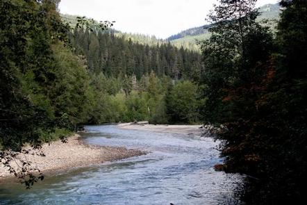
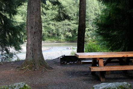
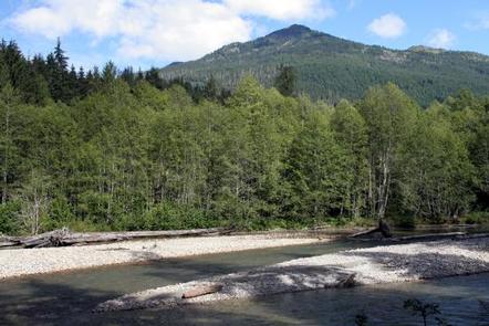
Silver Fir Campground is situated along the North Fork Nooksack River in Mt. Baker-Snoqualmie National Forest. The area offers stunning scenery and access to numerous recreational activities within the North Cascades in Washington.
Recreation
The campground provides a prime location for hiking and picnicking in summer and early fall and is a non-motorized Sno-Park in the winter. Hikers and backpackers are especially fortunate to have access to a variety of trails near the campground and in the surrounding Mt. Baker Wilderness area. Trails accessed from Hannegan Pass Road, less than a mile from the campground, lead into stunning scenery in the Mt. Baker Wilderness and North Cascades National Park.
Facilities
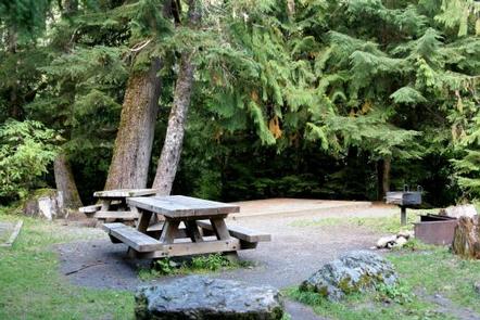
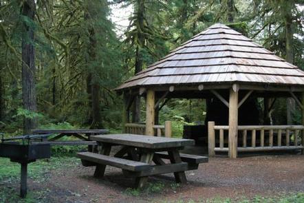
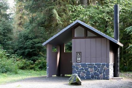
Silver Fir Campground is a smaller campground, offering sites to accommodate tents and RVs. A group picnic shelter for up to 25 people is also available. Picnic tables and campfire rings with grills are provided, as are vault toilets and drinking water. No electrical hookups are available. Groceries, firewood and other conveniences are available 20 minutes away in the nearby community of Glacier.
Natural Features
The Mt. Baker-Snoqualmie National Forest showcases rugged peaks, sparkling alpine lakes and old-growth forests, providing visitors with unique and surprising landscapes. Mt. Baker, the most prominent feature of the Mt. Baker Wilderness, dominates the landscape on a clear day. Rising to an elevation of 10,781 feet, the active volcano is perpetually snow-capped and mantled with an extensive network of creeping glaciers. Mt. Baker’s summit, Grant Peak, is a 1,300-foot-deep mound of ice, which hides a massive volcanic crater. Wildlife in the area includes mountain goats traversing the higher elevations to squirrels and black bears in the forests. Migratory birds and native fish find ample habitat in the varied ecosystems as well.
Nearby Attractions
Visitors enjoy hiking, picnicking and photography in the Heather Meadows area located along the upper reaches of the Mt. Baker Scenic Byway, SR 542. Many popular hikes and climbing routes are located in the surrounding Mt. Baker Wilderness and backpackers enjoy visiting the northern reaches of North Cascades National Park.