THOMAS CANYON, NV Campground Reservation, Info, Images, Map, Directions

THOMAS CANYON, Nevada Campground Images, Info & Reservations

Directions

Take I-80 to any Elko exit and head south to Idaho Street. Turn south on 12th Street (from the east) or on 5th Street (from the west), to State Route 227. Travel 25 miles on SR 227 to Forest Road 660 (Lamoille Canyon Scenic Byway). Travel 8 miles on FR 660 to the campground.

Phone

435-245-6521

Activities

BIKING, CLIMBING, CAMPING, FISHING, HIKING, WILDLIFE VIEWING

Keywords

THOM,LAMOILLE CANYON,HUMBOLDT-TOIYABE NF-FS

Related Link(s)

Rec Area Info & Images

Forest Service Concessionaire

Nevada State Tourism

Nevada State Road Conditions

Overview

Thomas Canyon Campground is located in the scenic Lamoille Canyon, in northeast Nevada, 30 miles from Elko. Visitors enjoy fishing Lamoille Creek and exploring many local hiking trails.

Recreation

Lamoille Creek is a popular stream among fly-fishermen. The creek contains brook and wild rainbow trout.

Lamoille Canyon offers numerous hiking and horseback riding trails that lead to alpine lakes and vistas. Thomas Canyon Trail begins at the campground, leading past several waterfalls, through an alpine meadow into a glacial cirque.

The canyon road is popular for scenic driving and road biking. Many rock climbing routes can be found on the canyon walls.

Facilities

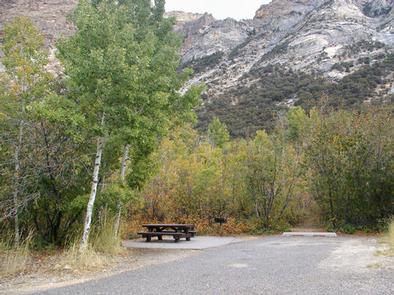
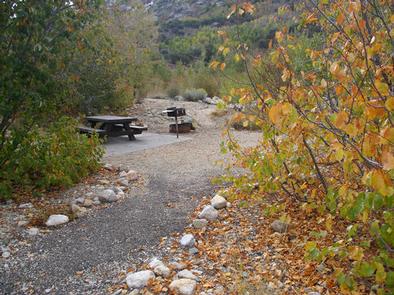
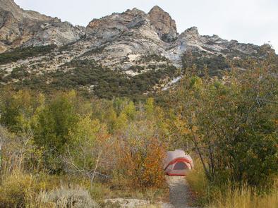
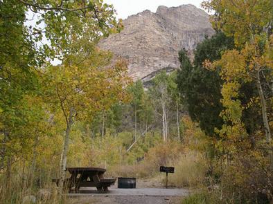
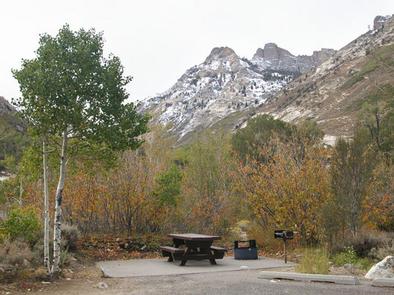
The campground offers single and double campsites, each equipped with a picnic table, campfire ring and grill. Some sites also have tent pads.

Vault toilets, drinking water and trash collection are provided. A campground host is on-site.

Natural Features

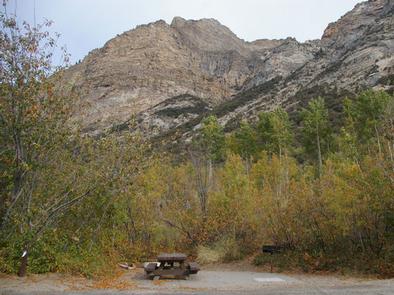
The campground sits at the mouth of Thomas Canyon, a part of larger Lamoille Canyon, at an elevation of 7,200 feet. Both canyons are within the beautiful Ruby Mountains, a desert island brimming with wildlife, sparkling lakes and streams, wildflower-filled meadows and jagged peaks.

Groves of aspen and cottonwood trees provide partial shade in the campground and beautiful fall color. Lamoille Creek runs through the site. All campsites afford breathtaking views of the surrounding peaks and canyon walls.

Reservation

More from CampingHiking.net:

CHEOAH POINT CAMPGROUND, North Carolina Campground Images, Info & Reservations

Directions From Robbinsville, North Carolina, continue on Highway 129 north for approximately 6 miles. Turn left on SR # 1145 – Thunderbird Mountain Road. Continue approximately 1.3 miles on Thunderbird Mountain Road to the Cheoah Point Campground. Phone 828-479-6431 Activities BOATING, CAMPING, FISHING, HIKING, SWIMMING, WATER ACTIVITIES, KAYAKING, CANOEING, NON-MOTORIZED

PIONEER TRAIL, California Campground Images, Info & Reservations

Directions From Sonora, California, take Highway 108 east for about 30 miles. Exit at Pinecrest Lake and turn right on Dodge Ridge Road. Continue 1 mile to Pioneer Trails Campground, located on the left. Phone 209-965-3474 Activities BOATING, CAMPING, FISHING, HIKING, SWIMMING SITE Keywords PION,STANISLAUS NF -FS Related Link(s) Rec

ANACAPA ISLAND, California Campground Images, Info & Reservations

Directions Boat transportation can be arranged with Island Packers from Ventura or Channel Islands (Oxnard) Harbors. To park headquarters in Ventura, California: Highway 101, exit Victoria or Seaward to Ventura Harbor. Phone 805-658-5730 Activities BOATING, HISTORIC & CULTURAL SITE, CAMPING, INTERPRETIVE PROGRAMS, FISHING, HIKING, PICNICKING, VISITOR CENTER, WATER SPORTS, WILDLIFE

HURRICANE BRIDGE, Tennessee Campground Images, Info & Reservations

Directions From I-40, take exit 273. Merge onto US-56 south and continue for approximately 7 miles to the Hurricane Bridge Recreation Area entrance on the right. Phone 931-858-3125 Activities BOATING, CAMPING, FISHING, HIKING, WATER SPORTS Keywords HURB,LITTLE PUCKETTS,CENTER HILL LAKE,CENTER HILL LAKE Related Link(s) Rec Area Info & Images Tennessee