
Directions
From Seattle, Washington: Go north on I-5 to Everett. Take exit 194 onto Hwy 2. Head north at Hwy 204, toward Lake Stevens. Turn north on Hwy 9, then east on Hwy 92 to Granite Falls.
Phone
360-804-1103
Activities
CAMPING
Keywords
TURL,MT. BAKER-SNOQU NF – FS
Related Link(s)
Washington State Road Conditions
Overview
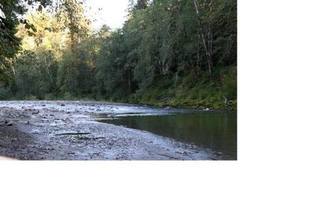
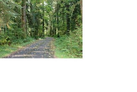
Turlo Campground is located just off the Mountain Loop Highway in the Mt.Baker-Snoqualmie National Forest. The campground is nestled in tall firs, cedars and hemlocks, adjacent to the south fork of the Stillaguamish River.
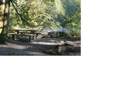
The location offers individuals and families a tranquil camping experience with plenty of opportunities to fish, enjoy the river or relax at their campsite.
Recreation
The Mt. Baker-Snoqualmie National Forest has 1,500 miles of trails, ranging from smooth paths through deep, quiet forests to challenging ascents up boulder-studded mountains. Hiking opportunities abound for every skill level.
The Mt. Dickerman Trail, close to the campground, switchbacks steeply for 3 miles through a dark forest to an alpine meadow, which was replanted in 1915 after a major forest fire. From this point, the trail rises above the timberline to an alpine meadow alive with masses of wildflowers in July and August.
The trail is generally in good condition, and spectacular views can be seen from all directions as the trail climbs to the 5,723 foot summit.
Facilities
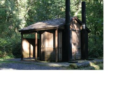
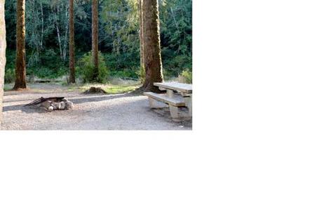
Turlo Campground offers standard sites, accommodating both tent and RV camping. Picnic tables, flush toilets and drinking water are also available, however there are no electrical hook-ups.
Access to the Stillaguamish River is available from the campground.
Natural Features
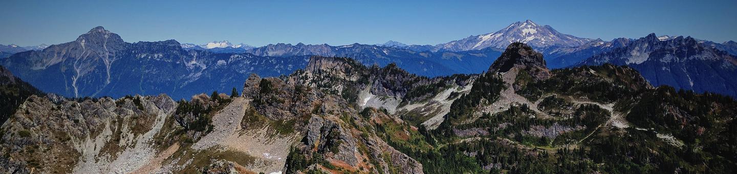
Situated on the west side of the Cascades between the Canadian border and Mt. Rainier National Park, Mt. Baker-Snoqualmie National Forest is one of the most spectacular in the the country, showcasing glacier-covered peaks, wide mountain meadows and old-growth forests, rich in history and outdoor opportunities.
On a clear day, visitors will see Mt. Baker, the most prominent feature of the Mt. Baker Wilderness Area. Rising to an elevation of 10,781 feet, the active volcano from which the forest takes its name, is perpetually snow-capped and mantled with an extensive network of creeping glaciers. Mt. Baker’s summit, Grant Peak, is actually a 1,300-foot-deep mound of ice, which hides a massive volcanic crater.
Old-growth forests line the wide, gently-flowing river, known for its salmon run. Salmon and other species including, chinook, coho, chum, pink, and sockeye salmon, steelhead trout, sea-run cutthroat, and bull trout, use the Stillaguamish and its tributaries for spawning.
Nearby Attractions
Visit or stay in one of the historic lookouts in the area. Lookouts are tangible symbols of Forest Service heritage, perched on high peaks with unobstructed views where they have been used throughout the years to detect and control fires in remote wildlands.
Take some time to visit nearby Mount Rainer National Park. Considered a wonderland, the park offers a fantasic glimpse into glaciers, subalpine ecology, and volcanic landscapes typical in the region.
Discover the Verlot Public Service Center, near the South Fork Stillaguamish River. Built by the Civilian Conservation Corps from 1933 to 1942, Verlot`s handsome buildings reflect the architectural style and fine craftsmanship of that era and are listed on the National Register of Historic Places.