MAHOGANY GROVE, NV Campground Reservation, Info, Images, Map, Directions

MAHOGANY GROVE, Nevada Campground Images, Info & Reservations

Directions

From Las Vegas, Nevada, take Highway 95 north to the junction with Highway 157/Kyle Canyon. Turn left and travel approximately 18 miles to junction with Highway 158/Deer Creek. Turn right and travel approximately 6 miles to the campground.

Phone

702-872-5486

Activities

CAMPING

Keywords

MAHO,MOUNT CHARLESTON,LAS VEGAS,SPRING MTNS NAT REC AREA,HUMBOLDT-TOIYABE NF-FS

Related Link(s)

Rec Area Info & Images

Nevada State Tourism

Nevada State Road Conditions

Overview

Mahogany Grove Campground is set in the beautiful Spring Mountains National Recreation Area, just 40 miles from downtown Las Vegas. Visitors enjoy hiking, horseback riding and scenic driving in this forested desert oasis.

Recreation

The North Loop-Mt. Charleston National Recreation Trail begins less than a mile away. Robber’s Roost Trailhead is nearby as well. The Spring Mountains Visitor Center is a short drive from the campground, offering guided hikes and educational programs.

Facilities

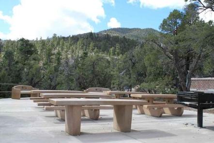
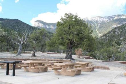
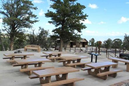
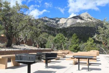
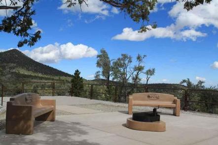
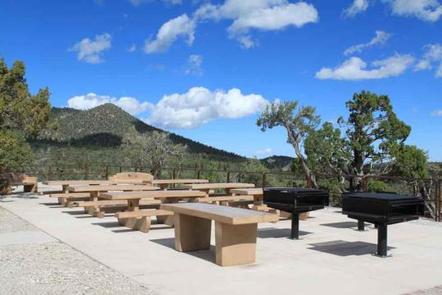
The campground was reconstructed and now contains six group sites, picnic and serving tables, grills, campfire circles, and tent pads. The sites are tent only, with lot-style parking. This means there are short distances to carry equipment to the campsites. Vault toilets are provided. Roads and parking areas are paved.

Natural Features

The Spring Mountains National Recreation Area is a beautiful island in the desert, brimming with breathtaking scenery and diverse flora and fauna. The Bristlecone pine, the world’s oldest organism, and the rare Mount Charleston blue butterfly are both found within the Spring Mountains.

More than 100 springs create the namesake for the mountain range, making it an ideal place to escape the heat of the city.

The campground is situated so campers are awarded sweeping views of the Spring Mountains. Stands of juniper and mountain mahogany forest the site, providing privacy from the highway but only limited shade.

Nearby Attractions

More than 60 miles of hiking and horseback riding trails crisscross the area; two trails allow mountain biking. Rock climbing, picnicking and scenic driving are popular activities.

Reservation

More from CampingHiking.net:

Gold Bar Group Sites, Utah Campground Images, Info & Reservations

Directions From Moab, drive five miles north on Hwy 191 to the intersection with Hwy 279. Turn left/west on Hwy 279 and drive ten miles to the campground entrance road. Phone 435-259-2100 Activities BIKING, BOATING, CLIMBING, CAMPING, HIKING, OFF HIGHWAY VEHICLE, RECREATIONAL VEHICLES, PHOTOGRAPHY, PADDLING, MOUNTAIN BIKING, OFF ROAD VEHICLE

EAST LAKE CAMPGROUND, Oregon Campground Images, Info & Reservations

Directions From Bend, travel 23.5 miles south on Hwy 97, then 16.6 miles east on Road 21. Phone 541-383-5300 Activities CAMPING Keywords Related Link(s) Rec Area Info & Images Oregon State Road Conditions Oregon State Tourism Overview East Lake Campground sits at the edge of beautiful East Lake in the

COSSATOT REEFS, Arkansas Campground Images, Info & Reservations

Directions From De Queen, Arkansas, head north on US-59/US-71. Continue for nearly 10 miles and turn Right at Gillham EZ-Mart. Turn right on Tower Road; go 1.3 miles turn left onto Gillham Lake road; go 4.3 miles turn right and follow signs into the campground. Phone 870-386-7261 Activities BOATING, CAMPING,

JACKS GULCH, Colorado Campground Images, Info & Reservations

Directions From Fort Collins, take Highway 14 northwest for 42 miles, then County Road 63 E (Pingree Park Road) south for 6 miles. Phone 970-295-6700 Activities BIKING, CLIMBING, CAMPING, FISHING, HIKING, HORSEBACK RIDING, WILDLIFE VIEWING, MOUNTAIN BIKING, BIRDING Keywords JAGU,ARAPAHO AND ROOSEVELT NF – FS Related Link(s) Rec Area Info

HELM BAY CABIN, Alaska Campground Images, Info & Reservations

Directions The cabin is approximately 24 miles from Ketchikan or 12 miles from the Clover Pass area, located on west end of Helm Bay. It is accessible by float plane, kayak or boat with a state-maintained floating dock near cabin. Refer to USGS topographic map for Ketchikan, C-6, and consult