PINE VALLEY RECREATION AREA, UT Campground Reservation, Info, Images, Map, Directions

PINE VALLEY RECREATION AREA, Utah Campground Images, Info & Reservations

Directions

From St. George, Utah, go north on Highway 18 to Central. Take a right on Forest Highway 35 towards Pine Valley. Take a left on Main Street and go 3 miles to the recreation area.

Phone

801-226-3564

Activities

CAMPING, FISHING, HIKING, DAY USE AREA, HORSE CAMPING, AMPHITHEATER

Keywords

PINV,PINE VALLEY,DIXIE NATIONAL FOREST,ST. GEORGE UTAH,PINE VALLEY GROUP DIXIE NAT L,DIXIE NF – FS

Related Link(s)

Rec Area Info & Images

Forest Service Concessionaire

Utah State Tourism

Utah State Road Conditions

Overview

Pine Valley Recreation Area is located in scenic Pine Valley, Utah at an elevation of 6,900 feet. The valley offers a great escape from the heat of the southern Utah desert. Visitors enjoy fishing at nearby Pine Valley Reservoir and exploring local trails.

Recreation

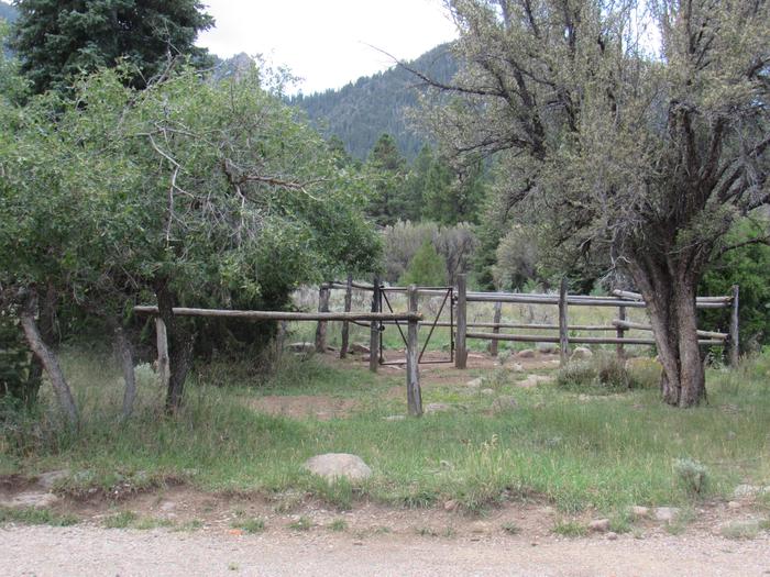
Hiking and horse trails are abundant in Pine Valley. Trails vary in length from 2 to 35 miles. Some trails allow mountain biking. Shoreline fishing for rainbow trout is a popular activity on the lake. Flotation devices – canoes, paddle boards, inner tubes, etc. -are not allowed on the lake. Pine Valley Mountain Wilderness is adjacent to the recreation area.

Facilities

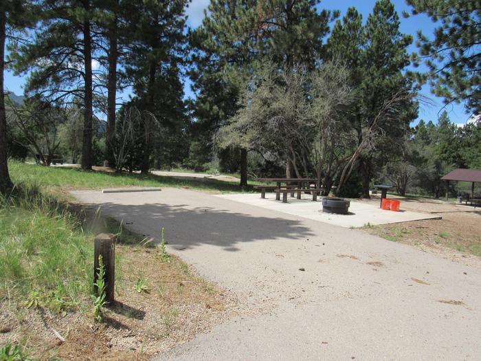
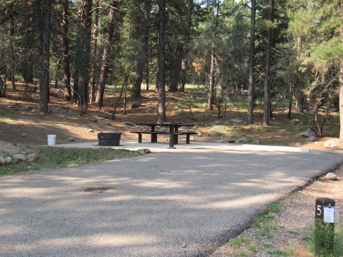
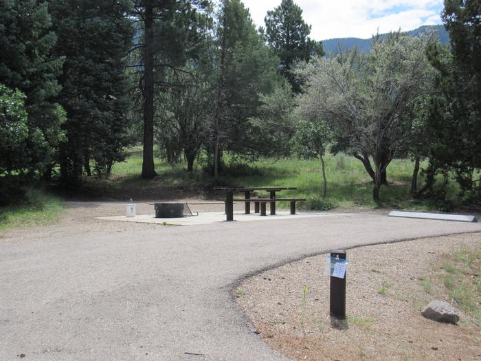
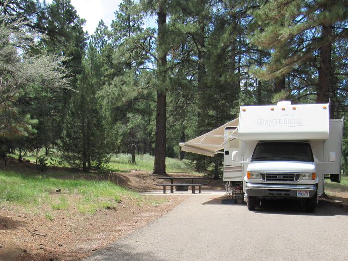
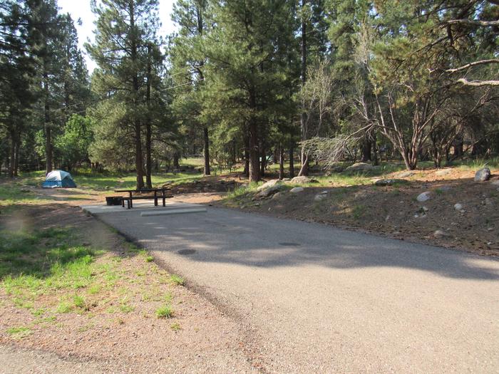
Located within the Pine Valley Recreation Area are six overnight family campgrounds, two overnight group areas, four day-use group sites and an amphitheater. Dean Gardner, Equestrian, and Yellow Pine family campgrounds are available for reservations. Mitt Moody, Crackfoot and Ebenezer Bryce Campgrounds are available on a first-come basis. The family campgrounds offer several single and double-family sites, all of which contain picnic tables, fire rings with grills, utility tables, tent pads and concrete site pads.

All group sites, both overnight and day-use are available for reservations. The Effie Beckstrom area offers two overnight sites, accommodating 80 people each. Vault toilets and drinking water are provided. Thomas Forsyth day-use area offers four picnic areas for groups ranging in size from 35-150 people. This beautiful facility contains large picnic tables, grills and campfire circles.

Vault toilets and drinking water are provided. Volleyball courts and horseshoe pits are on-site. Large parking areas are paved.

OHV/ATV’s including street legal are not allowed within the Pine Valley Recreation Area (they must be trailered at all times). 

Natural Features

Pine Valley is situated in the Pine Valley Mountains. A beautiful forest of ponderosa pine and oak covers the area, offering partial shade. Mountain mahogany, juniper and sagebrush dot the landscape.

Nearby Attractions

Zions National Park is a short 1 1/2 hour drive from Pine Valley with a 75 mile drive.

Reservation

More from CampingHiking.net:

HUNTER PEAK, Wyoming Campground Images, Info & Reservations

Directions From Cody, Wyo., travel north on State Highway 120 to Highway 296. The campground is approximately 60 miles from Cody, and located on the left side of the highway. From the northeast entrance of Yellowstone Park or Red Lodge, Mont, travel on U.S. Highway 212 to the junction with

CULTUS CORRAL HORSE CAMP, Oregon Campground Images, Info & Reservations

Directions From Bend, OR: Travel about 46 miles southwest on Cascade Lakes Highway (46); take a right onto Forest Road 4635 and travel about a mile; take a right onto Forest Road 4630. The campground is near the end of the road. Phone 541-323-1746 Activities CAMPING Keywords Related Link(s) Rec

LAKE ALPINE – LODGEPOLE GROUP, California Campground Images, Info & Reservations

Directions From Angel Camp, drive 50 miles east on Highway 4. Phone 209-753-6350 Activities BOATING, CLIMBING, CAMPING, INTERPRETIVE PROGRAMS, FISHING, HIKING, PICNICKING, RECREATIONAL VEHICLES, VISITOR CENTER, WILDERNESS, DAY USE AREA, SWIMMING SITE, SWIMMING, MOTOR BOAT, OFF ROAD VEHICLE TRAILS, PADDLE BOATING, WATER ACTIVITIES, KAYAKING, NON-MOTORIZED BOATING, DISC GOLF, SCENIC DRIVE,

ALLEY SPRING, Missouri Campground Images, Info & Reservations

Directions From the east on US Highway 60, turn north on Missouri Highway 19 in the town of Winona. Continue north 12 miles to the town of Eminence. From Eminence, Alley Spring campground is located five minutes west of State Highway 106. From Mountain View, travel 19 miles east from

PRINCESS, California Campground Images, Info & Reservations

Directions From Fresno, California, go east on Highway 180 to Grants Grove, continuing approximately 12 miles to Princess Campground on the right. Phone 559-335-2232 Activities CAMPING, HIKING, DAY USE AREA Keywords PRCS,GIANT SEQUOIA NAT. MONUMENT,SEQUOIA NF – FS Related Link(s) Rec Area Info & Images California State Tourism Forest Service

WILLIS KNOB HORSE CAMP, Georgia Campground Images, Info & Reservations

Directions From Clayton, Georgia, take Warwoman Road east for about 12 miles. Turn right on Forest Service Road 157 and continue for 2 miles to the campground on the left. Phone 706-754-6221 Activities CAMPING, HORSEBACK RIDING, HUNTING, WILDLIFE VIEWING, HORSE CAMPING Keywords KNOB,CHATTAHOOCHEE-OCONEE NF – FS,HORSE CAMP Related Link(s) Rec