JOES VALLEY RESERVOIR, UT Campground Reservation, Info, Images, Map, Directions

JOES VALLEY RESERVOIR, Utah Campground Images, Info & Reservations

Directions

From Price, Utah, travel 45 miles south on State Road 10, to the junction of State Roads 10 and 29. Turn west on State Road 29 and continue through Orangeville, approximately 12 miles. Turn north at the stop sign and follow State Road 29 approximately 18 miles to the campground.

Phone

435-384-2372

Activities

BIKING, BOATING, CAMPING, FISHING, WATER SPORTS, SWIMMING SITE

Keywords

JOES,MANTI-LASAL NF -FS

Related Link(s)

Rec Area Info & Images

Utah State Tourism

Utah State Road Conditions

Overview

Joe’s Valley Reservoir Campground is located in a high mountain valley next to its namesake, at an elevation of 7,000 feet. Visitors enjoy boating, fishing and exploring the surrounding off-road vehicle trails.

Recreation

The reservoir offers good fishing for cutthroat trout, rainbow trout, tiger muskie and trophy splake. Boating, water skiing and canoeing are popular on the lake. A boat ramp is located nearby on the eastern shoreline. Horseback riding, bouldering, hiking and mountain biking are popular in the area as well.

Facilities

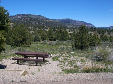
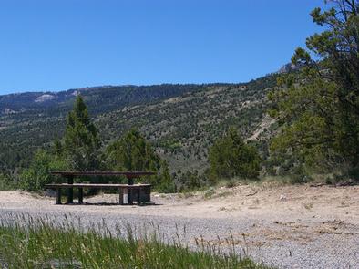
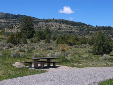
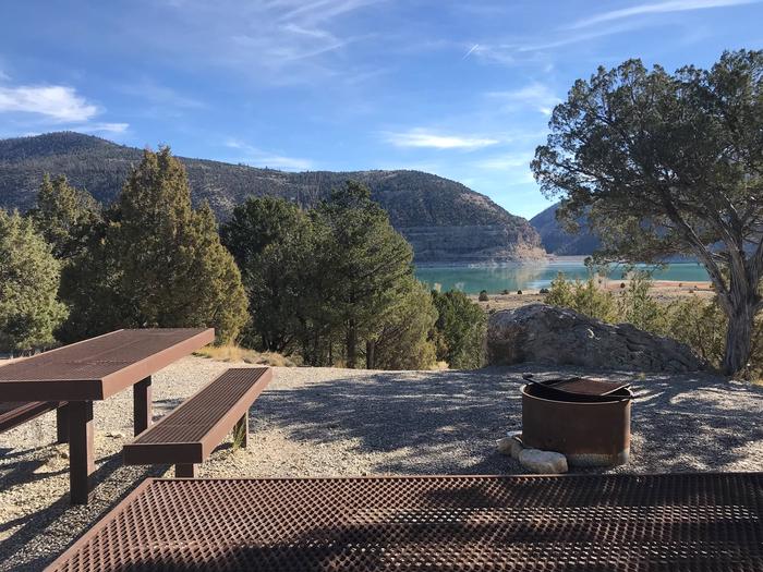
The campground contains several single- and double-family campsites, all of which are accessible. Many sites have lake views and some sites are shaded. Vault toilets and drinking water are provided. Roads and parking spurs are paved.

Natural Features

Joe’s Valley is situated on the Wasatch Plateau in Central Utah. Juniper, pinyon pine and sagebrush cover the area, and aspens and pines dot the surrounding hillsides.

Nearby Attractions

Renowned bouldering opportunities are located in nearby Straight and Cottonwood Canyons. Popular mountain fisheries at Grassy Lake, Pete’s Hole, and Potters Ponds are all within 10 miles of the group site. The 370-mile Arapeen Off-Highway Vehicle Trail System can be accessed directly from the Reeder Trailhead. Attractions at Joes Valley Reservoir include the Orange Olsen Guard Station rental, and Joes Valley Group Pavilion.

Reservation

More from CampingHiking.net:

REYNOLDS CREEK, Texas Campground Images, Info & Reservations

Directions From I-35, take exit 330B Hwy 6 N toward Meridian for about 7 miles. After passing over the Lake on the Twin Bridges, take the Speegleville Road exit (second exit after the bridges). Turn right on Speegleville Road. After 1 mile you will reach a 4-way stop. Continue straight

NIZHONI, Utah Campground Images, Info & Reservations

Directions From Blanding, Utah, travel north on Highway 191 approximately two miles. Turn left on E. Pinion Ridge Road (National Forest Access sign: Dry Wash Reservoir) and proceed 3/4-mile to the stop sign. Turn right on Forest Road 079 and continue approximately 10 miles to the campground on the right

KANZA VIEW PICNIC SHELTER, Kansas Campground Images, Info & Reservations

Directions 1 mile north of Council Grove, Kansas on Highway 177. Then west 200 yards on Lake Road (goes across dam). Phone (620) 767-5195 Activities HISTORIC & CULTURAL SITE, CAMPING Keywords Related Link(s) Rec Area Info & Images Kansas State Road Conditions Kansas State Tourism Overview Kanza View Picnic Shelter

CASCADE CREEK CABIN, Alaska Campground Images, Info & Reservations

Directions Access is by float plane or boat only. The cabin is located on the mainland in Thomas Bay, south of Cascade Creek and east of Spray Island. From Petersburg the journey is 14 miles by float plane or 19 miles by boat. Refer to USGS topographic map Petersburg D3;

CAZIER CABIN, Wyoming Campground Images, Info & Reservations

Directions From Afton, WY, take Highway 89 north about 31 miles to Alpine, WY. At Alpine, turn right (south) onto Greys River Road (Forest Road 10138) and travel about 46 miles. The cabin is located on the right (west) side of the road. Access is along a low-speed gravel road.