DEVILS CANYON, UT Campground Reservation, Info, Images, Map, Directions

DEVILS CANYON, Utah Campground Images, Info & Reservations

Directions

The campground is 13 miles south of Monticello, Utah and 9 miles north of Blanding, Utah on US Highway 19. The campground is approximately 1/4-mile off the highway.

Phone

435-587-2041

Activities

AUTO TOURING, BIKING, CAMPING, HIKING, PICNICKING, WILDLIFE VIEWING, INFORMATION SITE, STAR GAZING, SCENIC DRIVE

Keywords

DEVC,DRY WASH,JOHNSON CREEK,MANTI-LASAL NF -FS

Related Link(s)

Rec Area Info & Images

Utah State Road Conditions

Utah State Tourism

Overview

Devils Canyon Campground sits in the Manti-LaSal National Forest of southeast Utah at the foot of the Abajo Mountains.

Recreation

Several miles of off-road vehicle trails crisscross the Abajo Mountains. The Camp Jackson/Wagon Wheel Trail can be accessed nearby.

The Abajo Loop State Scenic Backway passes by the campground. It leads from the desert floor and red rock canyons to steep mountains over 10,000 feet high, with overlooks and panoramic views. The byway is suitable for passenger vehicles from late spring through fall but is not recommended for large RVs.

Facilities

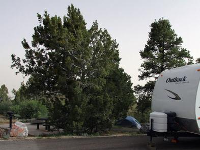
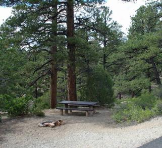
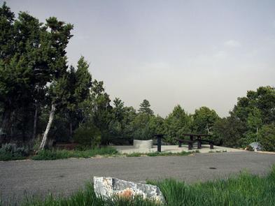
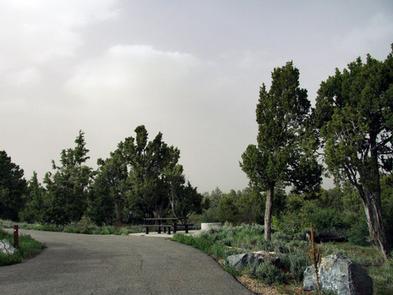
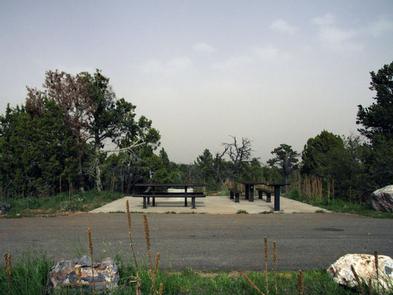
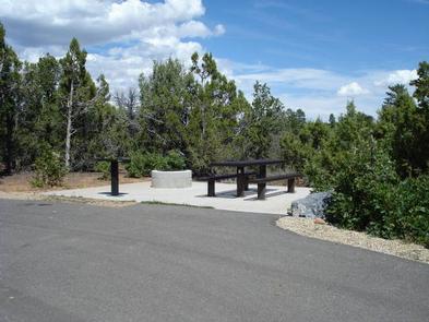
The campground contains numerous single-family sites with picnic tables and fire rings. Vault toilets and drinking water (seasonal) are provided. Showers are available eight miles south in Blanding. Firewood is limited. Parking spurs are paved. Sites # 1-5 and 8-16 are accessible and have paved areas around the fire pit and picnic table. Sites # 6 & 7 have short trails from parking spur to paved camping area and are not considered accessible. There is a 14 day stay limit at this campground.

Natural Features

Ponderosa pines, pinyon pines and juniper cover the area, offering limited shade. The campground sits at an elevation of 7,400 feet, and summer temperatures are warm in the day and cool in the evening. Birds, squirrels, chipmunks, mule deer and black bear may be seen in the area.

Nearby Attractions

Popular attractions in the area include Canyonlands, Arches and Mesa Verde National Parks, Dark Canyon Wilderness, Edge of the Cedars State Park, Lake Powell and numerous archaeological sites.

Evening programs are provided at Edge of the Cedars Museum in Blanding. The San Juan County Fair is held annually in August in Monticello.

Reservation

More from CampingHiking.net:

BUTTERMILK, Idaho Campground Images, Info & Reservations

Directions From West Yellowstone, Montana, take Highway 20 south, southwest for approximately 25 miles and from Ashton, Idaho, take Highway 20 north for approximately 27 miles. Turn west onto the Kilgore-Yale Road #030 (across from Elk Creek Gas Station) and go about 2 miles to the Buttermilk Loop Road #126.

CRAIGS CREEK GROUP AREA, Kentucky Campground Images, Info & Reservations

Directions From London, Kentucky, take Exit 38 from I-75. Take Kentucky 192 west for 12.2 miles. Turn left onto Forest Road 62 and drive 2 miles to the Craig’s Creek site. Phone 606-528-6156 Activities BIKING, CAMPING, FISHING Keywords CRAS,CRAIGS CREEK CAMPGROUND,CRAIGS CREEK SHELTER,CRAIGS CREEK PICNIC SHELTER,LAUREL RIVER LAKE,LAUREL LAKE,DANIEL BOONE

RUARK BLUFF WEST, Missouri Campground Images, Info & Reservations

Directions From Greenfield, Missouri, take State Highway H. north for 6.4 miles and turn left on the park access road. Follow signs into the park area. Phone 417-637-5279 Activities BOATING, CAMPING, FISHING, WILDLIFE VIEWING, SWIMMING SITE Keywords RUAW,STOCKTON LAKE,TWIN BRIDGES,STOCKTON LAKE Related Link(s) Rec Area Info & Images Missouri State

SOFTUK BAR CABIN, Alaska Campground Images, Info & Reservations

Directions Access to the cabin is by wheel plane only at low tide, typically a 25-minute flight from Cordova. Click here for local tide tables. Refer to USGS topographic map Cordova A-2. Phone 1 (907) 424-7661 Activities CAMPING, FISHING, HIKING, HUNTING, WILDLIFE VIEWING Keywords SOF1,CHUGACH NF – FS Related Link(s)

GLACIER VIEW CAMPGROUND, Idaho Campground Images, Info & Reservations

Directions From Stanley, Idaho, take State Highway 75 south approximately 4 miles. Go west onto Forest Road 214. Turn left at Glacier View Campground entrance sign. Phone 928-537-8888 Activities BIKING, BOATING, CAMPING, FISHING, HIKING, HORSEBACK RIDING, WILDLIFE VIEWING, SWIMMING SITE Keywords GLAC,SAWTOOTH NF – FS Related Link(s) Rec Area Info