
Directions
From Seattle, Washington, take I-5 north to exit 194 in Everett. Take Highway 2 north at Highway 204 toward Lake Stevens. Turn north on Highway 9, then east on Highway 92 to Granite Falls. Continue about 23 miles on Highway 7 Scenic Byway.
Phone
360-804-1103
Activities
CAMPING
Keywords
BEC2,MT. BAKER-SNOQU NF – FS
Related Link(s)
Washington State Road Conditions
Overview
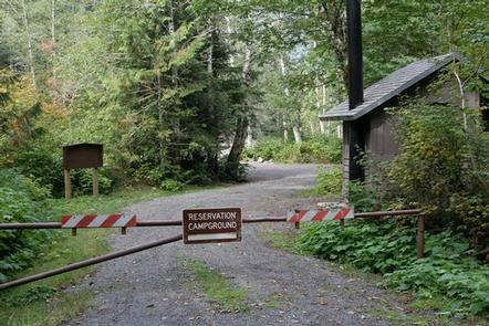
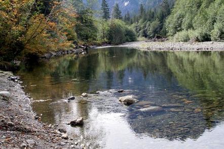
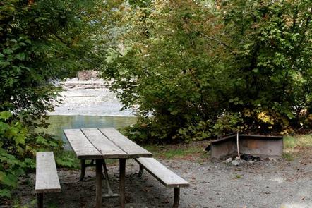
Beaver Creek campground is a popular group camp situated along the Stillaguamish River, with a spectacular view of Big Four Mountain.
Visitors traversing the scenic Mountain Loop Road through Mt. Baker-Snoqualmie National Forest will find the campground about 12 miles east of the Verlot Public Service Center, just past the small town of Silverton, Washington.
Fairly flat, surrounded by stands of old-growth forest and located near the bubbling Beaver Creek, this site is ideal for small group or family camping excursions.
Recreation
In addition to being a prime location for hiking, fishing, picnicking and horseback riding in summer and early fall, Beaver Creek offers excellent skiing and snowshoeing in the winter months.
Hikers may want to explore the nearby Big Four Ice Caves Trail off of the Mountain Loop Highway. The trail ends with a view of the ice fields and the immense north face of the 6,153 foot Big Four Mountain. The caves are exposed during August and remain visible through October.
The nearby Gold Basin Mill Pond interpretive trail is also accessible from the campground. This interpretive site includes a short, barrier-free trail that passes by mill relics and ends on a floating viewpoint looking across the old millpond. Interpretive signs discuss the history of the mill and the wildlife in the area. The trail is located directly across from the Gold Basin Campground.
Facilities
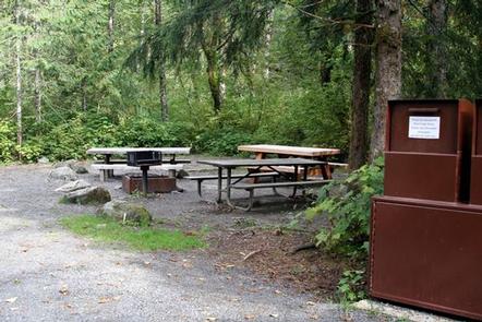
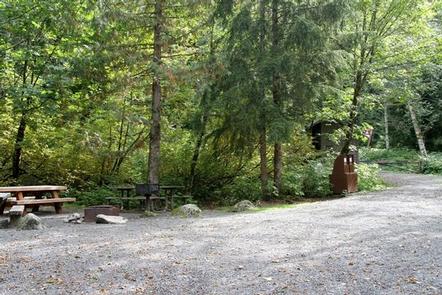
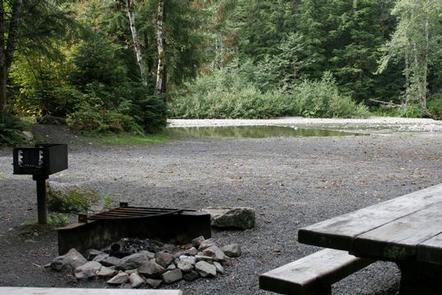
The campground offers one large group campsite, making it a perfect setting for families or groups. The site can accommodate about 15 campers and is ideal for a mix of tents and RVs.
The site is equipped with tables, tent pads and campfire rings with grills. Vault toilets are available, but there is no drinking water provided.
Natural Features
Located in the majestic Cascade region of Washington, the Mt. Baker-Snoqualmie National Forest offers visitors the chance to explore the region’s rugged peaks, scenic rivers and dense forest and wilderness areas.
Old-growth forests of cedar, fir and hemlock line the wide, gently-flowing Stillaguamish River and tower over trails of moss-covered boulders.
On a clear day visitors can spot Mt. Baker, the most prominent feature of the Wilderness Area. Rising to 10,781 feet, the active volcano is perpetually snow-capped and mantled with an extensive network of creeping glaciers. Mt. Baker’s summit, Grant Peak, is actually a 1,300-foot-deep mound of ice, which hides a massive volcanic crater.
The diverse forest provides an excellent habitat for a variety of wildlife. In addition to being home for a multitude of mammals, birds, amphibians and reptiles, the area sustains more rare species such as lynx, moose, wolves, and wolverine. Grizzly bear sightings have been confirmed in the Cascade region, though black bears are more common.
Nearby Attractions
Visitors enjoy the North Cascades and Mt. Rainer National Parks, where interpretive programs and exhibits offer opportunities to learn about the diverse landscape and history of the area.
The Pacific Crest Trail (PCT), one of the world’s premier National Scenic Trails, showcases some of North America’s most fantastic scenery, winding its way its way from Mexico to Canada through California, Oregon and Washington. The trail is accessible a short drive from the campground.