

Directions
There is no street address for the picnic pavilion Pavilion is 15 miles west of Gatlinburg, TN on Little River Road. Take Newfound Gap Road (akaUS441) south from Gatlinburg and turn west on Little River Road (TN73) at the Sugarlands Visitors Center. Go 10 miles and turn right at picnic area sign. Picnic pavilion is on west side of picnic area.
Phone
865-436-1261
Activities
HISTORIC & CULTURAL SITE, CAMPING, FISHING, HIKING, WILDLIFE VIEWING
Keywords
CG32,Great Smokey Mountain National Park,Great Smoky Mountains National Park,Great Smoky Mountain National Park,Great Smoky National Park
Related Link(s)
Tennessee State Road Conditions
National Park Services Concessionaire
Overview
Tucked in the mountains under a canopy of cool shade, this picnic pavilion creates a peaceful and secluded environment for visitors, offering the best of the Great Smoky Mountains National Park.
Recreation
Great Smoky Mountains National Park is a hiker’s paradise, offering over 800 miles of maintained trails ranging from short, leg-stretchers to strenuous treks, with a number of those trails easily accessible from the picnic area. But hiking is not the only reason for visiting the Smokies: Fishing, picnicking, wildlife viewing and auto touring are also popular activities.
Visitors can enjoy high-quality backcountry fishing in the cool waters of the countless streams and rivers that snake through the mountains, with trout available in abundance.
Wildlife viewing is a popular pastime, and with around 1,500 bears living in the park, it’s not uncommon for visitors to spot one. The park is a sanctuary for a magnificent array of animal and plant life, all of which is protected for future generations to enjoy.
The park also holds one of the best collections of log buildings in the eastern United States. Over 90 historic structures, including houses, barns, outbuildings, churches, schools and grist mills, have been preserved or rehabilitated in the park.
Facilities
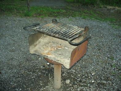
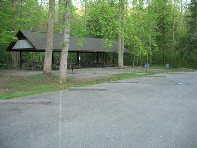
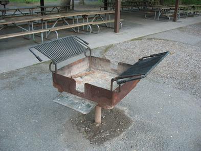
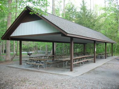
Metcalf Bottoms Picnic Pavilion can accommodate up to 70 guests and offers a covered eating area and multiple grills, making it an ideal location for a party or family get-together.
The pavilion may be reserved for a morning or evening block, so visitors who wish to use the area for a full day should reserve both time slots.
Natural Features
World-renowned for its diversity of plant and animal life, the beauty of its ancient mountains and the quality of its remnants of Southern Appalachian culture, Great Smoky Mountains is America’s most visited national park. Whether blanketed in bright wildflowers in the spring or vivid colors in the fall, the scenery at Metcalf Bottoms never disappoints.
At 1,700 feet, Metcalf Bottoms Picnic Pavilion provides a moderate climate, characterized by mild winters and hot, humid summers.
Great Smoky Mountains National Park preserves a rich cultural history of Southern Appalachia. From the prehistoric Paleo Indians to the early European settlements in the 1800s, the park strives to protect its historic structures, landscapes and artifacts that tell the stories of the people who once called these mountains home.
Nearby Attractions
Gatlinburg, a one of the Smokies’ famous tourist towns, is located about 11 miles from the picnic area. Visitors tours, organized rafting trips, museums, restaurants, galleries, an aquarium, skiing and more, are all offered.