DAM SITE(GREERS FERRY), AR Campground Reservation, Info, Images, Map, Directions

DAM SITE(GREERS FERRY), Arkansas Campground Images, Info & Reservations

Directions

From Heber Springs, AR, take SR-25 3 miles north and follow signs to the campground.

Phone

501-362-5233

Activities

BOATING, CAMPING, SWIMMING SITE

Keywords

DAM3,GREERS FERRY LAKE,DAM SITE Greers Ferry,GREERS FERRY LAKE

Related Link(s)

Rec Area Info & Images

Arkansas State Road Conditions

Arkansas State Tourism

Overview

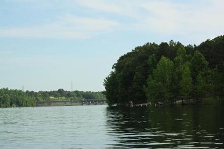
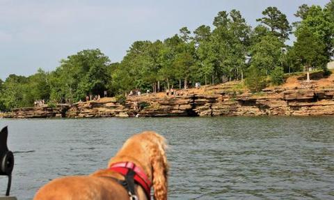
Dam Site Campground is located at Greers Ferry Dam at the foot of Round Mountain in the beautiful Ozark Mountains of north-central Arkansas. The environment provides the ideal location for family camping, fishing, boating and hiking.

Recreation

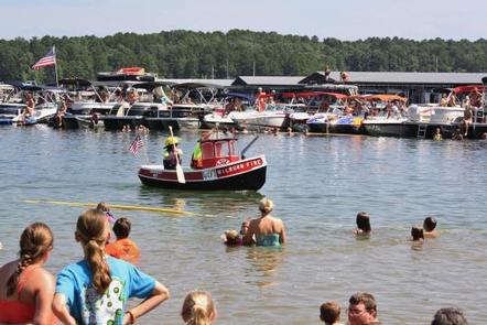
Greers Ferry Lake is an outdoor enthusiasts’ dream, with boating, sailing, water skiing, swimming, scuba diving and fishing opportunities. Hikers enjoy the area’s three National Nature Trails and one multi-purpose fitness trail.

The William Carl Gardner Visitor Center is just west of the dam, with exhibits, a children’s touch table, and a replica of the world record 40 lb. 4 oz. brown trout caught in the Little Red River downstream of the center.

Facilities

This large campground offers 252 sites, 40 of which have electric and water hookups, 108 have electric hookups, and 104 sites have no hookups.

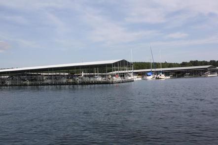
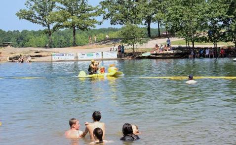
Additional amenities include flush and vault toilets, showers, a dump station, playground, marina, swimming area and a boat ramp.

Natural Features

A dense mix of red cedar, black gum, red oak, elm, pecan and sweet gum trees forest the area, providing shade in the summer months and beautiful fall colors during autumn.

Wildlife is plentiful around Greers Ferry Lake. Visitors commonly see white-tailed deer, wild turkeys, rabbits, squirrels and a wide variety of birds.

Nearby Attractions

With over 30,000 acres of water surface, the lake serves as a playground for all kinds of water sports. Eighteen parks around the shoreline provide modern campgrounds, boat ramps, swim areas and marinas.

Reservation

More from CampingHiking.net:

HARD ROCK CAMPGROUND, Oregon Campground Images, Info & Reservations

Directions From Blue River, OR, travel 4 miles east on Highway 126 to Aufderheide Drive (Forest Service Road 19). Turn right on Aufderheide Drive and continue south about 3/4 mile. Veer right at the Y and continue 10 miles to the campground. Phone 801-226-3564 Activities FISHING, WILDLIFE VIEWING Keywords HROC,WILLAMETTE

BELLE STARR, Oklahoma Campground Images, Info & Reservations

Directions From Eufaula, Oklahoma, take Highway 69N to the OK-150 exit toward Texanna Road/State Park/Lake Eufaula.Turn right onto E1140 Rd/Texanna Rd. Travel east for 2 miles, turn right onto Belle Starr Rd/Northsouth 420, travel south for 2 miles and you will arrive at Belle Starr Campground. Phone 918-799-5843 Activities BOATING,

UPPER ARCADIA, Arizona Campground Images, Info & Reservations

Directions From Safford, Arizona: Take State Route 191 south for 6 miles. Turn right onto State Route 366/Swift Trail and travel 11.5 miles to the Arcadia Campground entrance (MM 125.5), taking the next right turn to access Upper Arcadia.  From Tucson, Arizona: Take I-10 East for 90 miles. Take exit

MARION MOUNTAIN, California Campground Images, Info & Reservations

Directions From Interstate 10 in Banning, take Highway 243 south for about 20 miles to Alandale. Travel east on Stone Creek Campground Road for about 2 miles to Marion Mountain Campground. Phone 909-382-2922 Activities BIKING, CAMPING, FISHING, HIKING, HORSEBACK RIDING, FIRE LOOKOUTS/CABINS OVERNIGHT Keywords MARI,SAN BERNARDINO NF – FS Related

MILL DAM GROUP CAMP, Florida Campground Images, Info & Reservations

Directions Mill Dam is located just off of Highway 40, approximately 15 miles east of Silver Springs, Florida, and 50 miles west of Ormond Beach. From 40, look for the Mill Dam/Half Moon signs about a quarter-mile from the recreational area turnoffs. Phone 352-625-2520 Activities CAMPING, HIKING, WATER SPORTS, SWIMMING

MAMMOTH PICNIC SHELTERS, Kentucky Campground Images, Info & Reservations

Directions Note: Do not rely exclusively on your mobile GPS, Google Maps or similar automated navigation systems to get to the Mammoth Cave Campground. Routes can be misleading and incorrect. Directions from the North: Take Interstate 65 to Exit 53 (Cave City Exit). Turn right onto KY-70. Follow 70/255 as