

Directions
From Nashville, take I-65 North to exit 92, TN-45/Old Hickory Blvd toward Madison, continue until you cross over the Cumberland River then take the 2nd left onto Bridgeway Ave., travel approximately 0.2 miles and turn left onto Ensley Ave., continue approximately 0.3 miles and turn left onto Swinging Bridge Road, continue approximately 0.4 miles and turn right onto Burnett Road. The entrance to the park will be at the end of the road.
Phone
615-847-8091
Activities
CAMPING, FISHING, HIKING, SWIMMING SITE
Keywords
OLHB,OLD HICKORY LAKE,METRO BEACH,OLD HICKORY LAKE
Related Link(s)
Tennessee State Road Conditions
Overview
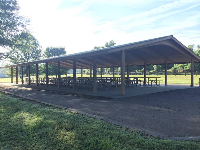
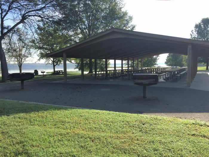
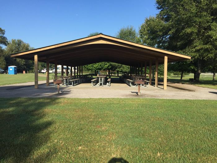
Old Hickory Beach sits along the lengthy shoreline of Old Hickory Lake. The day-use area is perfect for visitors looking to spend a day on the lake or lounging on the beach. Entertaining is easy with a large group picnic shelter accommodating up to 100 guests and grills for cooking out. Birders can find a mix of waterfowl, wading birds, migratory songbirds and the occasional Blue heron or Snowy egret. Other wildlife in the area includes wild turkey, rabbits and white-tailed deer.
Recreation
Swimming and sailing are popular activities on the lake, while anglers will find an abundant population of catfish, crappie and bass for exceptional bank and boat fishing. Hikers can explore the 1.1-mile Old Hickory Lake Nature Trail, featuring three loops (the Woodland Loop, Willow Swamp Loop and the Wildlife Loop), covering varying terrain. The trail is located below Old Hickory Dam near the tailwater parking lot.
Facilities
A sandy swimming beach, a playground for the kids, small shelter near the beach and water, large reserveable shelter, and boat ramps.
Natural Features
Old Hickory Lake is a 22,500 acre reservoir created by the Old Hickory Lock and Dam on the Cumberland River. The lake is named after former president Andrew Jackson, a Tennessee-native nicknamed “Old Hickory” for his tough and aggressive personality.
Nearby Attractions
Take in the nightlife of downtown Nashville if city entertainment beckons or stick with the great outdoors and sit on the fishing piers at Rockland, Sanders Ferry, Shutes Branch, and Bledsoe Creek State Park. The lake is also near the Hermitage, the plantation where U.S. President Andrew Jackson lived in the early 1800s.
Charges & Cancellations
If a customer cancels a group day use facility (shelter) reservation within 14 days of the scheduled arrival date, they will forfeit the total day use fee with no service charge.