OLD POST ROAD, AR Campground Reservation, Info, Images, Map, Directions

OLD POST ROAD, Arkansas Campground Images, Info & Reservations

Directions

From SR-7, take Lock and Dam Road for one mile and follow signs into campground.

Phone

479-968-7962

Activities

BOATING, CAMPING, FISHING, VISITOR CENTER, MOUNTAIN BIKING, BIRDING, DISC GOLF, SOCCER FIELDS

Keywords

OLDP,DARDANELLE LAKE – ARK.RIV.NAV.,DARDANELLE LAKE

Related Link(s)

Rec Area Info & Images

Arkansas State Tourism

Arkansas State Road Conditions

Overview

Old Post Road is a camping hotspot at Dardanelle Lake, with numerous opportunities for boating, biking, hiking and birding.

The river valley is a favorite winter destination for bald eagles.

Recreation

Boating and fishing are the top activities, and a boat ramp is provided for convenient lake access.

Soccer and baseball fields and tennis courts offer additional recreation opportunities, and a biking trail also starts at the campground.

Facilities

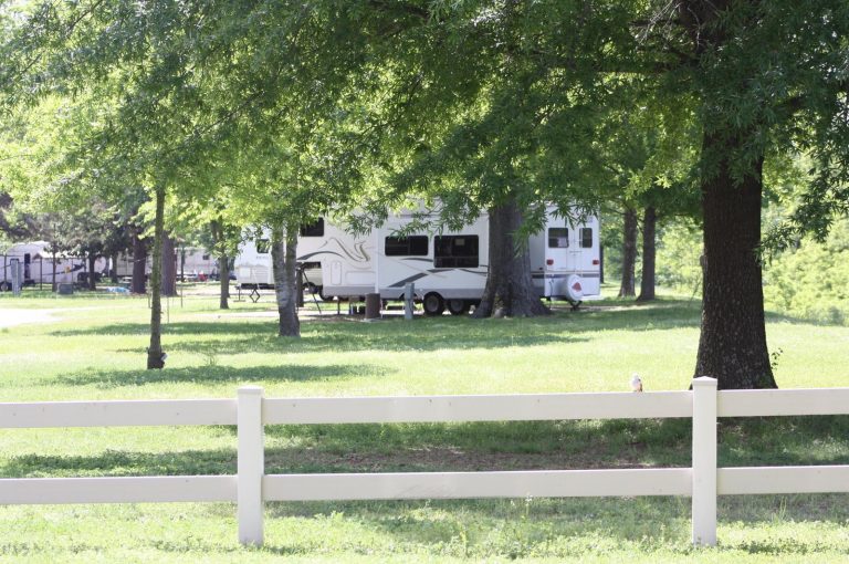
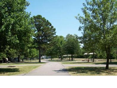
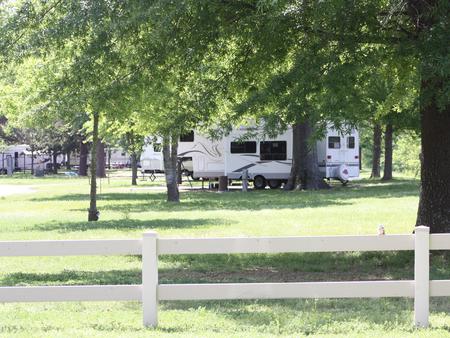
The 37 reservable campsites offer have water and electric hookups. A playground and multiple picnic areas make the park perfect for families and parties.

Natural Features

Perched between the Ozark and Ouachita National Forests, Dardanelle Lake creates an excellent setting for nature lovers. The lake, sourced by the Arkansas River, spans 40,000 acres and boasts 315 miles of shoreline. A variety of hardwoods surround the lake shore.

Nearby Attractions

The nearby Holla Bend National Wildlife Refuge offers excellent wildlife viewing and photography.

Reservation

More from CampingHiking.net:

BLOODY DICK CABIN, Montana Campground Images, Info & Reservations

Directions From Dillon, travel south on I-15 for about 19 miles and exit at Clark Canyon Reservoir (Hwy 324). Travel 17 miles west on Highway 324 through Grant, MT. Proceed west and turn north onto Bloody Dick Road/Forest Road 181. Continue about 18 miles following road signs. The Bloody Dick

TENDERFOOT CREEK, Alaska Campground Images, Info & Reservations

Directions From Anchorage, go south on Seward Highway approximately 81 miles to Summit Lake. Turn at milepost 46 before Summit Lake Lodge. Phone (907)288-3178 Activities BIKING, BOATING, CAMPING, FISHING, HIKING Keywords TEND,CHUGACH NF – FS Related Link(s) Rec Area Info & Images Forest Service Concessionaire Alaska State Tourism Alaska State

MANZANITA., Arizona Campground Images, Info & Reservations

Directions From Phoenix, take I-17 north to Exit 298 for Highway 179. Take 179 north to Sedona. Turn right (north) onto Highway 89A in Oak Creek Canyon and travel 6 miles to the campground. From Flagstaff, take I-17 south and exit for Highway 89A toward Sedona. Travel 23 miles south

WEST PARK (OR), Oregon Campground Images, Info & Reservations

Directions From Highway 730 turn north on Devore Road, at the stop sign turn left and continue down the hill, turn right onto Third Street and West Park will be about a half a mile down on your left. Phone 541-922-2268 Activities PICNICKING, DAY USE AREA Keywords Related Link(s) Rec

CALF CREEK CABIN, Montana Campground Images, Info & Reservations

Directions From White Sulphur Springs, head east on Highway 12 for 3 miles and turn left (north) on Highway 89. Continue about 15 miles, then head west (left) on Road 119 for 9 miles to the cabin. From Great Falls, head east on Highway 87/89 about 23 miles to the