

Directions
From Atlanta, take I-75 north to Exit 293; follow Highway 411 north. Turn right on Highway 136, then left on old Highway 411. Turn right on Highway 282/76. Campground is located 4.5 miles off Highway 282. From Ellijay, GA, take Highway 282/76 west for 11 miles to the access road and follow signs to the campground. Physical Address, 5600, Woodring Branch Rd, Ellijay,GA,30540
Phone
706-276-6050
Activities
BOATING, CAMPING, FISHING, HIKING
Keywords
WOO1,CARTERS LAKE,CARTERS,CARTERS LAKE
Related Link(s)
Overview
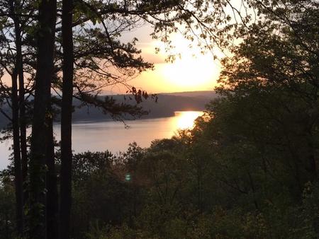
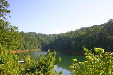
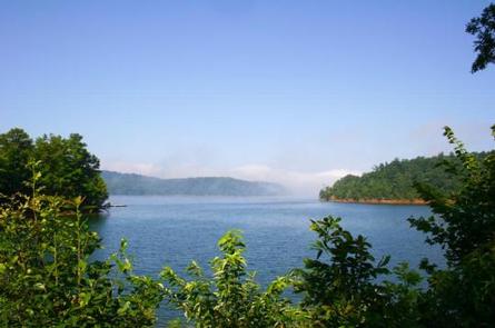
Woodring Branch Campground is located in the North Georgia Mountains on the beautiful Carters Lake Project, which is just a short 70 miles north of Atlanta. Carters Lake provides clean, safe, and quiet campgrounds that help you escape the hustle and bustle of your day to day routine and relax with your family. Woodring Branch offers boating, hiking, mountain biking, picnicking at the day use area, and many other summer activities. Woodring Branch has two different loop style trails from from easy to moderate. Amadahy and the Oak Ridge Nature trail will ensure a great family hiking experience as they both include a wide diversity of plants, animals, and scenic views. The campground has 2 boat ramps with limited boat trailer parking spaces for all your boating needs. Woodring branch at Carters Lake has something for everyone, no matter what your hobbies are.
Recreation
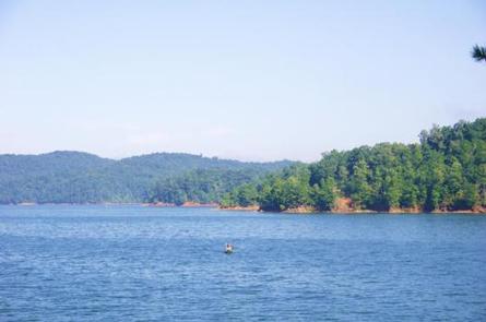
Boaters visit Carters Lake to enjoy its solitude and scenic beauty. Whether in a powerboat or sailboat on the open water or paddling along the shoreline in a canoe, Carters Lake offers enjoyable boating experiences for everyone.
Fishing is a popular activity on the lake. Major species include bass (largemouth, smallmouth, hybrid, striped and spotted), crappie, walleye, bream and catfish. Bank fishing locations are limited due to steep shoreline terrain, but six boat ramps are scattered around the shoreline, offering easy access to the lake.
The Amadahy Trail is located in the Woodring Branch Recreation Area. This 3.5-mile loop is excellent for beginners with flat to rolling terrain. Bikers and hikers are treated to beautiful views of Carters Lake along most of trail’s length.
Facilities
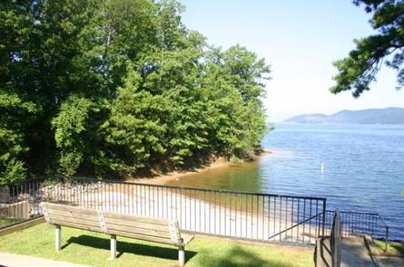
This heavily wooded campground offers many sites with scenic lake views. Electric hookups are available at many of the campsites. Flush toilets, showers and drinking water are provided. Additional amenities include a children’s playground and a dump station. A boat ramp and swimming area are on-site.
Natural Features
Carters Lake embraces a spectacular tract of foothills scenery in the Blue Ridge Mountains of North Georgia. It covers 3200 surface acres and has 62 miles of undeveloped shoreline.
Charges & Cancellations
Please review rules and reservation policies at the bottom of the page.