

Directions
From Highway 58, turn south at Crescent Lake Junction on Forest Service Road 60. Travel 2.2 miles to the junction with Forest Service Road 6005. Continue a mile south, following signs.
Phone
541-323-1746
Activities
CAMPING
Keywords
SIMA,DESCHUTES NF – FS
Related Link(s)
Overview
Simax Group Campground is located on the northeast end of Crescent Lake in Deschutes National Forest, offering visitors some of the most beautiful scenery in central Oregon and easy access to an abundance of recreational activities.
Designed as a fully accessible campground, the four group sites and large picnic pavilion provide all visitors with ample opportunities to explore the area’s diverse lush forest and spectacular surroundings.
Recreation
At Simax Group Campground, water skiing, sailing, windsurfing, sunning, hiking, mountain biking, horseback riding, off-roading and fishing are popular with visitors.
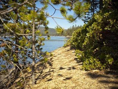
Hiking on one or more of the trails in the area offers a wide variety of scenic terrain, ranging from lakeside trails to routes weaving through towering pine, fir, and spruce trees, typical for the area.
For anglers, Crescent Lake provides the perfect setting to fish from boat or the shoreline. Fish species found in the lake include kokanee salmon, mackinaw, rainbow trout, brown trout and mountain whitefish. Summer months offer the best fishing.
Facilities
Four separate group sites offer visitors opportunities for both lakeside and forest camping.
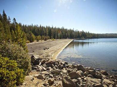
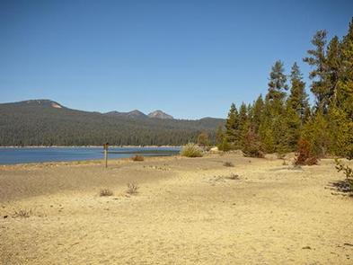
Picnic areas, sandy beaches and stunning views of the lake, along with the conveniences of drinking water and flush toilets, give visitors the opportunity to enjoy the outdoors while still having many of the conveniences of home.
The roads and spurs throughout the campground are paved.
This site was designed to be fully accessible for those with disabilities and is the first of its kind in the Northwest. A trail system designed for accessibility links the group site to the day-use areas and beaches.
Natural Features
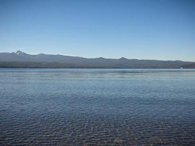
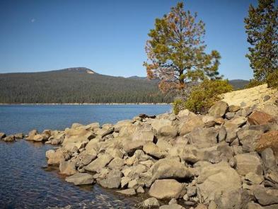
Crescent Lake, nestled in a naturally glaciated basin behind a moraine dam, lies east of the towering Cascade Mountain Range. Its brilliant blue-green water, sandy beaches and water temperature are exceptional for a high-elevation lake.
Towering lodgepole pine trees provide the backdrop for this area, with mountain hemlock, fir, and spruce also in the mix.
Volcanic activity throughout the surrounding area of Deschutes National Forest is evident in its landscape, showcasing cinder cones, calderas and lava flows.
Nearby Attractions
The trailhead to Fawn Lake starts at the northeast end Crescent Lake and is open to hikers and horseback riding. The trail, 4.7 miles one-way, begins in a forest of white fir, Douglas fir and mountain hemlock before making a transition into lodgepole pine, ending at the Crater Butte Trail near Fawn Lake. There are views of Redtop and Lakeview Mountains at Fawn Lake.
Lava Lands Visitor Center in Bend, Oregon, offers visitors the opportunity to learn about the diverse landscape and history of the area through interpretive programs and exhibits.
Visitors will also enjoy traveling the Cascade Lakes Scenic Byway, known as Oregon’s Highway in the Sky, which climbs into the clouds on a 66-mile drive through the Cascade Mountain range, weaving through snow-capped peaks and alpine lakes.
A nearby resort on Crescent Lake offers lodging and a general store. Supplies and equipment rentals are available to visitors.