
Directions
Accessible June through October. Located 20 air miles from Sitka on the east side of Baranof Island, west of Warm Springs Bay. Access by floatplane from Sitka, 25 minutes in clear weather.
For geographic features surrounding cabin, refer to USGS topographic map Sitka A-3.
Phone
907-747-6671
Activities
CAMPING, FISHING
Keywords
BARA,TONGASS NF – FS
Related Link(s)
Overview
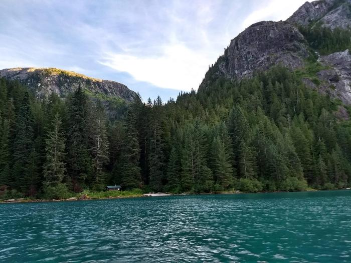
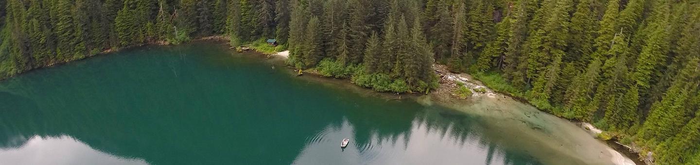
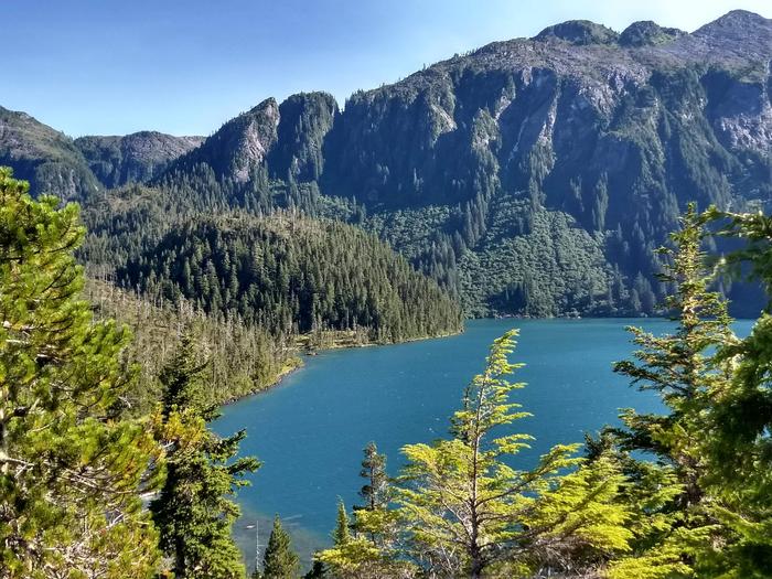
Baranof Lake Cabin sits on the shores of greenish-blue Baranof Lake on the southwestern edge of Baranof Lake, 20 air miles east of of Sitka, Alaska. The cabin is generally available June through October, and makes an excellent base for experiencing this corner of Alaska.
This is a remote site. The cabin can be accessed by a 25-minute floatplane trip, weather permitting. In poor weather and low clouds, flying time can double, as flights must go the northern route around Baranof Island. Visitors are responsible for their own travel arrangements and safety, and must bring their own amenities.
Recreation
Recreation options include wilderness-like solitude, photography and fishing. Cutthroat trout, Dolly Varden and rainbow trout runs occur from late July to late August, especially near inlet streams. Dense vegetation along the shoreline makes fishing and hiking along the shore impossible.
For information about fishing permits and seasons, visit the Alaska Department of Fish and Game website.
Facilities
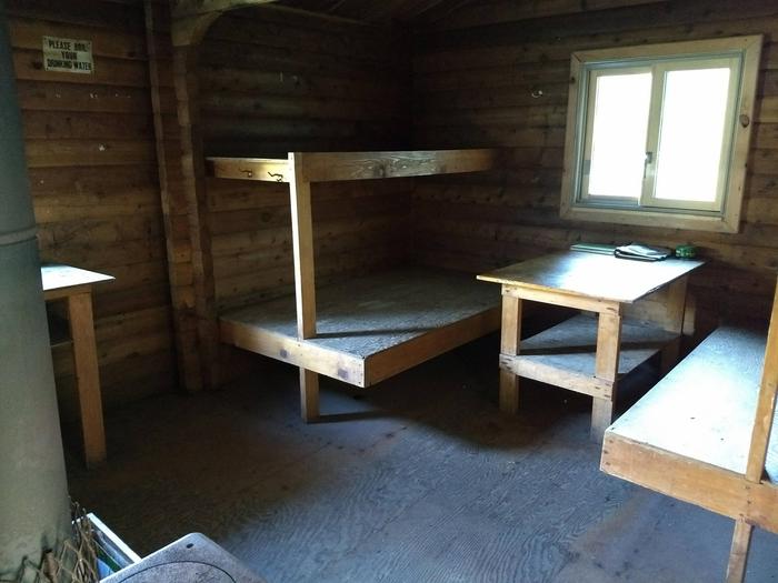
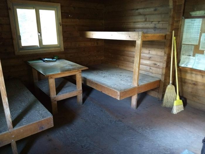
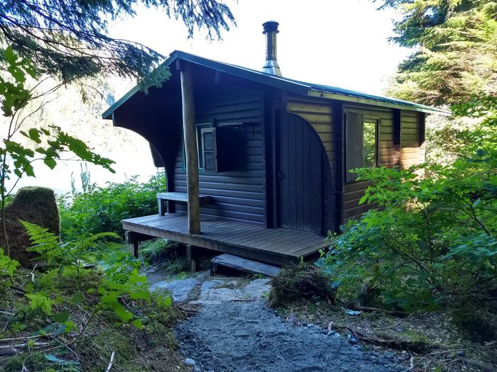
The 12’x14′ wood Pan Abode-style cabin accommodates up to six people with two double and two single plywood bunks. Amenities include a wood stove for heat, a table with benches, cooking counter, cupboard, broom, an axe or splitting maul and an outhouse toilet.
The cabin does not include mattresses or cooking utensils. Visitors should bring sleeping bags and pads, a cooking stove, pots, pans, plates, utensils, food, toilet paper, garbage bags, a lantern, fire extinguisher, fire starter and personal flotation devices (PFDs). Rain gear and boots are recommended.
Water is available from the lake or a nearby inlet stream but must be treated before using. It’s recommended that visitors bring their own water.
A small but heavy square-bowed skiff with oars is provided. A long-shaft 2-10 hp outboard motor enhances use of the skiff, but is not provided. Each person in the skiff should wear a Coast Guard approved personal flotation device (PFD). Be sure the plug is in before launching the boat. Tie the skiff well up on the shore and pull the plug before leaving so the boat does not fill with rain water.
Click here for more cabin information and maps.
Natural Features
Baranof Lake is a glacier-fed lake surrounded by a spruce and hemlock forest, with mountain ridges rising to 3,000 feet on either side. The lake is nearly 3 miles long and half a mile wide, and sits at an elevation of 145 feet.
The cabin has a small, sandy beach and is located near the mouth of the Baranof River. The sound of rushing water prevails as the Baranof River enters the lake in view of the cabin. A beautiful waterfall cascades over steep slopes across the lake. Brown bear frequent the area.