


Directions
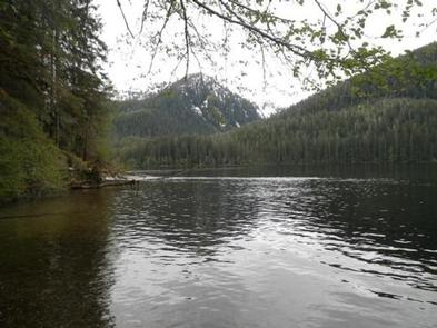
The cabin is located southeast of Wrangell, on the east shore of Eagle Lake. The lake is on the mainland south of Bradfield Canel (at an elevation of about 300 feet) and is about 44 miles by air from Wrangell. This cabin is accessible by float plane only. The lake is normally ice free from May to October. In the fall, winter, and early spring, the cabin may be inaccessible due to frozen lake surface (float planes cannot land). Please check local conditions in advance by calling (907) 874-2323.
Phone
907-874-2323
Activities
CAMPING, FISHING, HUNTING
Keywords
EAGK,TONGASS NF – FS
Related Link(s)
Overview
A stay at Eagle Lake Cabin provides for a uniquely Alaskan experience at a remote, fly-in only lake. Eagle Lake is 44 air miles south of Wrangell, Alaska, and recognized as a trophy cutthroat lake. The site can only be accessed by float plane, depending on conditions. The lake freezes in winter, which may prevent float planes from landing. Visitors are responsible for their own travel arrangements and safety, and must bring several of their own amenities.
Recreation
Anglers can fish for cutthroat trout in the lake from May through September. Guests can use the provided skiff with oars, but must provide their own flotation devices.
Hunting is possible in designated seasons with the proper permits.
Facilities
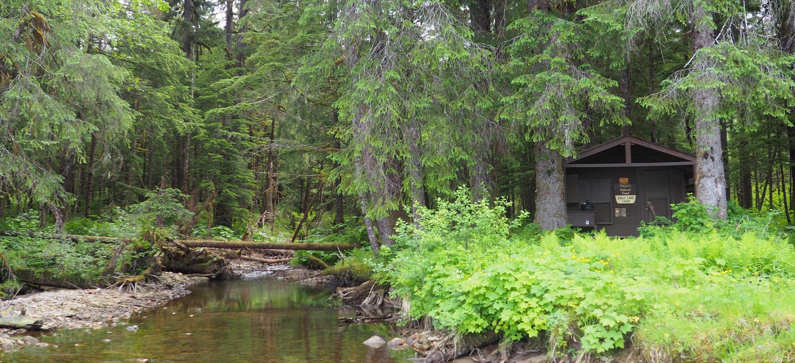
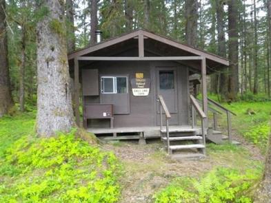
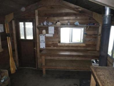
The 12-by-14 cabin ( hunter-style ) has two single and two double bunks, to sleep up to six people. It is also equipped with a table and benches, broom, wood stove and an outhouse toilet. A bear-proof food storage locker is provided. Water and electricity are not provided. Water is available from an adjacent stream, but guests should be sure to treat water before drinking or cooking with it ( water safety tips ). It is recommended that guests bring their own water supply. In addition to bringing a cook stove, guests should provide their own firewood, sleeping bags, sleeping pads, lanterns or flashlights, cookware, plates, utensils, food, toilet paper, garbage bags, a fire extinguisher and matches, among other necessities. Guests are expected to pack out trash and clean the cabin before leaving ( click here for more cabin details).
Natural Features
The cabin sits on a gravel outwash, with a view over Eagle Lake. The surrounding rainforest is primarily Sitka spruce and western hemlock with scattered cedar. Steep hills provide the backdrop for the cabin and the lake. This area provides habitat for brown and black bears ( bear safety information ). Mountain goats may be seen on the surrounding ridges.