
Directions
From Price, Utah, travel 45 miles south on State Road 10, to the junction of State Roads 10 and 29. Turn west on State Road 29 and continue through Orangeville, approximately 12 miles. Turn north at the stop sign and follow State Road 29 approximately 18 miles to campground.
Phone
435-384-2372
Activities
BIKING, BOATING, CAMPING, FISHING, WATER SPORTS, SWIMMING SITE
Keywords
JOES,MANTI-LASAL NF -FS
Related Link(s)
Overview
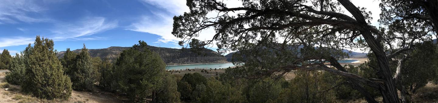
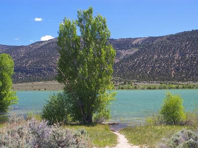
Joes Valley Pavilion Group Site is located in a high mountain valley just above Joes Valley Reservoir, at an elevation of 7,000 feet. Visitors enjoy boating, fishing, and exploring surrounding off-road vehicle trails.
Recreation
The reservoir offers good fishing for cutthroat trout, rainbow trout, tiger muskie and trophy splake. Boating, water skiing and canoeing are popular on the lake. A boat ramp is located nearby on the eastern shoreline. Horseback riding, bouldering, hiking and mountain biking are popular in the area as well.
Facilities
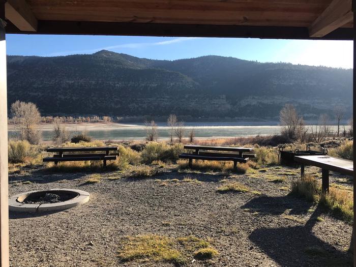
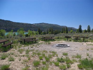
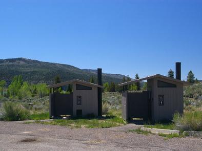
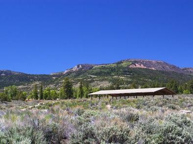
The group campsite can accommodate up to 100 people. A large pavilion offers shade over the picnic tables only. Vault toilets and water are provided, but no electricity is available within the group site. A large gravel parking area provides ample space for vehicles, RVs, trailers and tents.
Natural Features
Joes Valley is situated on the Wasatch Plateau in Central Utah. Sagebrush covers the area. A few cottonwoods line the lakeshore and aspens and pines dot the surrounding hillsides. There are no trees or natural shade in the immediate area of the campground.
Nearby Attractions
Renowned bouldering opportunities are located in nearby Straight and Cottonwood Canyons. Popular mountain fisheries at Grassy Lake, Pete’s Hole, and Potters Ponds are all within 10 miles of the group site. The 370-mile Arapeen Off-Highway Vehicle Trail System can be accessed directly from the Reeder Trailhead. Attractions at Joes Valley Reservoir include the Orange Olsen Guard Station rental, and Joes Valley Campground.