


Directions
From Bend go south 23.5 miles on Hwy 97, then 13.9 miles east on Rd. 21
From La Pine go north 5 miles on Hwy 97, then 13.9 miles east on Rd. 21
Phone
541-383-5300
Activities
HIKING, HORSEBACK RIDING, HORSE CAMPING
Keywords
CHIF,Chief Paulina,Paulina Horse,Chief,Newberry Horse,Chief Paulina Horse Campground,Chief Paulina Horse Campground (OR)
Related Link(s)
Overview
Chief Paulina Horse Camp is the only horse campground located in Newberry National Volcanic Monument in Deschutes National Forest. A favorite for horse enthusiasts, the campground provides visitors with access to lakes, lava flows and spectacular geologic features.
Recreation
Visitors on horseback can explore the area on a variety of trails, with several trailheads located at the campground. Lakes, lava flows and forested areas provide a beautiful scenic backdrop for a variety of rides.
The Crater Rim Trail, considered one of the premiere high country trails in the area, boasts vast stretches of forest, desert and mountain views, with many access points and connector trails for convenient and customized rides.
For visitors who enjoy hiking, the Peter Skene Ogden National Scenic Trail parallels Paulina Creek as it ascends 8.5 miles to the spectacular Paulina Lake.
Lost Lake Trail traverses drier landscapes and heads up from the lakes into a more arid part of the Newberry Caldera. This trail affords some excellent views of The Big Obsidian Flow as well as pumice flats and other features of Newberry Volcanic National Monument. The start of the trail is near Big Obsidian Flow.
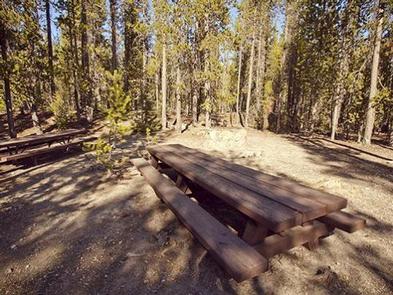
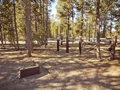
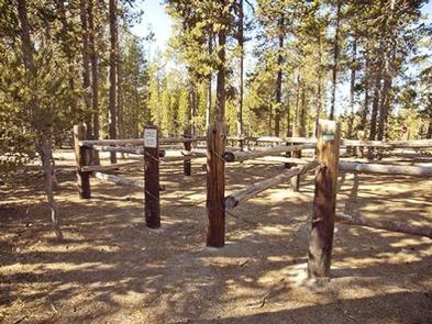
Facilities
All sites are reservable at this campground. There are basic amenities for horse camping, including large equestrian sites with double or quadruple corrals and ample room for parking vehicles and trailers. Roads in the campground are unpaved as are the parking spurs. The campground parking was reconstructed in the fall of 2018 to allow for larger vehicle trailer combinations and some sites were modified to accomodate pull thru parking.
While there is a water tank for the live stock, no potable drinking water is available. Restaurants and basic supplies are available at nearby resorts. Monument information is available at the nearby Paulina Visitor Center.
Natural Features
Visitors can catch a glimpse of the area’s unique geological features by exploring nearby Paulina Lake, located within the collapsed caldera of Newberry Volcano. The lake covers a surface area of 1,531 acres and reaches depths of up to 250 ft., but neither Paulina Lake or its twin, East Lake, receives water from an inlet stream. Instead, each lake relies on relies on rain, snowmelt and hot springs for water. Paulina Creek drains the lake and has chiseled a narrow gorge through the caldera’s west wall creating a remarkable twin waterfall. Thermal vents and hot springs along the lake’s northeast edge help create a highly productive ecosystem. Wetlands, diverse forests, and rocky slopes near the campground provide a necessary habitat for shorebirds, racoons, deer, bats, and the occasional black bear. In September, the outlet of Paulina Lake may be choked with Kokanee salmon moving to spawn in Paulina Creek.
Nearby Attractions
Lava Lands Visitor Center in nearby Bend, Oregon, is a great starting point for visitors to learn about the diverse landscape and history of the area through interpretive programs and exhibits.
Visitors can explore the Lava River Cave, also located in the Newberry National Volcanic Monument. At 5,211 feet (1,588 m) in length, the northwest section of the cave is the longest continuous lava tube in Oregon.