WEST FORK CAMPGROUND, CO Campground Reservation, Info, Images, Map, Directions

WEST FORK CAMPGROUND, Colorado Campground Images, Info & Reservations

Directions

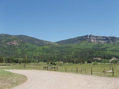
From Pagosa Springs, Colo., travel east on U.S. Highway 160 for about 13 miles, then turn northwest on Forest Road 684 and continue more than a mile to the campground entrance on the West Fork Road.

Phone

970-264-2268

Activities

BOATING, CAMPING, FISHING, HIKING

Keywords

None

Related Link(s)

Rec Area Info & Images

Forest Service Concessionaire

Colorado State Road Conditions

Colorado State Tourism

Overview

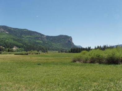
West Fork Campground sits near the West Fork San Juan River in a secluded 10-acre area, just over a mile from Highway 160. Visitors enjoy the area for its hiking opportunities and plentiful solitude.

Recreation

The West Fork and nearby Wolf Creek offer fishing opportunities, but are heavily fished streams. Only skilled and patient fishermen have much luck in these waters.

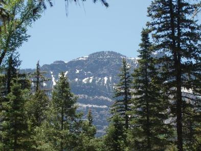
The West Fork Trail, also known as the Rainbow Trail, leads into the Weminuche Wilderness from a trailhead a mile beyond the campground. The first portion of the trail passes through private property, so please stay on the trail and leave the gates as you find them.

Facilities

The campground offers single-family sites, some of which are adjacent to the river but without direct views. Most sites are suitable for large RVs. Picnic tables and campfire rings are provided, as are vault toilets and drinking water.
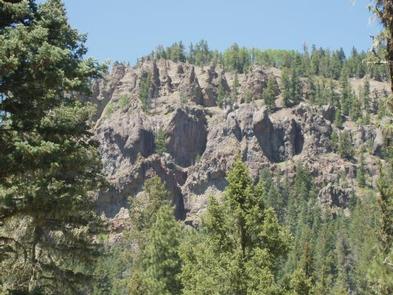
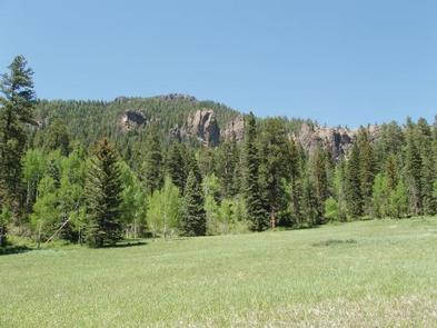
Natural Features

The campground is situated among a forest of mixed conifers, where sites have sun and shade. The West Fork can be heard, but not seen from the campground.

Nearby Attractions

Trailheads for Windy Pass and Treasure Mountain Trails are located across Highway 160 from the West Fork Road turnoff.

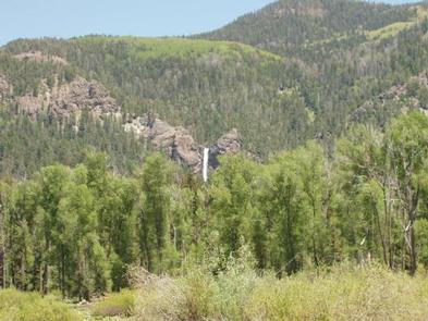
Treasure Falls, located off Highway 160 about three miles from the campground, is an impressive 100-foot waterfall with a short hike leading to its base.

Reservation

More from CampingHiking.net:

LITTLE MAUD CAMPGROUND, Colorado Campground Images, Info & Reservations

Directions Take I-70 west of Denver to Glenwood Springs Exit 116, Highway 82 to Basalt. At Basalt, take Frying Pan Road 15 miles to the Ruedi Complex Entrance. Phone (970) 927-0107 Activities BIKING, CAMPING, INTERPRETIVE PROGRAMS, FISHING, HIKING, WATER SPORTS, WILDLIFE VIEWING Keywords LITTLE MAUD CAMPGROUND,LITTLE MAUD,MAUD Related Link(s) Rec

ALEXANDER SPRINGS REC AREA, Florida Campground Images, Info & Reservations

Directions Alexander Springs Recreation Area is located along County Road 445 in the northeast corner of Lake County between Astor and Altoona, Florida. From I-75, take Highway 40 east through Ocala and Silver Springs approximately 40 miles to Highway 19. Go south on Highway 19 approximately 5 miles to Country

RED BLUFF CAMPGROUND, Missouri Campground Images, Info & Reservations

Directions From St. Louis, Missouri, take I-44 west to Cuba. Continue on Highway 19 south to Cherryville. Take 49 south to Highway V, turn left to Davisville and travel approximately 1 mile and turn left into the campground. Phone 573-743-6042 Activities CAMPING, FISHING, WATER SPORTS Keywords REDB,MARK TWAIN NF -FS

HORSFALL BEACH, Oregon Campground Images, Info & Reservations

Directions From North Bend, OR, proceed north on HWY 101 1.5 miles to Transpacific Lane at the Horsfall Dunes and Beach road sign. Turn left and proceed 1 mile, turning right across railroad tracks. Travel 100 feet cross the railroad tracks and turn righ on Horsfall Beach Road. Proceed 2