BAD BEAR CAMPGROUND, ID Campground Reservation, Info, Images, Map, Directions

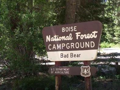
BAD BEAR CAMPGROUND, Idaho Campground Images, Info & Reservations

Directions

Hayfork Group Cg (ID) HIGHWAY 21 Idaho City ID 83706

Phone

208-392-6681

Activities

CAMPING, FISHING, VISITOR CENTER, WILDLIFE VIEWING

Keywords

None

Related Link(s)

Rec Area Info & Images

Idaho State Tourism

Idaho State Road Conditions

Overview

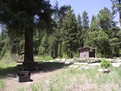
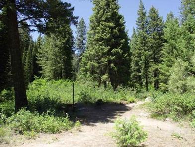
Bad Bear Campground is located 48 miles northeast of Boise, Idaho, in a scenic Ponderosa pine forest along Highway 21 at an elevation of 5,100 feet. Wildlife and summer wildflowers are abundant. Historic Idaho City is just 11 miles south. Mores Creek runs adjacent to the site, offering whitefish and rainbow trout fishing. Highway 21, also known as the Ponderosa Pine Scenic Byway, snakes along Mores Creek to Mores Creek Summit, Gold Fork, and Banner Ridge with breathtaking views of the surrounding mountains and forest.

Recreation

Numerous trail opportunities are in the area, offering hiking, biking, horseback riding, and ATVing. In winter, the area becomes a playground for backcountry skiers and snowmobilers.

Facilities

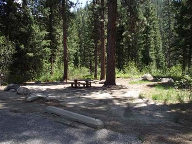
This campground contains 6 sites that can accommodate up to 6 people each. Picnic tables, a charcoal BBQ grill, and fire ring with benches are profided. The site is in an open area with shade. Vault toilets and garbage service are provided. Parking spurs are paved. Due to its proximity to the highway, some noise from passing traffic is to be expected.

Nearby Attractions

Reservation

More from CampingHiking.net:

TRACY RIDGE, Pennsylvania Campground Images, Info & Reservations

Directions Take State Route 321 north off of State Route 59, or south off of State Route 346. Phone 814-368-4158 Activities BOATING, CAMPING, FISHING, HIKING, WATER SPORTS Keywords TRAC,ALLEGHENY NF – FS Related Link(s) Rec Area Info & Images Pennsylvania State Road Conditions Pennsylvania State Tourism Forest Service Concessionaire Overview

ACKER ROCK LOOKOUT, Oregon Campground Images, Info & Reservations

Directions Important note regarding GPS use: please be advised that GPS units can, and have sent guests down the wrong roads to access the Lookout. Please consider following the directions below rather than your GPS unit. Directions: From Canyonville take West 1st Street and turn onto SE 3rd St/OR-227. Continue

SHOAL BAY, Arkansas Campground Images, Info & Reservations

Directions From New Blaine, Arkansas, take State Route 197 north for 2 miles. Follow signs into campground. Phone 479-938-7335 Activities BOATING, CAMPING, FISHING, WILDLIFE VIEWING, SWIMMING SITE Keywords SHOA,DARDANELLE LAKE – ARK.RIV.NAV.,DARDANELLE LAKE Related Link(s) Rec Area Info & Images Arkansas State Tourism Arkansas State Road Conditions Overview This shady

ALTURAS LAKE PICNIC AREA (ID), Idaho Campground Images, Info & Reservations

Directions From Stanley, Idaho, take State Highway 75 south for about 22 miles. Turn right on Alturas Creek Road/Forest Road 205 and continue west for about 2.6 miles to the campground. Phone 928-537-8888 Activities BOATING, CAMPING, FISHING, HIKING, WATER SPORTS, SWIMMING SITE Keywords ALTU,SAWTOOTH NF – FS Related Link(s) Rec