LEPAGE PARK, OR Campground Reservation, Info, Images, Map, Directions

LEPAGE PARK, Oregon Campground Images, Info & Reservations

Directions

From Dalles, Oregon, take I-84 east for 30 miles. Take exit 114 and follow signs to the John Day River.

Phone

541-739-1135

Activities

BOATING, CAMPING, FISHING, PICNICKING, WATER SPORTS, WILDLIFE VIEWING, DAY USE AREA, SWIMMING SITE, PADDLING, SWIMMING, MOTOR BOAT, WATER ACTIVITIES, KAYAKING, CANOEING, WATER ACCESS, WATER SKIING, SAILING, SAILBOARDING

Keywords

LEPA,JOHN DAY LOCK & DAM,Lepage,LePage,LePage Park,Lepage park

Related Link(s)

Rec Area Info & Images

Oregon State Tourism

Oregon State Road Conditions

Overview

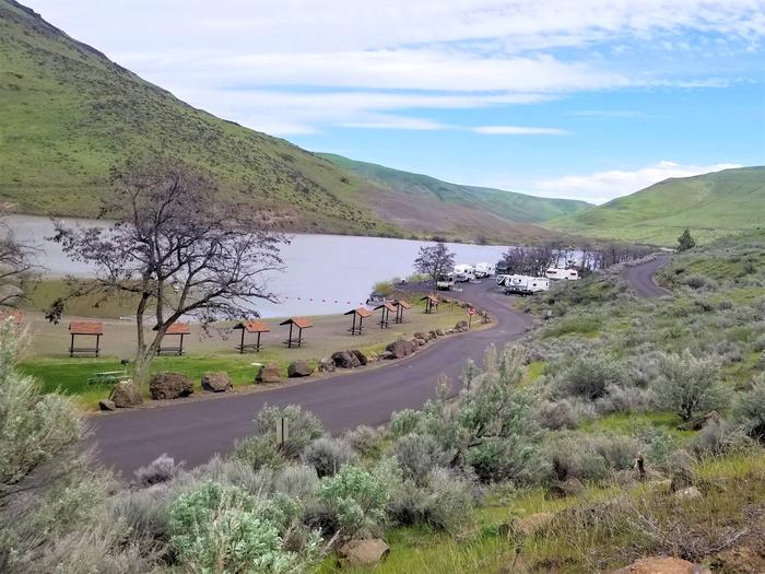
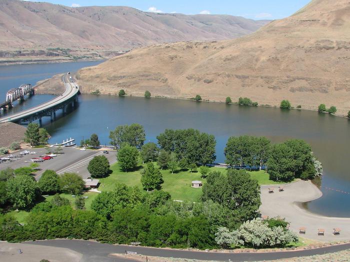
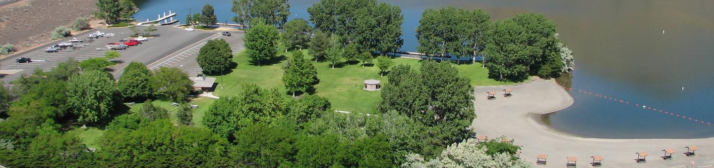
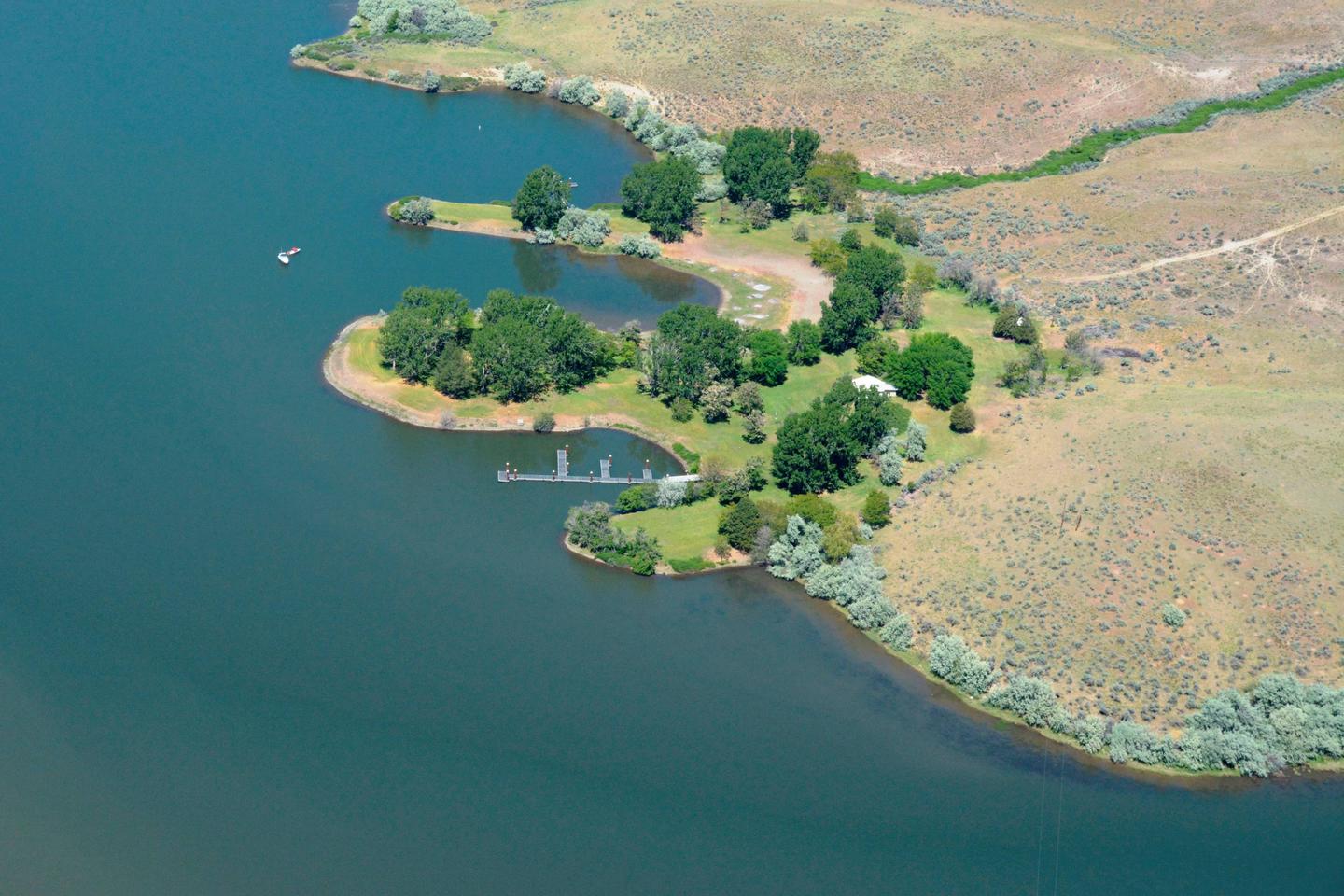
LePage Park is located at the confluence of the John Day and Columbia Rivers just five miles from Rufus, Oregon, and the John Day Dam. Popular activities include river fishing, swimming, water skiing and boating.

Recreation

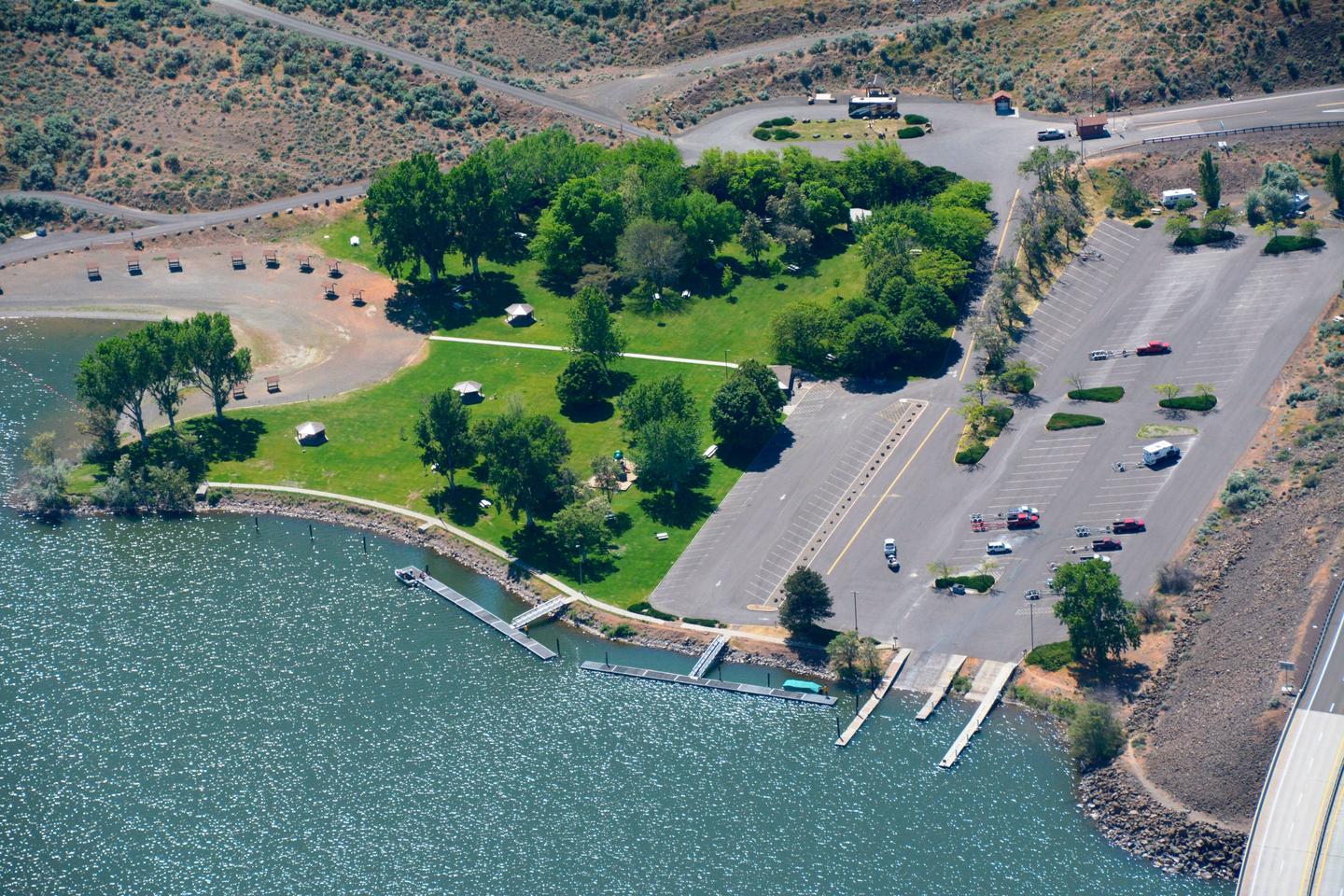
Visitors enjoy boating, water sports and swimming in the river. Anglers fish for smallmouth bass, catfish, and abundant sunfish. A boat ramp is located at the campground for convenient river access.

Facilities

The campground offers 22 sites with electric hookups and 20 primitive walk-to tent sites. Amenities include flush and pit toilets, showers, drinking water, a dump station and boat ramp.

Natural Features

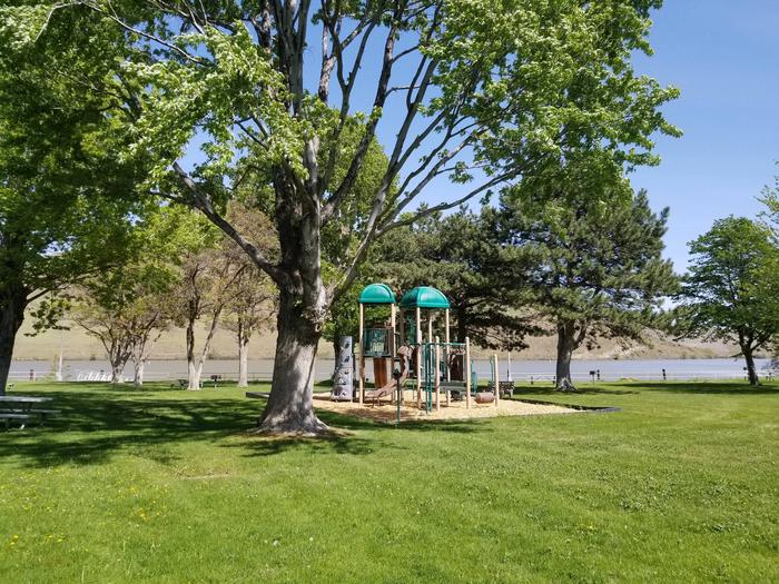
The park is situated in a river basin with a high desert climate. Mature shade trees line the edges of this open grassy park on the banks of the John Day River. Wildlife is abundant in the area, such as mule deer, waterfowl, and birds of prey.

Reservation

More from CampingHiking.net:

BEAVER CREEK CABIN (MT), Montana Campground Images, Info & Reservations

Directions Summer access from West Yellowstone: Proceed 8 miles north on U.S. Highway 191. Turn left onto U.S. Highway 287/Hebgen Lake Road and continue for 14.5 miles. Turn right on Beaver Creek Road/Forest Service Road 985 and drive for 3.5 miles. The cabin access road is on the right side

LOST CREEK GROUP, California Campground Images, Info & Reservations

Directions From Redding, California drive 48 miles east on State Highway 44 to State Highway 89. Turn right into Lassen Volcanic National Park and continue five miles south to Lost Creek Group Campground. It is 1/8-mile south of Crags Campground. Phone 530 595-6121 Activities BOATING, HISTORIC & CULTURAL SITE, CAMPING,

INDIAN TREES CAMPGROUND, Montana Campground Images, Info & Reservations

Directions From Sula, travel 6 miles south on Highway 93, then 1 mile southwest on Forest Road 729. Road to campground is gravel, but the campground and parking spurs are paved. Phone 406-821-3913 Activities BIKING, HISTORIC & CULTURAL SITE, CAMPING, FISHING, HIKING, HUNTING, SWIMMING SITE Keywords INDT,BITTERROOT NF -FS Related

DRIPPING SPRINGS CAMPGROUND (CA), California Campground Images, Info & Reservations

Directions Campground is 11 miles east of Temecula off of Highway 79. Phone 760-788-0250 Activities HISTORIC & CULTURAL SITE, CAMPING, HUNTING, VISITOR CENTER Keywords Dripping Springs Campground (CA) Related Link(s) Rec Area Info & Images California State Road Conditions California State Tourism Overview Dripping Springs campground is a wonderful campground

BIG CREEK HORSE CAMP, North Carolina Campground Images, Info & Reservations

Directions The campground is located off I-40 Exit 451 (Waterville). It sixteen miles east of Newport, TN. Follow Waterville road, crossing over the Pigeon River, past the Walters Power Generating Station and continue one mile to the 4-way intersection at Mt Sterling Gap.   Follow the signs to Big Creek. Drive

Mineral Park Campground, Washington Campground Images, Info & Reservations

Directions From Seattle, take I-5 north for about 42 miles. Exit onto WA-530 East, then continue east on Highway 20 for about 40 miles. At the town of Marblemount, cross the bridge over the Skagit River and continue east approximately 16 miles to the Mineral Park Campground. Phone 360-804-1103 Activities