
Directions
From I-35, take exit 90 to Ankeny/Oralabor Road and go west for 4.8 miles. The road turns into Highway 415, continue and follow signs to the campground.
Phone
515-984-6925
Activities
BIKING, BOATING, CAMPING, FISHING, HIKING, HUNTING, WATER SPORTS, SWIMMING SITE
Keywords
PRAF,SAYLORVILLE LAKE,PRAIRIE FLOWER NORTH,PRAIRIE FLOWER SOUTH,ASTER,BLAZINGSTAR,CONEFLOWER,DOGBANE,ELDERBERRY,FLEABANE,GOLDENROD,HONEYSUCKLE,IRONWEED,JUNEBERRY,KNAPWEED,LEADPLANT,MAYWEED,NIPPLEWORT,OXEYE,SAYLORVILLE LAKE
Related Link(s)
Overview
Prairie Flower Recreation Area is located on the 26,000-acre Saylorville Lake Project, which stretches more than 50 miles up the Des Moines River Valley.
The lake provides a wide variety of recreational activities, including boating, swimming, fishing, hiking and hunting.
Recreation
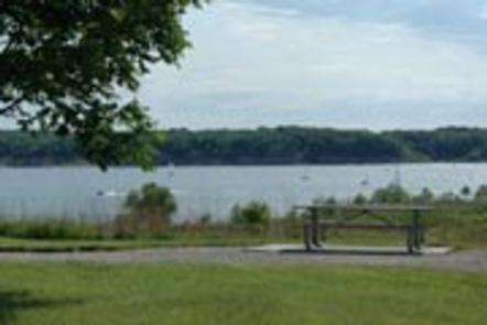
Visitors enjoy Saylorville Lake for its excellent boating, sailing, water skiing, windsurfing and swimming opportunities. Anglers will find walleye, wiper, largemouth bass, catfish, crappie and northern pike.
The paved Neal Smith Trail winds 24 miles from Des Moines to Big Creek State Park and connects the campgrounds on the east side of the lake. It is designated as a National Recreation Trail and is used for biking, hiking, jogging, walking and in-line skating.
Facilities
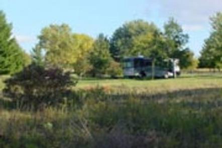
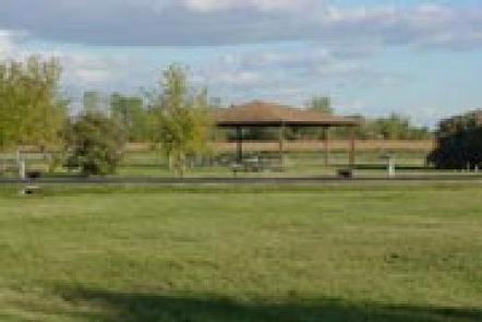
Prairie Flower is a large, open campground covering more than 60 acres. It offers 153 family sites and 10 group sites, all with electric hookups. Many of the family sites in the south end offer a pleasant view of the 6000-acre lake. The north end is made up of mostly group sites in a circle-the-wagon design. Amenities include flush toilets, showers, drinking water and a dump station. The campground also provides educational programs, group shelters, playgrounds and a swimming beach. Nearby amenities include a visitor center, hiking trail, volleyball courts and a disc golf course. Boat ramps and a fishing dock are also close by.
Natural Features
Iowa’s prairie heritage is celebrated in more than 40 acres of prairie plantings throughout the campground. The wide variety of grass and flowers provides vivid colors from mid-summer to fall. Wildlife is abundant throughout the project. White-tailed deer, turkeys, waterfowl and other small game animals roam the lands around the lake.