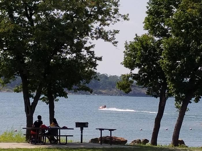
SNAKE CREEK, OK Campground Reservation, Info, Images, Map, Directions

SNAKE CREEK, Oklahoma Campground Images, Info & Reservations

Directions

From Gore, OK, go 15 miles northeast on Highway 100, then turn left and go 1/2 mile west on paved access road.

Phone

918-487-5252

Activities

BOATING, CAMPING, SWIMMING SITE

Keywords

SANK,TENKILLER LAKE,TENKILLER FERRY LAKE,TENKILLER FERRY

Related Link(s)

Rec Area Info & Images

Oklahoma State Road Conditions

Oklahoma State Tourism

Overview

Snake Creek Park is one of the most popular campgrounds on Tenkiller Ferry Lake. With modern facilities, convenient access to boating, and plenty of opportunities to view wildlife, it’s no wonder campers come here year after year.

Recreation

Boating, fishing, water skiing, hiking, and swimming are some of the activities enjoyed by visitors. Prevailing winds and secluded coves create an ideal environment for sailing. Scuba divers enjoy the lake’s clear waters and high visibility. Fishing is good for black bass, white bass, striped bass, crappie and catfish. The trout stream below the dam is one of only two year-round trout fisheries in Oklahoma, and is regularly stocked with rainbow trout. Hunting is also permitted in parts of the lake area, in accordance with federal and state laws.

Facilities

All campsites are equipped with electrical hookups, and the group shelters also have electricity. The park has flush toilets, hot showers, water hydrants, a swim beach, playground, dump station and boat ramps. A marina with concessions is adjacent to the campground. Of the ten marinas with concessions located on the lake, most offer boat and jet-ski rentals, and several have floating restaurants.

Natural Features

Tenkiller Ferry Lake is often referred to as “Oklahoma’s clear water paradise.” The 12,500 acre lake is sourced by the Illinois River and the Baron Fork, which are both designated as Oklahoma Scenic Rivers. It is nestled in the foothills of the Ozark Mountains in the northeastern part of the state. This area, known as Green Country, is surrounded by dense oak-hickory forests, tall bluffs, and rolling hills. The lake has 130 miles of shoreline with plenty of wildlife such as deer and turkey. It serves as one of the flyways of migratory birds, including bald eagles, common loons, and white pelicans.

Nearby Attractions

Visit the Tenkiller State Park for its nature center and scuba diving park, the Sequoyah National Wildlife Refuge near Vian, or the historic city of Tahlequah – the capital of the Cherokee Nation. The scenic upper Illinois River near Tahlequah is great for canoeing and rafting, and the lower Illinois near Gore offers prime trout fishing.

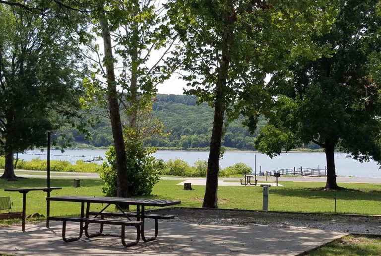
Reservation

More from CampingHiking.net:

SANTA FE TRAIL, Kansas Campground Images, Info & Reservations

Directions From I-70, take Highway 177 south for 30 miles. Continue west across the dam road, then right onto City Lake Road. After a mile turn right into the campground entrance. Phone 620-767-5195 Activities BOATING, CAMPING, FISHING, HIKING, HUNTING Keywords SANT,COUNCIL GROVE,COUNCIL GROVE LAKE Related Link(s) Rec Area Info &

SOUTH OVERLOOK (IA), Iowa Campground Images, Info & Reservations

Directions 1105 North HWY T15 Knoxville, Iowa 50138 From Pella, Iowa, follow county road T-15 southwest for 4 miles, then follow signs to South Overlook. Phone 641-828-7522 Activities BIKING, BOATING, CAMPING, HUNTING, WILDLIFE VIEWING Keywords Related Link(s) Rec Area Info & Images Iowa State Road Conditions Iowa State Tourism Overview

LAST CHANCE CAMPGROUND, Alaska Campground Images, Info & Reservations

Directions From the Alaska State Ferry Terminal, take Tongass Highway north 4.8 miles. At milepost 7, turn right on Revilla Road and drive for 3 miles. The campground is on the right. Phone 907-225-2148 Activities BOATING, HISTORIC & CULTURAL SITE, CAMPING, FISHING, HIKING, WILDLIFE VIEWING, SWIMMING SITE Keywords LAST,TONGASS NF

JOHN W. FLANNAGAN DAY USE, Virginia Campground Images, Info & Reservations

Directions From VA-63, turn right onto State Route 614. Continue straight for approximately two miles. Phone 276-835-9544 Activities BOATING, CAMPING, FISHING Keywords JOHW,John W. Flannagan Dam,Spillway- Shelters 2 and 3,Below dam recreation area,The two smaller shelters below,JOHN W FLANNAGAN DAY USE,JOHN W FLANNAGAN DAM Related Link(s) Rec Area Info &

KEYSTONE RANGER STATION, Wyoming Campground Images, Info & Reservations

Directions From Laramie, take Highway 130 west, then State Highway 11 to Albany, WY. The cabin is located 8 miles west of Albany, on Forest Service Road 542. In the winter, access to the cabin is 8 miles by snowmobile, skiing or snowshoeing from Albany Snowmobile Parking Lot. Phone 307-745-2300

PINEKNOT, California Campground Images, Info & Reservations

Directions From I-10 in Redlands, take Highway 330 to Highway 18 in Running Springs. Continue east on Highway 18 at Big Bear Lake Dam, go straight at the dam and follow Highway 18. Turn onto Summit Boulevard and continue to a block wall. Turn left into the campground. Phone 909-866-8550