GREENVILLE RECREATION AREA, MO Campground Reservation, Info, Images, Map, Directions

GREENVILLE RECREATION AREA, Missouri Campground Images, Info & Reservations

Directions

The physical address of the park is located a mile south of Greenville, MO.

From St. Louis, take I-55 south to Highway 67 south to Greenville. From here, continue south about 1 mile and look for signs.

From Poplar Bluff take Highway 67 north about 29 miles and look for signs.

Phone

573-224-3884

Activities

BIKING, HISTORIC & CULTURAL SITE, CAMPING, FISHING, DAY USE AREA

Keywords

GRRE,OLD GREENVILLE,OLD GREENVILLE HISTORIC SITE,HWY 67 CAMPGROUND,WAPPAPELLO LAKE,OLD TOWN OF GREENVILLE,GREENVILLE CAMPGROUND,WAPPAPELLO LAKE

Related Link(s)

Rec Area Info & Images

Missouri State Tourism

Missouri State Road Conditions

Overview

Greenville Recreation Area is located on the northern end of Wappapello Lake, on the St. Francis River. The spacious campground provides entertainment like biking/hiking for families and friends who choose to visit. The playground is great for keeping the younger children occupied.

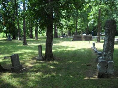
Every year, the park puts on the Black Powder Rendezvous and the Old Greenville Days events to celebrate history of the early 1900’s. Live music and food are part of the festivities.

Click here to take a virtual tour of the facilities at Wappapello Lake! 

Recreation

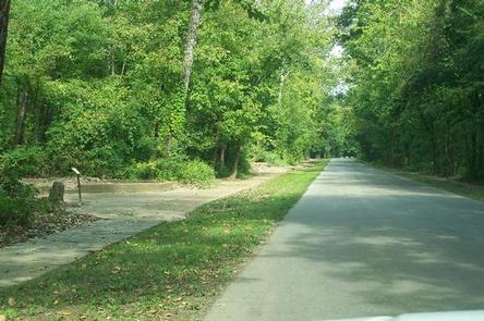
Greenville boasts a one-mile historical trail to explore. The lake is home to some of Missouri’s most sought after game fish, including largemouth bass, crappie, bluegill, white bass and channel catfish.

Special events are put on throughout the year.

Facilities

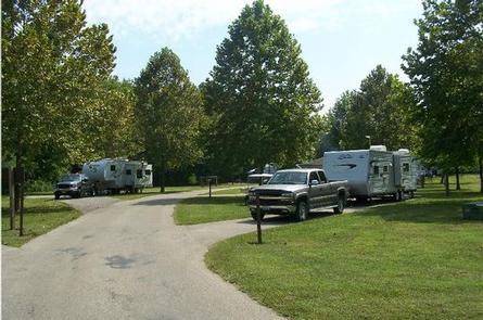
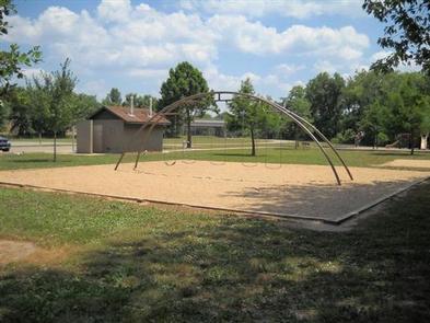
The day use portion of the recreation area includes 14 picnic sites, a playground, basketball court, volleyball court, horseshoe pits, day use shelter, boat ramp with courtesy dock. Facilities within the campground include showers, a playground, and 111 campsites with full hookups, consisting of electric, water, and sewer.

Natural Features

Wappapello Lake, fed by the St. Francis River, has a seemingly endless string of secluded coves hugged by a winding, wooded shoreline. The public recreation area spans 45,000 acres in the southeastern Ozark foothills.

Nearby Attractions

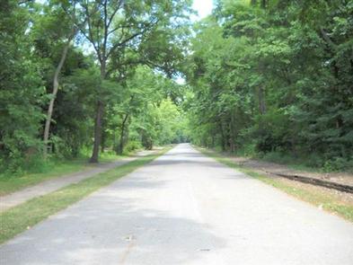
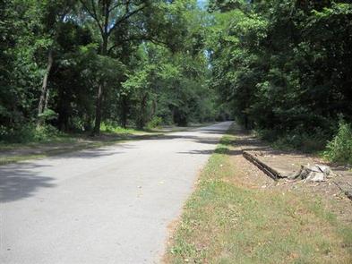
Visitors can hike or bike down a scenic 3 mile asphalt bike trail that connects the Greenville Campground and Recreation area to the City of Greenville. Other enjoyable trails surround the lake, like the Johnson Tract Natural Area and Trail, the Ozark Trail, and the Wappapello State Park Trail.

Reservation

More from CampingHiking.net:

JACKSON GUARD STATION, Colorado Campground Images, Info & Reservations

Directions From Montrose, take Highway 50 east for about 20 miles. Turn right (south) onto County Road 858, which leads up the Big Cimarron Drainage for about 20 miles. Shortly after passing Silver Jack Reservoir on the right, Jackson Guard Station will be on the left. From Gunnison, take Highway

PLENTY CUTTHROAT CABIN, Alaska Campground Images, Info & Reservations

Directions Approximately 35 air miles from Ketchikan at the west end of Orchard Lake. Accessible by float plane or boat. A 1-mile trail from Shrimp Bay provides saltwater access. Mooring buoy for boat is located in Klu Bay. Refer to USGS Ketchikan D-5. In fall, winter, and early spring, the

CIRCLE X RANCH GROUP CAMPGROUND, California Campground Images, Info & Reservations

Directions Pacific Coast Highway to Yerba Buena Road. Turn inland; go 5.4 miles to Circle X Ranch contact station. Phone 805-370-2301 Activities BIKING, CLIMBING, CAMPING, HIKING, PICNICKING, VISITOR CENTER, WILDLIFE VIEWING Keywords Circle X Ranch Campground,Circle X Ranch Group Camp,NPS Santa Monica Mountains Campground,Circle Ranch Campground Related Link(s) Rec Area

HASTINGS CAMPGROUND, Maine Campground Images, Info & Reservations

Directions From Gilead, Maine, take Highway 113 south for 3 miles to campground. Phone 603-466-2713 Activities BIKING, CAMPING, FISHING, HIKING Keywords HAST,WHITE MOUNTAIN NF -FS Related Link(s) Rec Area Info & Images Maine State Road Conditions Forest Service Concessionaire Maine State Tourism Overview Hastings Campground is located on Route 113

Alpine Meadows Campground, California Campground Images, Info & Reservations

Directions From State Highway 267, turn onto Martis Dam Road. Continue on Martis Dam Road for approximately 1.2 miles. Tur miles. Turn right a 0.2 miles to the campground entrance. You have now arrived at the entrance to Alpine Meadows Campground.  Phone (530) 587-8113 Activities BIKING, CAMPING, FISHING, PICNICKING, WILDLIFE

BIG OAKS, Georgia Campground Images, Info & Reservations

Directions From Hartwell, GA, take Highway 29 North towards Anderson, SC for about 5 miles. Big Oaks is located on the left next to the Hartwell Visitor Center and Manager’s Office. 5823 DAM ROAD HARTWELL, GA 30643 Phone 888-893-0678 HARTWELL PROJECT OFFICE Activities BOATING, FISHING, PICNICKING, DAY USE AREA, SWIMMING,