TWO LAKES, WI Campground Reservation, Info, Images, Map, Directions

TWO LAKES, Wisconsin Campground Images, Info & Reservations

Directions

From Drummond follow Forest Road 213 southeast to the intersection of Forest Road 213 and 216. Veer left (east) and continue on Forest Road 213 for 2 miles. Veer right (south) onto Forest Road 214 and travel 0.5 mile to the campground.

Phone

715-739-6334

Activities

BIKING, BOATING, CAMPING, FISHING, HIKING, WATER SPORTS, SWIMMING SITE

Keywords

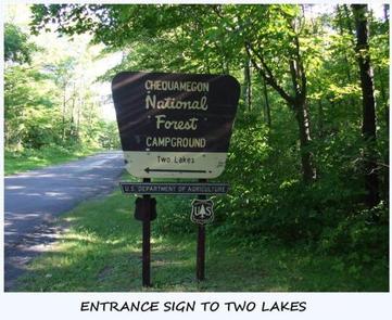
TWOL,TWO LAKES CAMPGROUND,CHEQUAMEGON-NICOLET NF – FS

Related Link(s)

Rec Area Info & Images

Forest Service Concessionaire

Wisconsin State Road Conditions

Wisconsin State Tourism

Overview

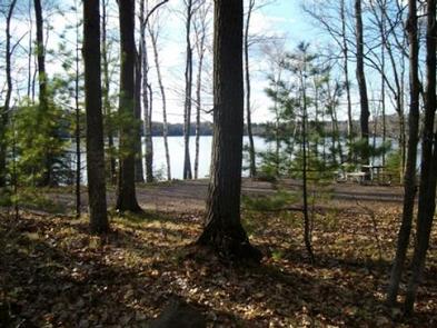
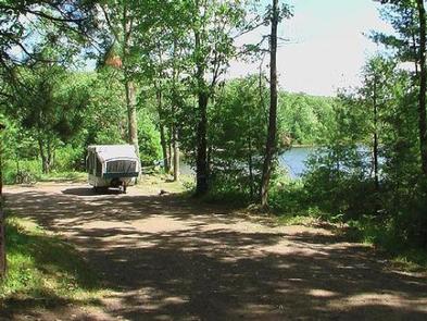
Two Lakes Campground is nestled between Lake Owen and Bass Lake. Campsites are spacious and shaded by pine and mixed hardwoods, and most sites offer sweeping lake views.

Recreation

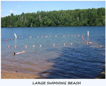
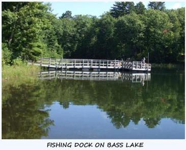
Campers have access to two swimming beaches, two boat ramps and a fishing pier. Lake Owen and Bass Lake contain panfish, northern pike, walleye, bass and trout.

Lake activities include power boating, sailing, water skiing, canoeing and kayaking. There is a half-mile interpretive trail, as well as access to the North Country National Scenic Trail.

Facilities

The campground has drinking water, vault toilets and a dump station for RVs. Each site has a picnic table, fire ring and grill.

Natural Features

Two Lakes is adjacent to the Porcupine Lake Wilderness in Chequamegon National Forest. The forest covers more than 1.5 million acres of Wisconsin’s Northwoods.

Some of the Porcupine Lake Wilderness contains rolling hills covered with oak, maple, hemlock and white pine. The remainder of the area is fairly flat.

Nearby Attractions

The town of Drummond, Wisconsin, is less than 10 miles away for getting supplies, dining out or visiting the historical museum.

Reservation

More from CampingHiking.net:

SILTCOOS SAND CAMPING, Oregon Campground Images, Info & Reservations

Directions From Florence Oregon, travel 7 miles south on Highway 101 to the Siltcoos Beach Access Road. Turn west on Siltcoos Beach Access Road and proceed 1 mile 1.5 miles to Driftwood II Campground on the right. The Sand Access is within the Campground. Phone 541-271-6000 Activities CAMPING, FISHING, HIKING,

COTTONWOOD CAMPGROUND (CA), California Campground Images, Info & Reservations

Directions The park headquarters address is not the physical address of the campground. To get to the campground, take Interstate 10 to the I-10 exit 168 Mecca/Twentynine Palms exit and follow signs to Joshua Tree National Park. The exit is 25 miles east of Indio, California. Phone 760-367-5554 Activities CAMPING,

LADYBIRD LANDING, Oklahoma Campground Images, Info & Reservations

Directions From Porum, Oklahoma, take Highway 71 west for 8 miles, then follow signs to the campground. Phone 918-799-5843 Activities BOATING, CAMPING, FISHING, HIKING, SWIMMING SITE Keywords Dam Site South Related Link(s) Rec Area Info & Images Oklahoma State Road Conditions Oklahoma State Tourism Overview Ladybird Landing Campground sits along

Fish Dam Creek Park, North Carolina Campground Images, Info & Reservations

Directions From Charlotte, North Carolina , take I-77 North (approximately 60 miles) before merging onto Highway 421 North towards Wilkesboro/Boone. Continue to Exit 286B (approximately 20 miles), turn left onto Highway 268 and continue for approximately 3.5 miles. Turn right onto Reservoir Road. Continue on Reservoir Road across the dam

SWINGING BRIDGE, Idaho Campground Images, Info & Reservations

Directions From Horseshoe Bend, ID, take State Rt. 55 north for 21.5 miles to the campground sign. Turn left after the sign into the campground(on west side of highway). Phone 541-351-1182 Activities BOATING, CAMPING, FISHING Keywords SWIN,PAYETTE RIVER HIGHWAY 55,BOISE NF – FS Related Link(s) Rec Area Info & Images