
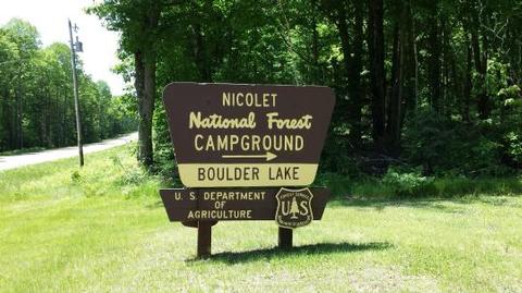
Directions
From Townshed, travel Highway T for about 17 miles to the intersection with Highway W. Turn onto Highway W and continue just over a mile to Forest Road 2116. Turn right and continue to the campground.
Phone
715-276-6333
Activities
BOATING, CAMPING, FISHING, WATER SPORTS, DAY USE AREA, SWIMMING SITE
Keywords
BOLA,CHEQUAMEGON-NICOLET NF – FS
Related Link(s)
Wisconsin State Road Conditions
Overview
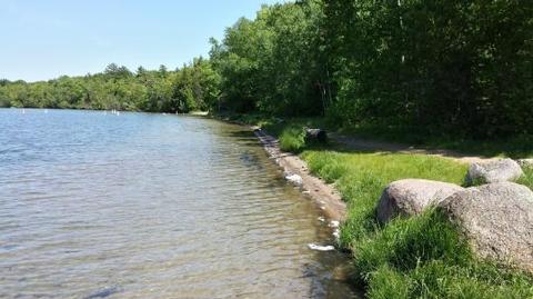
Boulder Lake Campground is conveniently located near Boulder Lake in northern Wisconsin. It is the forest’s largest campground but campsites fill up fast. The campground is home to individual and group sites, making it an ideal location to relax with friends or family. Recreational opportunities abound.
Recreation
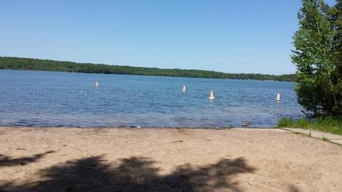
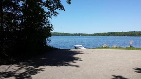
Boulder Lake provides ample opportunities for power boating, water skiing, fishing and swimming. Anglers might catch walleye, northern pike, bass or panfish. Ice fishing is also popular on the lake, and the boat ramp and parking area are plowed during the winter to provide better access to the lake.
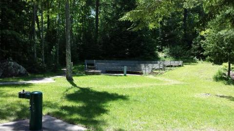
Nearby streams are good for trout fishing and in addition, the Wolf River offers whitewater rafting and canoeing opportunities. Educational programs may be offered sporadically at the campground’s amphitheater.
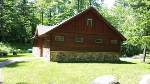
Facilities
The campground offers dozens of accessible, single-family sites for tent and RV camping. Ten accessible group sites are also available for reservation. They can accommodate anywhere from 16 to 30 people.
Campsites are equipped with tables and campfire rings with grills. Accessible vault toilets, showers and drinking water are provided. Some sites offer electric hookup. A dump station is located within the campground. Some campsites are available on a first-come, first-served basis.
Natural Features
The campground lies around the southern end of 362-acre Boulder Lake and is the largest public campground in the Chequamegon-Nicolet National Forest area. It is located in a stand of young hardwoods, overlooking the lake. Some campsites are situated along the water’s edge and others are further away, providing a quieter camping experience. Puddles and damp spots are common throughout the lush campground.
Nearby Attractions
Langlade is the nearest city, about 25 miles west of the campground.