
Directions
Take the Snowville, Utah, exit off Interstate 84, northwest of Tremonton. Continue north on the paved highway for 6.5 miles. Turn left (north) at the Curlew Campground sign, then go another half-mile on a gravel road to the campground.
From Holbrook, Idaho, travel 24 miles west of Malad and continue south for 7.5 miles on the paved highway. Turn right (west) following the same highway and go almost 2 miles to the Curlew Campground turnoff. Turn right (north) on gravel road and go a half-mile to the campground. The route is relatively easy for RVs.
Phone
208-236-7500
Activities
BIKING, CAMPING, FISHING, HORSEBACK RIDING, SWIMMING SITE
Keywords
CURL,Stone,Stone Reservoir,CARIBOU-TARGHEE NF – FS
Related Link(s)
Overview
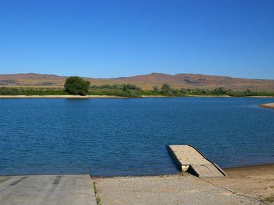
Curlew Campground is located just seven miles north of Snowville, Utah, and fewer than 10 miles south of Holbrook, Idaho. The campground is adjacent to Stone Reservoir in the Curlew National Grassland. It sits at an elevation of 4,700 feet.
Recreation
Stone Reservoir is closed to all motor crafts, boats and water crafts do to invasive spieces.
The surrounding area is crisscrossed by numerous off-road vehicle trails. Horseback riding is allowed on the open range.
Facilities
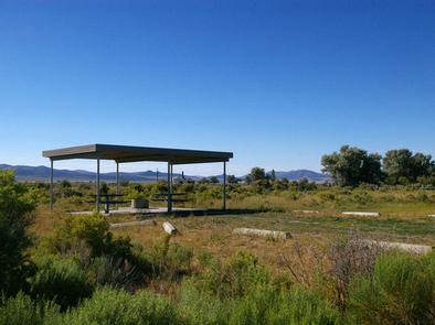
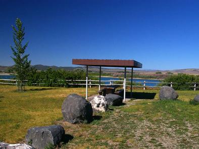
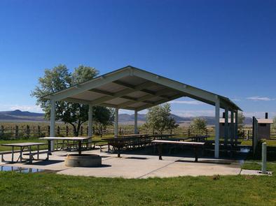
The campground is open year-round and contains one large group site that can accommodate up to 200 people. A picnic shelter, picnic and serving tables, grills, campfire rings, drinking water spigot, cement site pad and horseshoe pits are provided.
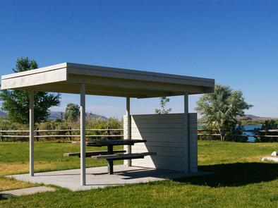
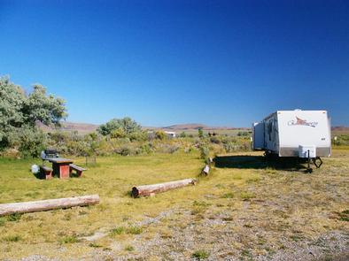
Several single sites and one triple-family campsite, are available as well. Each individual campsite is equipped with tables, campfire rings and grills. Most sites have small picnic shelters for shade. Site 14 is accessible, with a cement site pad and paved parking spur.
Accessible vault toilets and drinking water are provided. A campground host is on-site. The road within the campground is paved and parking spurs, unless otherwise noted, are gravel. Security is provided by the host and periodic patrols by the county sheriff.
Natural Features
The surrounding area is an open desert environment dotted with sagebrush and very few trees. The campground contains open, mowed lawns. Natural shade is very limited.
Curlew National Grassland offers great areas for year-round birding. Some of the birds found in the area include Sage Thrasher, Vesper Sparrow, Brewer’s Sparrow, Ash-throated Flycatcher and Scott’s Oriole. Sharp-tailed grouse are best viewed in March and April.
Nesters include the Ferruginous Hawk, Common Poorwill, Gray Flycatcher, Pinyon and Western Scrub-Jays, Juniper Titmouse, Blue-gray Gnatcatcher, Mountain Bluebird and Loggerhead Shrike. Redhead, Ring-necked duck, Canvasback and Lesser Scaup can often be seen near Stone Reservoir. Fall brings Canada and Snow geese. Wintering birds include Killdeer, Marsh Wren and song sparrows.