

Directions
From Ferron Utah Willow Lake is located approximately 25 miles up Ferron Canyon, on Forest Road 022. From Mayfield Utah Willow Lake is located approximately 27 miles from Mayfield. Head East from up Forest Road 022, turn left on Skyline Drive at 12 Mile Campground then following signage towards Ferron Reservior. Willow Lake is located approximately 4 miles east of Ferron Reservior.
Phone
435-384-2372
Activities
BIKING, BOATING, CAMPING, FISHING, HIKING, HUNTING, PICNICKING, WILDLIFE VIEWING, PADDLING, OFF ROAD VEHICLE TRAILS, KAYAKING, CANOEING, NON-MOTORIZED BOATING
Keywords
WILA,Willow,MANTI-LASAL NF -FS
Related Link(s)
Overview
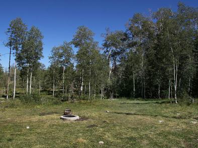
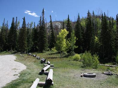
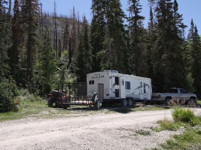
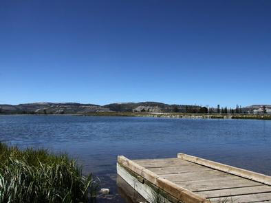
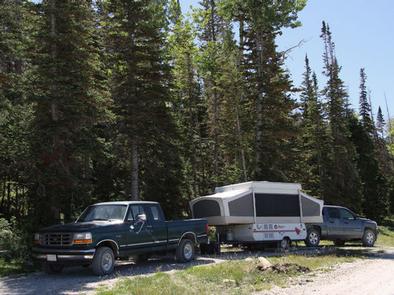
WIllow Lake Campground is located on the east shore of Willow Lake, at an elevation of 9,640 feet. The small lake sits in an alpine basin high on the Wasatch Plateau. Spruce, fir and aspen trees dot the open landscape, providing partial shade in the campground. Wildlife and summer wildflowers are plentiful, and autumn leaves put on quite a show in the surrounding area. This campground contains 10 single-family sites with picnic table and campfire rings. Most sites have lake views, though none have direct lake access. A footpath leads to the shore from the campground. Vault toilets are provided, but there is no water or garbage service. Roads and parking spurs are gravel. Visitor enjoy fishing, canoeing, wildlife viewing, mountain biking, and hiking to explore many of the surrounding trails. In winter, the area becomes a playground for snowobile enthusiasts.
Recreation
Canoeing and fishing are popular activities on the lake. A footpath leads to the lakeshore from the campground.
The campground is a staging area for the expansive Arapeen OHV Trail System, with more than 350 miles of designated, maintained trails for all riding levels.
Facilities
The campground contains ten single-family campsites, most of which have lake views. Sites are equipped with vault toilets and campfire rings. This campground does not have water or garbage service so visitors will need to plan to “pack it in and pack it out”. Roads and parking spurs within the campground are gravel.
Natural Features
This small lake sits in an alpine basin high on the Wasatch Plateau. Spruce, fir and aspen trees dot the open landscape, providing partial shade in the campground. Wildlife and summer wildflowers are plentiful, and autumn leaves put on quite a show in the surrounding area.
Nearby Attractions
Ferron Reservoir is a short drive west, offering additional fishing and canoeing opportunities. Other lakes in the area include Duck Fork Reservoir and Wrigley Reservoir. Skyline Drive runs along the top of the Wasatch Plateau for more than 60 miles, rewarding visitors with beautiful mountain scenery, glacial cirques, spruce-fir forests, aspen forests and access to numerous lakes and reservoirs.