
Directions
From Troy, travel west on Highway 2 for approximately 7 miles. The fee station and campground hosts are located on the east side of the road, prior to crossing the Yaak River.
Phone
406-295-4693
Activities
BIKING, BOATING, HISTORIC & CULTURAL SITE, CAMPING, FISHING, HIKING, WILDLIFE VIEWING, SWIMMING SITE
Keywords
YAAR,YAAK,RIVER,GROUP,YAAK RIVER CAMPGROUND GROUP,KOOTENAI NF – FS
Related Link(s)
Overview
Yaak River Day Use Area is a great place for a large group to enjoy beautiful scenery and access to ample recreation opportunities. Some spectacular sites on the Kootenai National Forest can be found nearby.
Recreation
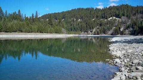
The Yaak and Kootenai Rivers provide ample opportunity for visitors to enjoy fishing, rafting and canoeing, among other activities. Boats can be launched at a primitive boat ramp near the campground. Anglers can expect a catch of mostly whitefish and a variety of trout.
Hiking and mountain biking opportunities are available on a variety of trails within the Cabinet Mountains.
Kootenai Falls, the largest un-dammed waterfall in the state and an attraction of historical significance for the Kootenai Tribe, is located about 7 miles east of Yaak River Day Use Area. It offers spectacular views, as the river drops 300 feet in just a few hundred yards. A swinging bridge is available and provides a different point of view to see the falls.
Facilities
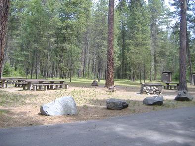
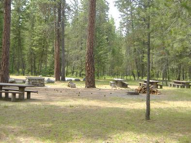
The day use area can accommodate up to 125 people. It is equipped with multiple tables, grills and a large campfire circle. Accessible vault toilets and drinking water are provided.
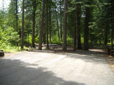
An adjacent campground is available for overnight tent and RV camping. It offers dozens of campsites and access to a boat ramp.
Natural Features
The day use area is located on the east side of Yaak River Campground. Both facilities are in a heavily wooded part of the forest, with the Yaak and Kootenai Rivers running nearby. Tall grasses, shrubs and young pines cover the ground and mature evergreens offer shade overhead.
The facility is situated at an elevation of about 1,900 feet, close to the Montana-Idaho border in northwestern Montana. A variety of wildlife makes its home in the area.
Nearby Attractions
Yaak River Day Use Area is located along the David Thompson Historic Route, which is listed as one of the Top 10 Scenic Drives in the Northern Rocky Mountains.
Ross Creek Giant Cedars, a 100-acre grove of majestic cedar trees, is about 23 miles south of the day use area and campground.