

Directions
From Red Bluff, drive east on Highway 36 toward Lassen National Park and Chester. Turn right onto Payne’s Creek Loop in Paynes Creek, then turn right on Plum Creek Road (County Road 202) and continue for about 9 miles to the junction of County Road 707B (Forest Service Road 28N29/Ponderosa Way). Turn right and follow this road past Black Rock Campground until you reach Forest Service Road 27N08. Turn left and drive less than a mile to road 27N21. Turn left and proceed to the McCarthy Point Lookout.
Please call the Almanor Ranger District for alternate road directions if needed.
Phone
530-258-2141
Activities
HISTORIC & CULTURAL SITE, CAMPING, FISHING, HIKING, HORSEBACK RIDING, WILDLIFE VIEWING
Keywords
MCPL,LASSEN NF – FS
Related Link(s)
California State Road Conditions
Overview
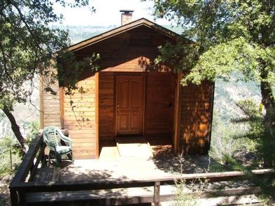
McCarthy Point Lookout was constructed in 1936 by the Civilian Conservation Corps for use in spotting wildfires. During World War II, the lookout served as part of an aircraft defense monitoring system that extended throughout California. The lookout is accessible by vehicle, but a high-clearance vehicle is recommended. Guests must walk approximately 1,000 feet along a paved trail to reach the lookout from the parking area. This is a high cliff area, so caution is advised. The cabin offers several creature comforts, but guests may need to bring some supplies and gear for their stay. The scenic views and remote location make McCarthy Point Lookout an ideal retreat.
Recreation
The lookout is an excellent base for exploring the recreational opportunities of the Ishi Wilderness. Many hiking and equestrian trails crisscross the Wilderness.
Special fishing regulations are in effect for Mill and Deer Creeks within the Wilderness. Please check the State of Californias Fishing Regulations before fishing. A valid California fishing license is required.
Facilities
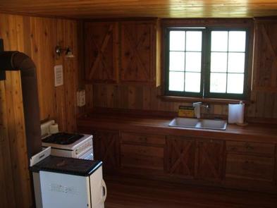
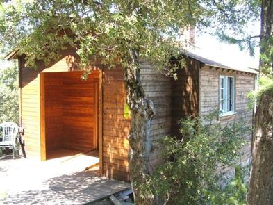
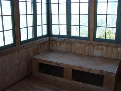
McCarthy Point Lookout is a two-room cabin with a kitchen and a bedroom. The bedroom is surrounded on three sides by windows and has overhead propane lights, two single-sized sleeping platforms and six aluminum cots. The kitchen has overhead propane lights, a propane cook stove, wood stove, double sinks with running non-potable water (hot water is not available), a large picnic-style table with benches and a portable gas barbecue. Propane is provided. There is a broom and dust pan for tidying up the cabin. Wheeled carts are provided to transport gear to the lookout. An outhouse with a pit toilet is located at the parking area. The cabin does not have potable water or electricity. Guests need to provide their own drinking water. Garbage bags are needed to pack out trash. Items such as bedding, sleeping pads, cooking pots, utensils, dishes, dish soap, toilet paper, paper towels, matches and flashlights are not provided.
Natural Features
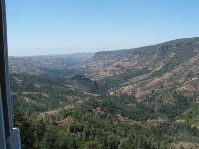
The lookout is perched at an elevation of 3,600 feet on the southern end of Mill Creek rim overlooking scenic Mill Creek Canyon and the Ishi Wilderness. The cabin is tucked into a stand of mixed evergreens. McCarthy Point is located within a state game refuge that protects species like wild hog, mountain lion, black bear, coyote, bobcat, Tehama deer and rabbit. A variety of raptors nest on rock cliffs in the nearby Ishi Wilderness, including hawks, eagles, falcons and owls. Other common bird sightings include wild turkey, quail, canyon wrens, band-tailed pigeons and myriad songbirds.
Nearby Attractions
Ishi Wilderness