KANZA VIEW PICNIC SHELTER, KS Campground Reservation, Info, Images, Map, Directions

KANZA VIEW PICNIC SHELTER, Kansas Campground Images, Info & Reservations

Directions

1 mile north of Council Grove, Kansas on Highway 177. Then west 200 yards on Lake Road (goes across dam).

Phone

(620) 767-5195

Activities

HISTORIC & CULTURAL SITE, CAMPING

Keywords

Related Link(s)

Rec Area Info & Images

Kansas State Road Conditions

Kansas State Tourism

Overview

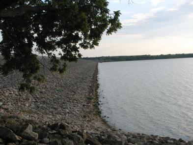
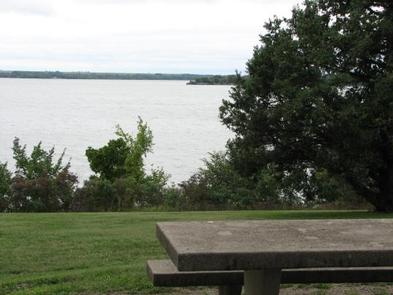
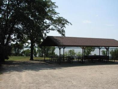
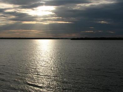
Kanza View Picnic Shelter is located at the east end of Council Grove Dam just off Kansas Highway 177. It offers some of the most scenic views of the lake.

Recreation

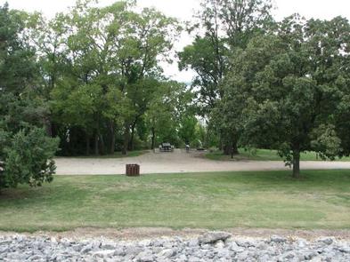
Although Council Grove Lake has excellent fishing and boating opportunities, access to the water limits these activities at Kanza View. Picnicking and tent camping at Kanza View’s primitive sites are this location’s primary activities.

Facilities

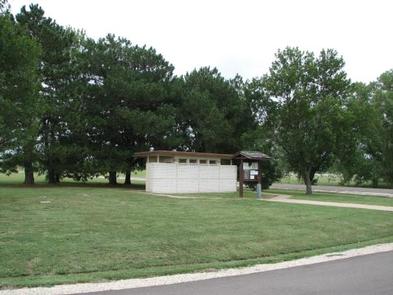
Kanza View offers five undeveloped campsites most suitable for tent camping. The roofed day-use picnic pavilion has six picnic tables seating 40 people. The picnic pavillion is the only facility that may be reserved in advance. There is no electricity. A single water hydrant for shared use is located near the pavillion. Bathroom facilities are masonary vault toilets.

Natural Features

The park sits on top of a hill adjacent to the lake offering breathtaking lake views. Although the park has many open grassy areas interspersed with large Cottonwood and Oak trees, access to the lake is limited due to the steep, rocky terrain.

Nearby Attractions

Multiple developed campgrounds surround Council Grove Lake in the near vicinity. The town of Council Grove affords an array of historic sites and the Tallgrass Prairie National Preserve is 18 miles south on Highway 177.

Reservation

More from CampingHiking.net:

HOUSTON VALLEY, Tennessee Campground Images, Info & Reservations

Directions From Greeneville, TN take TN 70 south about 10 miles. Turn right onto TN 107 west, travel nine miles. Houston Valley is located on the left. From Newport, TN, travel on US25/70 south, turn left onto TN 107 east and travel five miles to Houston Valley. It will be

SHIRTTAIL CREEK, California Campground Images, Info & Reservations

Directions From either east bound or west bound Interstate 80 take exit 121, Auburn Ravine Road to Foresthill. Continue east for 17 miles, to Foresthill. Travel through town, about 9 miles, to Forest Road 10/Sugar Pine Road. Turn left and continue 9 miles to the Sugar Pine Campgrounds road (approximately

STONY FORK CAMPGROUND, Virginia Campground Images, Info & Reservations

Directions From Wytheville, VA, follow I-77 north to Exit 47. Turn left onto Route 717 and drive 4 miles to Stony Fork Campground. Total travel distance is 10 miles. Phone 276-783-5196 Activities BIKING, CAMPING, FISHING, HUNTING, WILDLIFE VIEWING Keywords SFCA,GEORGE WASHINGTON/JEFFERSON NF-FS Related Link(s) Rec Area Info & Images Virginia

SOUTH PIKE BAY, Minnesota Campground Images, Info & Reservations

Directions From Cass Lake, Minn., travel 3 miles south on Highway 371. Turn east onto Forest Road 2137 and travel 2 miles to the campground. Phone 218-547-1044 Activities BIKING, BOATING, HISTORIC & CULTURAL SITE, CAMPING, FISHING, WATER SPORTS, SWIMMING SITE Keywords SPKB,Pike Bay Related Link(s) Rec Area Info & Images

WHITTEN PARK, Mississippi Campground Images, Info & Reservations

Directions From Interstate 22 , take Highway 25 (exit 104). Then turn left at the first red light, then turn left onto Access Road at the next traffic light. Go north 4 miles. Campground is on the left side of the road within the Jamie L. Whitten Historical Center Park.