THIELSEN VIEW CAMPGROUND, OR Campground Reservation, Info, Images, Map, Directions

THIELSEN VIEW CAMPGROUND, Oregon Campground Images, Info & Reservations

Directions

From Roseburg, OR, travel east on OR-138 / NE Diamond Lake Boulevard for 80 miles, turn right onto Forest Road 4795 at the sign for the Diamond Lake Recreation Area. Turn right at the gas station and continue for 3 miles, the campground is on the left. From Bend or Klamath Falls: Take HWY 97 to HWY 138. Take HWY 138 east towards Roseburg. Make a right turn onto HWY 230, west. Take right onto Diamond Lake Loop road, make a left at the sign for Broken Arrow Campground. Follow the road around until you reach Thielsen View Campground on the right.

Phone

541-498-2531

Activities

BIKING, BOATING, FISHING, HIKING, KAYAKING, CANOEING

Keywords

Related Link(s)

Rec Area Info & Images

Oregon State Tourism

Oregon State Road Conditions

Overview

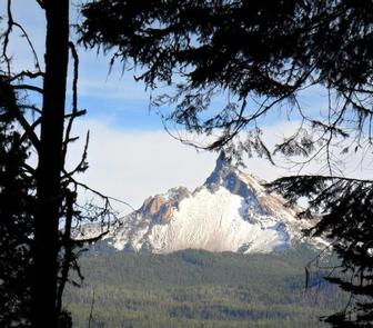
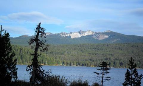
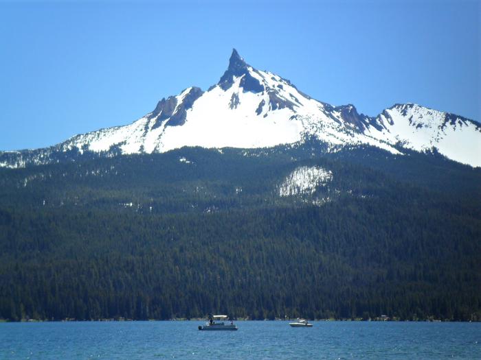
In the shadow of majestic Mount Bailey on the west shore of Diamond Lake, this campground takes its name from the view of the unforgettable peak of Mt. Thielsen. Thielsen View Campground is a favorite with families and anglers.

Recreation

This campground is a great location for many recreational opportunities. Diamond Lake is stocked annually with 300,000 rainbow trout. If fishing is not your thing, the campground is on the John Dellenback trail. This paved trail is an 11-mile loop around the lake. If you prefer to travel by foot, Mount Bailey and Rodney Butte trails are less than a five-minute drive to the trailhead.

Facilities

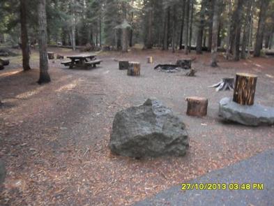
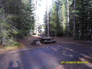
Thielsen View Campground has a boat ramp, free for campers staying in Thielsen View. Water spigots and gray water sumps are located throughout the campground. Each loop has at least two vault toilets. The closest RV dump station is at the resorts gas station. The fee is $5 to use the resorts dump or campers may use the Forest Service dump station in Diamond Lake or Broken Arrow Campgrounds. There are 60 sites in the campground. The 20 sites in C loop are reservable and the A and B loops are available on a first-come, first-served basis.

Natural Features

The mixed conifer canopy generously shades most sites during the warm summer days. All campsites are very close to Diamond Lake, which offers great sunrises over Mount Thielsen.
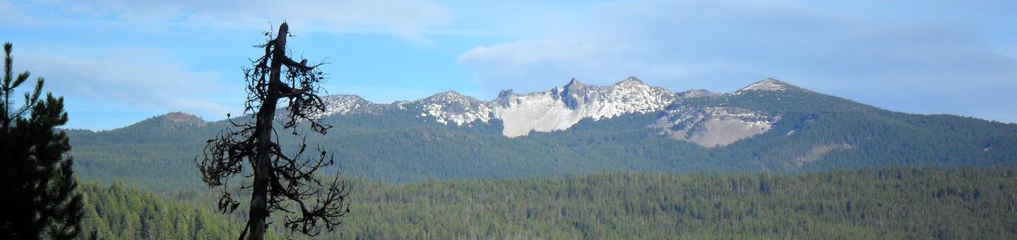
Nearby Attractions

Mount Bailey, Mount Thielsen, Pacific Crest Trail, Dellenback Trail, Diamond Lake Resort, Diamond Lake Stables, and Lemolo Lake and Resort are all nearby. Visitors may also want to take some time to visit nearby Crater Lake National Park, the only national park in Oregon! The amazing Crater Lake area offers a glimpse into the volcanic history of the area.

Reservation

More from CampingHiking.net:

SNAKE CREEK, Oklahoma Campground Images, Info & Reservations

Directions From Gore, OK, go 15 miles northeast on Highway 100, then turn left and go 1/2 mile west on paved access road. Phone 918-487-5252 Activities BOATING, CAMPING, SWIMMING SITE Keywords SANK,TENKILLER LAKE,TENKILLER FERRY LAKE,TENKILLER FERRY Related Link(s) Rec Area Info & Images Oklahoma State Road Conditions Oklahoma State Tourism

SOUTH SHORE CAMPGROUND, California Campground Images, Info & Reservations

Directions From Pioneer, CA, take State Route 88 east 21.9 miles to Bear River Lake Resort sign. Turn left at the sign and go 3.4 miles to campground on right side of the road. Phone 209-295-4360 Activities BIKING, BOATING, CAMPING, FISHING, SWIMMING SITE Keywords SOSH,BEAR RIVER RESERVOIR SO.SHORE,ELDORADO NF –

TUOLUMNE MEADOWS, California Campground Images, Info & Reservations

Directions Take Highway 41 north from Fresno, Highway 140 east from Merced, Highway 120 east from Manteca or west from Lee Vining (State Route 395) into Yosemite National Park. Tuolumne Meadows Campground is located 5 miles from the Tioga Pass Entrance station (Hwy 120 from the east), and is 55

WEST POINT CABIN, Alaska Campground Images, Info & Reservations

Directions The West Point Cabin is located near the mouth of Portage Bay on Kupreanof Island. It is situated west of West Point, just around the point from Fredrick Sound. It is 18 miles by float plane or 24 miles by boat from Petersburg. The cabin can be found on

ELROD FERRY, Georgia Campground Images, Info & Reservations

Directions From Hartwell, GA, travel approximately 2.5 miles on Highway 29 North. Turn left onto Elrod Ferry Road, and after a mile follow the brown directional signs to the facility. 1387 ELROD FERRY ROAD, Hartwell GA 30643 Phone 888-893-0678 HARTWELL PROJECT OFFICE Activities BOATING, FISHING, PICNICKING, DAY USE AREA, SWIMMING

SUNSET-UNION VALLEY, California Campground Images, Info & Reservations

Directions On Highway 50, east of Placerville, travel for 21 miles to the Icehouse Road turnoff on your left. Continue north for 16 miles to the campground. Phone 831-245-6891 Activities BIKING, BOATING, CAMPING, FISHING, HIKING, SWIMMING SITE, SAILING Keywords SUNP,PENINSULA,SUNSET,UNION VALLEY,YELLOWJACKET,WOLF CREEK,LOON LAKE,SUNSET UNION VALLEY,ELDORADO NF – FS Related Link(s)