BRIDAL VEIL GROUP AREA AND PICNIC GROUND, CA Campground Reservation, Info, Images, Map, Directions

BRIDAL VEIL GROUP AREA AND PICNIC GROUND, California Campground Images, Info & Reservations

Directions

From Placerville, take Hwy 50 east for 17 miles. The site is on the South Fork of the American River.

Phone

831-245-6891

Activities

CAMPING, FISHING, SWIMMING SITE

Keywords

Bridalveil

Related Link(s)

Rec Area Info & Images

Forest Service Concessionaire

California State Road Conditions

California State Tourism

Overview

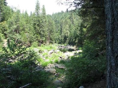
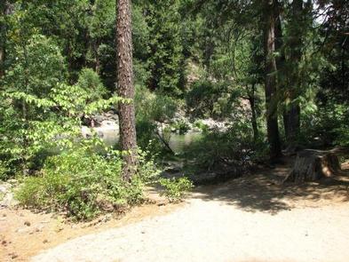
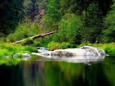
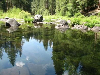
Bridal Veil Group Campsite and Picnic Area is located on the South Fork of the American River. It offers picnicking sites, a group overnight area, beautiful swimming holes, and close access to fishing.

Recreation

This site provides two large swimming holes in the river that are popular with the local residents. Fishing is also a popular activity, mainly rainbow and brown trout.

Facilities

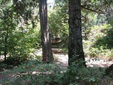
Bridal Veil Group Area is on a hill overlooking the river and day use area. The group area includes lot-style parking with 7 parking stalls, 5 tent pads, 8 picnic tables, 6 serving tables, and a large group fire ring. Group campsite users may use the day use areas with no additional fees. None of the facility is accessible. There is no water available on site. The facility has a host on site from mid-May through mid-October.

Natural Features

Sitting at an elevation of 3,200 feet, Bridal Veil group campsite provides easy access to the American River. A Mediterranean climate extends over most of this forest, creating warm, dry summers, and cold, wet winters. Vegetation is mixed conifers with riparian vegetation along the river.

Nearby Attractions

Visitors enjoy scenic drives along Highway 50 and surrounding forest roads. The site is within a half hour drive of both Jenkinson Lake and Crystal Basin. It is 10 minutes from the stores and restaurants of Pollock Pines and 5 minutes from Bridal Veil Falls. South Lake Tahoe is a 45 minute drive.

Reservation

More from CampingHiking.net:

ORLAND BUTTES, California Campground Images, Info & Reservations

Directions From Interstate 5, take the Black Butte Lake exit at Orland, CA. Travel west on County Road 200/Newville Road for 6 miles. Turn left on County Road 206 and drive 4 miles to the campground. Phone 530-865-4781 Activities BOATING, CAMPING, FISHING, HIKING, HUNTING, WILDLIFE VIEWING, SWIMMING SITE Keywords OBUT,BLACK

INDIAN POINT, Missouri Campground Images, Info & Reservations

Directions From Branson, Missouri, take Highway 76 west for 3 miles, then turn south on Indian Point Road and follow for 2 miles to park entrance. Phone 417-338-2121 Activities BOATING, CAMPING, FISHING, HIKING, PICNICKING, WATER SPORTS, WILDLIFE VIEWING, DAY USE AREA, SWIMMING SITE, PHOTOGRAPHY, RANGER STATION, KAYAKING, WATER ACCESS Keywords

CALPINE LOOKOUT, California Campground Images, Info & Reservations

Directions From Sierraville, the lookout is approximately 10 miles north on State Highway 89. Renters will be given a renters packet after check-in with the best access or parking based on current weather conditions. During the winter months, access is by snowshoes, skiis or snowmobiles on a 2 mile trail

PEAKS OF OTTER CAMPGROUND, North Carolina Campground Images, Info & Reservations

Directions From Roanoke, Virginia, take the Blue Ridge Parkway north for 26 miles to Milepost 86. From Bedford, Virginia, follow Route 43 to Blue Ridge Parkway; the campground is on the left before reaching the Parkway. Phone 540-586-7321 (MAY – OCTOBER) Activities HISTORIC & CULTURAL SITE, CAMPING, INTERPRETIVE PROGRAMS, FISHING,