
Directions
Located 6 miles north of the Hwy 140 turn off. Hwy 140 turn off is located 1/4 mile west of mile post 36 on Hwy 140 near Lake of the Woods.
Phone
8662014194
Activities
BOATING, CAMPING, FISHING, WINTER SPORTS
Keywords
4 MILE LAKE CAMPGROUND
Related Link(s)
Overview
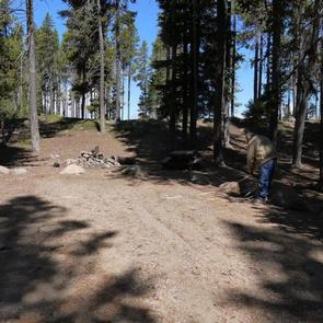
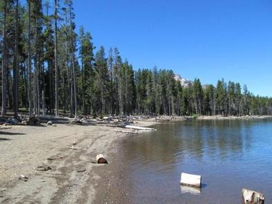
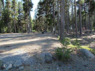
Fourmile Lake is located off Highway 140 near Lake of the Woods. The campground and day use area is at the southern end of Sky Lakes Wilderness area. This rustic campground with few amenities is the place to get away from the modern world. Horse corrals are available in the upper portion of the campground and the proximity to the wilderness and Pacific Crest Trail make it ideal for the backcountry enthusiast.
Recreation
Visitors to the area will enjoy a variety of activities including hiking, backpacking, climbing, kayaking, canoeing, rafting, horse packing, bird watching, stargazing, fishing, and horse camping.
Facilities
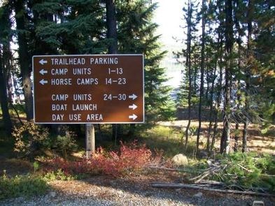
The campground is equipped with hand-pumped water and stock-loading facilities, picnic tables, campfire rings, vault toilets and boat ramp. Sites are available on a first-come, first-served basis.
Look for improved boat trailer and passenger vehicle parking in boat ramp and day use areas. Please follow directional signage and park in a responsible manner. $7 extra vehicle fee.
Natural Features
The 113,400-acre Sky Lakes Wilderness occupies the crest of the High Cascades, extending south from the boundary of Crater Lake National Park to Fourmile Lake. The wilderness has gentle, densely forested terrain with occasional steep areas. The name derives from the many small lakes, most of them clustered in several glacial basins near the crest of the Cascade Range. Several species of trees including Shasta red fir, western white pine, mountain hemlock, lodgepole pine, Engelmann spruce and whitebark pine are found throughout the area. The forest’s understory is dominated by species of huckleberry, as well as manzanita, snowbrush, and heather.
Nearby Attractions
Lake of the Woods is another nearby lake with USFS facilities and a full service family oriented resort just six miles down the road. Travel along the Volcanic Scenic Byway as you explore the surrounding area. Other stops of interest may include Kla-Mo-Ya Casino (57 miles), Fort Klamath Museum (35 miles), Collier Memorial State Logging Museum (60 miles), Pacific Crest Trail (within 2 miles) and Crater Lake (55 miles).