BACKBONE ROCK CAMPGROUND, TN Campground Reservation, Info, Images, Map, Directions

BACKBONE ROCK CAMPGROUND, Tennessee Campground Images, Info & Reservations

Directions

Highway TN 133 north from Highway 91. The campsite is on Highway 133, just north of Backbone Rock.

Phone

423-735-1500

Activities

BIKING, CAMPING, FISHING, HIKING, HUNTING, WILDLIFE VIEWING, SWIMMING, STAR GAZING, SCENIC DRIVE, BACKPACKING, ROCK CLIMBING

Keywords

Related Link(s)

Rec Area Info & Images

Tennessee State Road Conditions

Tennessee State Tourism

Overview

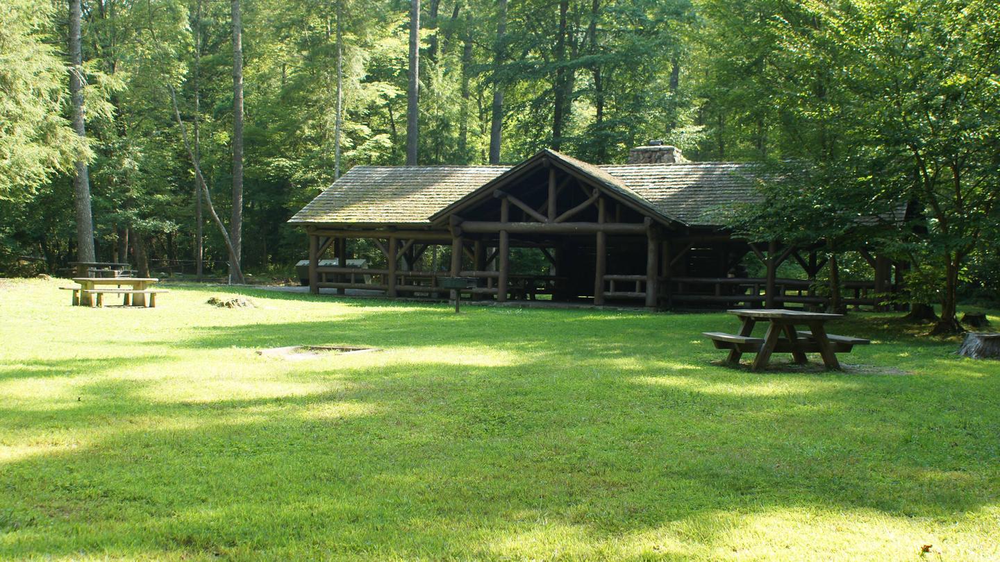
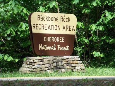
Backbone Rock Campground will close for the season on Monday, October 14, 2019. Backbone Rock Campground is a small campground situated along the beautiful Beaverdam Creek at an elevation of 2,100 feet in northern Johnson County. This developed campground is popular with those visiting the nearby Backbone Rock, a tunnel originally blasted through the rock ridge for the railway. The creek side location with popular swim area and lush forest surroundings make Backbone Rock Campground particularly desirable during hot summer months. With 10 campsites and an adjacent large Civilian Conservation Corps- built reservable pavilion with lawn, Backbone Rock is a great option for a group to reserve the whole campground for retreats and other events.  

Recreation

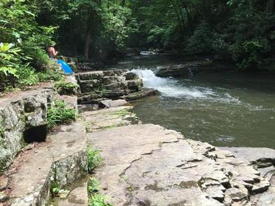
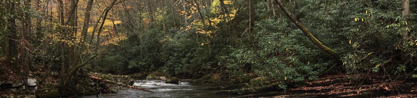
Along with camping, Beaverdam Creek is stocked with trout. The Appalachian National Scenic Trail is accessed via the nearby Backbone Rock Recreation Area parking.

Facilities

There are 10 single campsites, including two double sites within Backbone Rock Campground. The campground has flush toilets. Each site contains a table, fire ring and lantern holder.

Natural Features

Backbone Rock Campground is located along the beautiful Beaverdam Creek nestled in the mountains of the Southern Appalachians.

Nearby Attractions

The trailhead for the Appalachian National Scenic Trail (#1) is approximately a quarter mile south of the campground on TN Highway 133. Damascus, VA is approximately 5 minutes north of the campground.

Reservation

More from CampingHiking.net:

BEN ROVER CABIN, Montana Campground Images, Info & Reservations

Directions Ben Rover Cabin is located 35 miles north of Columbia Falls, on North Fork Road (County Road 486). From Columbia Falls, travel north on Nucleus Avenue. Turn east at the stop sign, on Railroad Street. The road becomes the North Fork Road as it travels over the railroad overpass.

BIG ELK, Idaho Campground Images, Info & Reservations

Directions From Idaho Falls, Idaho, travel approximately 56 miles on Highway 26 to Palisades Dam. Once at the dam, continue 6 miles east on Highway 26, then turn left onto Forest Road 262 (Big Elk Creek Road) and travel 2 miles to the campground. Phone (208) 270-0150 OR 541-351-1182 Activities

BERNERS BAY CABIN, Alaska Campground Images, Info & Reservations

Directions Located 37 miles northwest of Juneau, the cabin is on shore of Berners Bay, 8 miles north from boat launch at Echo Cove at mile 40 Glacier Highway. Access is by boat, kayak and float plane only. Consult tide charts, as some parts of the bay become extremely shallow

CLARKS HILL, South Carolina Campground Images, Info & Reservations

Directions Located off US 221, approximately 1 mile west of Clarks Hill, SC. Phone 800-533-3478 Activities BOATING, FISHING, PICNICKING, DAY USE AREA, SWIMMING SITE, SWIMMING, WATER ACCESS Keywords CLAH,J STROM THURMOND LAKE Related Link(s) Rec Area Info & Images South Carolina State Road Conditions South Carolina State Tourism Overview Clarks

MEEKS BAY, California Campground Images, Info & Reservations

Directions Meeks Bay Campground is located 10 miles south of Tahoe City, on California Highway 89. Phone 530-525-4733 Activities BIKING, BOATING, CAMPING, INTERPRETIVE PROGRAMS, VISITOR CENTER, SWIMMING SITE Keywords MEEK,WEST SHORE,LAKE TAHOE,RUBICON,WEST SHORE LAKE TAHOE,LAKE TAHOE BASIN – FS Related Link(s) Rec Area Info & Images California State Road Conditions

SHORELINE, Idaho Campground Images, Info & Reservations

Directions From Boise, Idaho, travel 85 miles north on Highway 55 to Cascade. Turn east on Warm Lake Highway and go 25 miles to Forest Road 489. Turn south and continue a half-mile to the campground. Phone 208-382-7400 Activities BIKING, BOATING, CAMPING, FISHING, HIKING, HUNTING, WILDLIFE VIEWING, SWIMMING SITE Keywords