

Directions
From Charlotte, North Carolina, take I-77 North (approximately 60 miles) before merging into Highway 421 North towards Wilkesboro / Boone. Continue to Exit 286B (approximately 20 miles), turn left onto Highway 268, continue for approximately 4 miles and turn right on Reservoir Road. Turn left into the Visitor Assistance Center parking lot after 0.25 miles.
From Winston-Salem, North Carolina, take Highway 421 North (approximately 55 miles) to Exit 286B, turn left onto Highway 268, continue for approximately 4 miles and turn right on Reservoir Road. Turn left into the Visitor Assistance Center parking lot after 0.25 miles.
From Wilkesboro, North Carolina, head west on Main Street / Hwy 268 / Hwy 18 (approximately 4 miles) and turn right on Reservoir Road. Turn left into the Visitor Assistance Center parking lot after 0.25 miles.
Phone
336-921-3390
Activities
VISITOR CENTER, ENVIRONMENTAL EDUCATION, RANGER STATION
Keywords
Related Link(s)
North Carolina State Road Conditions
Overview
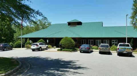
The Visitor Assistance Center conference room is located beside the dam at W. Kerr Scott Reservoir in northwestern North Carolina.
Recreation
The 1,475-acre reservoir offers excellent boating, canoeing, kayaking and swimming opportunities. Anglers will find channel catfish, large and smallmouth bass, bluegill, threadfin shad, spotted bass, striped bass, and hybrid striped bass. Miles of multi-use trails, that allow hiking and mountain biking, surround the lake, including the Overmountain Victory National Historic Trail, which can be accessed from the parking lot outside the Visitor Center. An additional 25 miles of trails can be found at the Warrior Creek and Dark Mountain areas.
Facilities
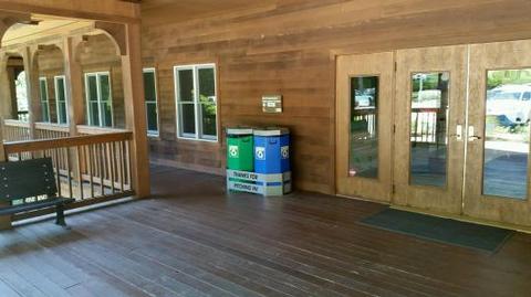
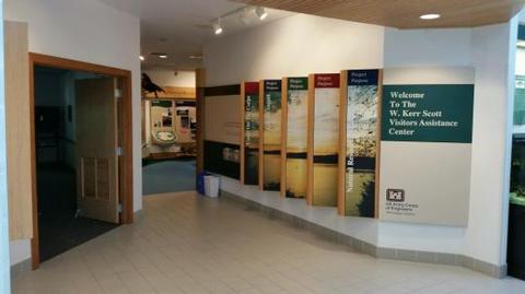
The conference room offers eight, 8-foot tables, 40 chairs, and is ADA-accessible. Flush bathrooms and a water fountain are located within the building. There is no kitchen available. The area around the Visitor Assistance Center has scenic views and is close to other park amenities which include a boat ramp, two reservable shelters, a museum and Environmental Education Center located in the Visitor Assistance Center, and access to the Overmountain Victory Trail and Native Tree Trail.
Natural Features
The gentle Yadkin River flows through its scenic namesake valley in the foothills of the eastern Blue Ridge Mountains. Forests of mixed hardwoods, including sycamore, poplar, oak and hickory, cover the region. Wildlife is abundant in the valley. White-tailed deer, black bear, eastern cottontails and more can be found among the hills. Birds in the area include wild turkey, woodpeckers, Carolina chickadees, red-eyed vireo, ovenbirds, mallards and wood ducks.