
Directions
From Fresno, CA, follow California State Highway 180 East to Cedar Grove. Sentinel Campground is located on the left (north) side of the road in the village.
Phone
(559) 565-3341
Activities
CAMPING, INTERPRETIVE PROGRAMS, HIKING, HORSEBACK RIDING, VISITOR CENTER, DAY USE AREA
Keywords
Related Link(s)
California State Road Conditions
Overview
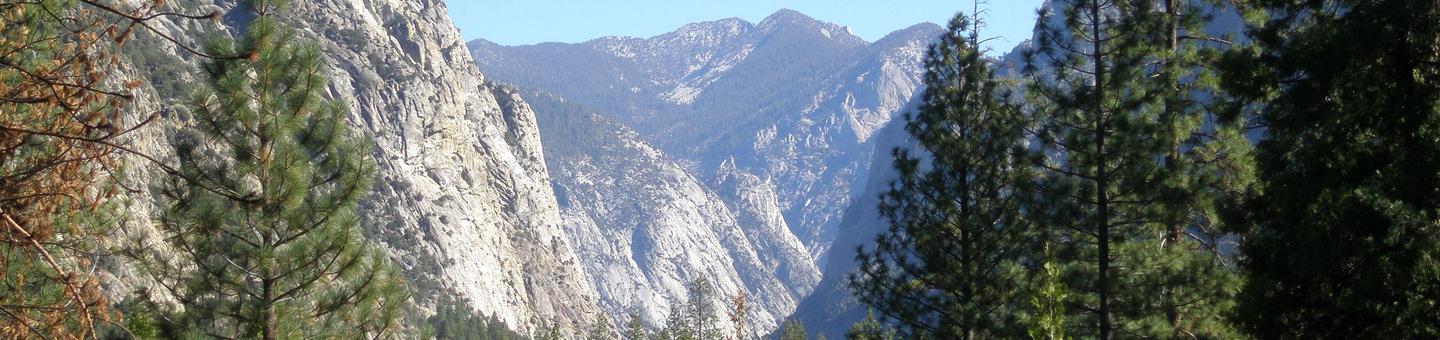
Sentinel Campground in Cedar Grove is nestled in the stunning Kings Canyon, one of the deepest canyons in the United States. With views of a lovely meadow central to the campground, the sound of the Kings River, and glowing mountainsides just beyond the trees, Sentinel Campground is a wonderful place for families to spend time in the great outdoors.
Recreation
Cedar Grove provides a plethora of hiking trails, from the hiking newcomer to the avid backpacker, and everyone in between. Day hikers can hike to Mist Falls, Cedar Grove Overlook, around the peaceful Kanawyer Loop along the Kings River, through Zumwalt Meadow, and more. Visitors can also fish for trout in the Kings River, or take a scenic horseback ride through the canyon with the Cedar Grove Pack Station.
Facilities
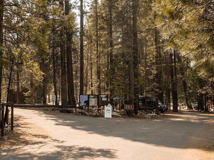
Each site in Sentinel Campground provides a fire ring, picnic table and large bear-proof food storage box. The roads through Sentinel Campground are paved, making it easier for both RVs and smaller cars to access the entire campground. There are five comfort stations throughout the campground, all with flush toilets, a large sink for dish-washing, and drinking water. The Cedar Grove Visitor Center is located just outside Sentinel Campground, and Cedar Grove Village is across the street and offers a convenience store, gift shop, snack bar, hotel, showers and laundry.
Natural Features
Tall granite mountainsides cradle the south fork of the Kings River, as streams and creeks feed the river with snowmelt from higher elevations. Abundant wildlife roam through the tall ponderosa pine and incense cedar trees, meadows and along riversides. Hikes into the backcountry out of Cedar Grove will give visitors an ever deeper understanding of the beauty and uniqueness of Kings Canyon National Park.
Nearby Attractions
Hume Lake, Grizzly Falls, Mist Falls, Zumwalt Meadow, Roaring River Falls, Sequoia Groves and numerous hiking trails attract visitors to this area. Campfire stories, nature and wildlife presentations, and ranger-led hikes are also available during most of the season.
Charges & Cancellations
- Payment in full will be charged to your credit card upon completion of the reservation. A $10.00 service fee will apply if you change or cancel your reservation. Additional fees will apply for late cancellations
- All cancellations made between midnight on the day before arrival and check out time on the day after arrival are considered late cancellations and will incur a $10.00 cancellation fee and will also forfeit the first nights use fee. Cancellations for a single nights reservation will forfeit the entire use fee but no cancellation fee will apply.