W.P. FRANKLIN SOUTH RECREATION AREA, FL Campground Reservation, Info, Images, Map, Directions

W.P. FRANKLIN SOUTH RECREATION AREA, Florida Campground Images, Info & Reservations

Directions

From Interstate 75, take Exit 141 (Palm Beach Blvd.) east for 7 miles to Old Olga Road. Make a left on Old Olga Road and proceed 0.3 miles to Franklin Lock Road. Make a right on Franklin Lock Road into the WP Franklin South Recreation Area.

Phone

239-694-2582

Activities

BOATING, FISHING, PICNICKING, VISITOR CENTER, DAY USE AREA, KAYAKING, CANOEING

Keywords

Related Link(s)

Rec Area Info & Images

Florida State Road Conditions

Florida State Tourism

Overview

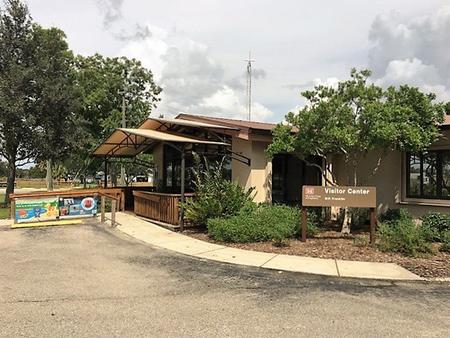
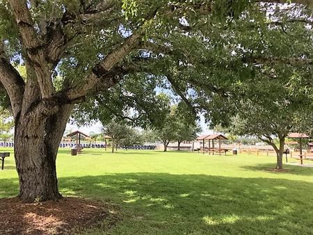
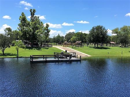
WP Franklin South Recreation Area is a day use area located on the Caloosahatchee River adjacent to the WP Franklin Lock and Dam. Visitors can watch boats traversing the 152 mile Okeechobee Waterway that spans South Florida from the Atlantic Ocean to the Gulf of Mexico, enjoy the exhibits at the visitor center or just relax with a picnic lunch.

Recreation

Boating, canoeing and kayaking on the Caloosahatchee River are popular activities. Anglers can try their luck with catching both freshwater and saltwater fish.

Facilities

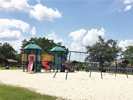
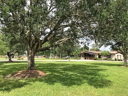
This day use area has a visitor center, boat ramp, volleyball and horseshoe courts, a playground and several covered picnic sites. Flush toilets and drinking water are also available. There are two group picnic shelters available for reservation. Each shelter has water and electricity, six picnic tables, a large charcoal BBQ grill and can accommodate up to 50 people.

Nearby Attractions

Lee County Manatee Park is six miles west on Palm Beach Blvd. Hickeys Creek Mitigation Park is two miles east on Palm Beach Boulevard, Gulf of Mexico beaches and the J.N. Ding Darling National Wildlife Refuge are 30 miles to the west.

Reservation

More from CampingHiking.net:

Loft Mountain Campground, Virginia Campground Images, Info & Reservations

Directions From Washington, D.C., metro area, travel west on Interstate 66 to exit 43A. Take US Highway 29 south approximately 55 miles to Ruckersville, Virginia, then take US Highway 33 west to Shenandoah National Park and Skyline Drive Swift Run Entrance. Follow Skyline Drive south approximately 15 miles and turn

SMITH AND MOREHOUSE, Utah Campground Images, Info & Reservations

Directions From Salt Lake City, Utah, take Highway 80 east for 36 miles to the Kamas exit. Travel south for 12 miles to Oakley, turn left on Highway 213 and travel 12 miles to end of pavement. Turn right and go 2 miles to the campground entrance. Phone KAMAS RANGER

PINE VALLEY RECREATION AREA, Utah Campground Images, Info & Reservations

Directions From St. George, Utah, go north on Highway 18 to Central. Take a right on Forest Highway 35 towards Pine Valley. Take a left on Main Street and go 3 miles to the recreation area. Phone 801-226-3564 Activities CAMPING, FISHING, HIKING, DAY USE AREA, HORSE CAMPING, AMPHITHEATER Keywords PINV,PINE

BOLDING MILL, Georgia Campground Images, Info & Reservations

Directions From Atlanta, GA, take SR 400 north to Exit 17, turn right on GA Hwy 306, turn right on GA Hwy 53, turn left on Old Sardis Rd, and turn left on Chestatee Rd. Follow into campground. Phone 770-534-6960 Activities BIKING, BOATING, CAMPING, FISHING, PICNICKING, DAY USE AREA, SWIMMING