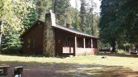
RED IVES CABIN, ID Campground Reservation, Info, Images, Map, Directions

RED IVES CABIN, Idaho Campground Images, Info & Reservations

Directions

From St. Maries, Idaho: Follow paved Forest Highway 50 (St. Joe River Rd) 47 miles to Avery. Continue 29 more miles along FH-50 to the Red Ives Road #218. Turn right (south) on road #218 and travel 10 miles upstream to the Red Ives Ranger Station. The Red Ives Road is a narrow One-lane road with turn-outs.

Phone

(208) 245-2531

Activities

BIKING, CAMPING, FISHING, HIKING

Keywords

Related Link(s)

Rec Area Info & Images

Idaho State Road Conditions

Idaho State Tourism

Overview

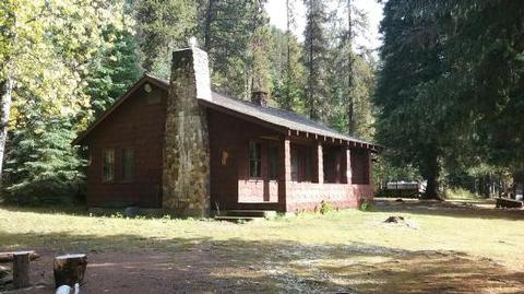
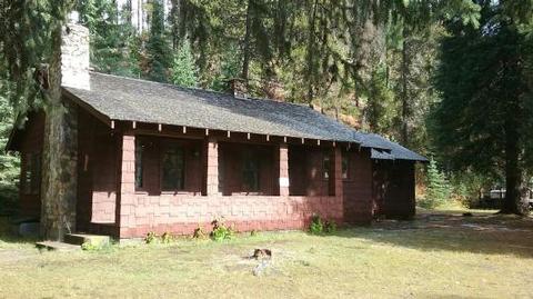
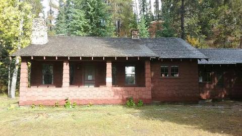
Red Ives Cabin is a popular location in the Idaho Panhandle National Forests. It served as the Ranger Station for the Red Ives Ranger District of the St. Joe National Forest from the 1930s to 1984. Attractions include its location on the St. Joe Wild and Scenic River. It is located 86 miles southeast of St. Maries, Idaho on Forest Road 218.  

The Cabin requires an entry key code to get in. Contact St. Joe Ranger District for instructions if you have a reservation at 208 245 2531.

Recreation

Red Ives offers several recreation opportunities from hiking and OHV use to world-class fishing and wildlife spotting. The St. Joe River also offers opportunities in floating and kayaking.

Facilities

The cabin features two bedrooms (one queen, two sets of bunkbeds and one queen size futon), kitchen, living room, bathroom and covered front porch; propane stove/oven and refrigerator; hot water, flush toilet and shower/tub. Battery lanterns are provided for lights, however visitors are recommended to bring additional battery operated lights. A gas log fireplace provides heat. Absolutely no pets.

Natural Features

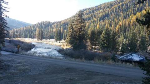
The facility is set alongside the St. Joe National Wild and Scenic River. The terrain is mountainous with steep drainages and heavily forested mountain sides.

Nearby Attractions

Avery is the nearest town for conveniences.

Reservation

More from CampingHiking.net:

MOUNT RYNDA CABIN, Alaska Campground Images, Info & Reservations

Directions Accessible by shallow draft boat and float plane during moderate to high river levels, 18 miles from Wrangell. Low river levels limit small boat access as the Andrews Creek entrance becomes blocked. Tides may affect access; consult local tide tables. A tide of 14 feet or higher is needed

MAMMOTH CABIN, Utah Campground Images, Info & Reservations

Directions From Fairview, Utah, for 8.5 miles proceed east on Utah Highway 31. Then turn east (left) to Utah highway 264 for .2 miles, then turn left (north) through the paved parking lot to the gravel road, then right (FS road 0124 downhill). You will pass the Gooseberry Campground sign,

POINT CAMPGROUND – DESCHUTES, Oregon Campground Images, Info & Reservations

Directions From Bend, OR: Travel about 34 miles west on County Road 46 (Cascade Lakes Hwy). Phone 541-323-1746 Activities CAMPING Keywords Related Link(s) Rec Area Info & Images Oregon State Road Conditions Oregon State Tourism Overview Located next to Elk Lake, Point Campground provides access to fishing, boating and swimming.

ASPEN GROUP AREA, New Mexico Campground Images, Info & Reservations

Directions In southeast New Mexico, approximately 20 miles east of Alamagordo. From Alamagordo take US 82 east and go 16 miles. Just before Cloudcraft turn right (South) on NM 130. Go 1.4 miles. Turn left (east) on Forest Road 24B, go 0.5 miles. Aspen Group Area is on the left

GREENS LAKE, Utah Campground Images, Info & Reservations

Directions Located on Forest Road 095/Red Canyon Road off Highway 44, approximately 40 miles north of Vernal, Utah. Phone 435-784-3445 Activities BIKING, BOATING, CAMPING, FISHING, HIKING, WILDLIFE VIEWING, BIRDING Keywords GRLK,RED CANYON COMPLEX,FLAMING GORGE,ASHLEY NF – FS,Flaming Gorge National Recreation Area Related Link(s) Rec Area Info & Images Utah State