DAMSITE DAY USE AREA SHELTER, GA Campground Reservation, Info, Images, Map, Directions

DAMSITE DAY USE AREA SHELTER, Georgia Campground Images, Info & Reservations

Directions

From Atlanta: Take Interstate 75 North until Exit 293, turn right onto Georgia Highway 411 North, travel approximately 30 miles; take a right onto Georgia Highway 136 East; proceed approximately 2 miles and turn left onto Carters Dam Road; turn right onto Marina Road; turn left onto Cove Road and enter park.

Damsite
359 Cove Road
Chatsworth, GA 30705

Phone

706-334-2248

Activities

BOATING, FISHING, DAY USE AREA, KAYAKING, CANOEING

Keywords

Related Link(s)

Rec Area Info & Images

Georgia State Road Conditions

Georgia State Tourism

Overview

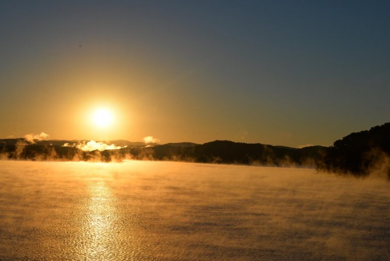
Damsite Day Use Area is located on Carters Lake in the North Georgia Mountains about 70 miles north of Atlanta. The sparkling waters and rugged shoreline provide a beautiful surrounding for a variety of outdoor recreational opportunities including camping, hiking, boating, mountain biking, fishing, hunting and picnicking.

Recreation

Boaters visit Carters Lake to enjoy its solitude and scenic beauty. Whether in a powerboat or sailboat on the open water or paddling along the shoreline in a canoe, Carters Lake offers enjoyable boating experiences for everyone. Fishing is a popular activity on the lake. Major species include bass (largemouth, smallmouth, hybrid, striped and spotted) crappie, walleye, bream and catfish.

Facilities

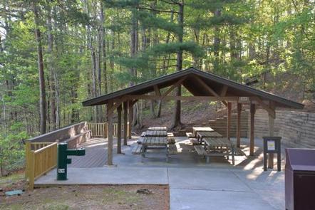
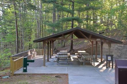
Damsite Day Use Area provides boaters with a launch ramp with three lanes and courtesy dock. The area also provides ample picnic sites and restrooms. Shelter (CL-10) seating capacity is 30 people maximum and parking capacity of 15 vehicles.

Natural Features

Carters Lake embraces a spectacular tract of foothills scenery in the Blue Ridge Mountains of North Georgia. It covers 3,200 surface acres and has 62 miles of undeveloped shoreline.

Nearby Attractions

The City of Ellijay is about 30 minutes away, offering restaurants, grocery stores and fuel, along with other amenities.

Reservation

More from CampingHiking.net:

DEWDROP, Pennsylvania Campground Images, Info & Reservations

Directions From Warren, Pennsylvania, take PA-59 east for 13 miles. Turn onto Longhouse Scenic Byway/Forest Road 262 south and continue 3 miles to the campground. From the east, take PA-59. Just after crossing the Morrison Bridge over the Kinzua Arm of the reservoir, turn left and proceed 3 miles to

Midway Campground (FL), Florida Campground Images, Info & Reservations

Directions From Naples: Follow US HWY 41 east until you see signs for campground (approximately mile marker 52) From Miami: Follow US HWY 41 west until you see signs for campground (approximately mile marker 52) Phone 1 (239) 695-1205 Activities CAMPING, DAY USE AREA Keywords Midway Campground,Big Cypress Related Link(s)

FISH CREEK PAVILION, Idaho Campground Images, Info & Reservations

Directions From Grangeville, head south on Grangeville-Salmon Road for approximately 7 miles to the Fish Creek Meadows area. Turn right onto Forest Road 4600. The entrance to Fish Creek Pavilion is located 300 feet ahead on the left. Phone 208-983-1950 Activities CAMPING, HIKING, HORSEBACK RIDING Keywords None Related Link(s) Rec

JENNINGS FERRY, Alabama Campground Images, Info & Reservations

Directions From Demopolis, Alabama, take Highway 43 north towards Eutaw. At Highway 14, take a right. Proceed for approximately seven miles to the park. Phone 205-372-1217 Activities CAMPING, FISHING, HIKING Keywords JENF,BLACK WARRIOR Related Link(s) Rec Area Info & Images Alabama State Tourism Alabama State Road Conditions Overview Jennings Ferry

LITHIA SPRINGS, Illinois Campground Images, Info & Reservations

Directions From Shelbyville, Illinois, go three miles east of Shelbyville on State Route 16 to County Road 2200E. Turn left and go two miles to County Road 1500N. Turn left again and drive 1.4 miles to the campground. Phone 217-774-3951 Activities BOATING, CAMPING, FISHING, VISITOR CENTER, DAY USE AREA, SWIMMING