
The US has some of the most beautiful lakes and reservoir recreation areas you will find anywhere.
There is nothing like a waterfront vacation with boating and swimming opportunities right on your doorstep!
Click through on each of the entries listed below for full details of what each lake or reservoir rec area has to offer.
You will find everything from campground information to maps, directions, stunning images and more.
Pocosin Lakes National Wildlife Refuge, North Carolina Camping & Hiking
Listen Directions The Refuge is located 6 miles south of Columbia, NC off Hwy 94 on the east and 18 miles south of Plymouth, NC off Hwy 45 on the west. There are several access points to the refuge. The Pungo Unit can be accessed by taking Hwy 45 South
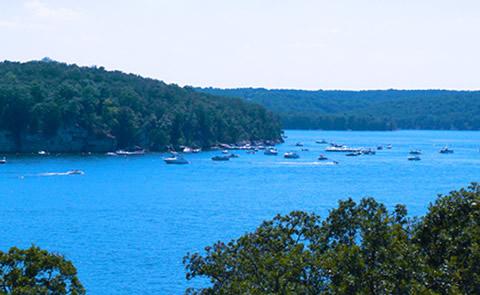
Pomme De Terre Lake, Missouri Camping & Hiking
Listen Directions From Springfield, 53 miles north on US 65, 5 miles west on US 54, 4 miles south on MO 254. Phone (417) 745-6411 Activities BOATING, CAMPING, FISHING, HIKING, PICNICKING, WATER SPORTS, WILDLIFE VIEWING, PLAYGROUND PARK SPECIALIZED SPORT SITE, OTHER RECREATION CONCESSION SITE, HOTEL/LODGE/RESORT PRIVATELY OWNED, ENVIRONMENTAL EDUCATION Camping
Pomona Lake, Kansas Camping & Hiking
Listen Directions From Topeka, 24 miles south on US 75, 7 miles east on KS 268. Phone (785) 453-2201 Activities BOATING, CAMPING, FISHING, HIKING, HORSEBACK RIDING, PICNICKING, WATER SPORTS, WILDLIFE VIEWING, PLAYGROUND PARK SPECIALIZED SPORT SITE, HOTEL/LODGE/RESORT PRIVATELY OWNED Camping Reservations Reserve your campsite at these camping areas: Kansas Campgrounds
Proctor Lake, Texas Camping & Hiking
Listen Directions From Comanche, 5 miles east on US 377, 2 miles north on FM 2861. Phone (254) 879-2424 Activities BOATING, CAMPING, FISHING, PICNICKING, WATER SPORTS, WILDLIFE VIEWING, PLAYGROUND PARK SPECIALIZED SPORT SITE Camping Reservations Reserve your campsite at these camping areas: Texas Campgrounds COPPERAS CREEK PROMONTORY SOWELL CREEK Hiking
Prompton Lake, Pennsylvania Camping & Hiking
Listen Directions From Scranton, east on US 6 through Honesdale, north on PA 170 to project. Phone (610) 377-0438 Activities BOATING, WATER SPORTS, WILDLIFE VIEWING Camping Reservations Reserve your campsite at these camping areas: Pennsylvania Campgrounds Hiking Trails Looking for nice hiking areas to take a hike? Choose from these
R.D. Bailey Lake, West Virginia Camping & Hiking
Listen Directions The dam is on the Guyandotte River near the southern West Virginia town of Justice. From Justice, which is in Mingo County, take US Route 52 south. On US Route 52 south, after leaving Mingo County and crossing the Guyandotte River into Wyoming County, approximately one-tenth of a
Rathbun Lake, Iowa Camping & Hiking
Listen Directions From Des Moines, 85 miles southeast on IA 5. Phone (641) 647-2464 Activities AUTO TOURING, BIKING, BOATING, HISTORIC & CULTURAL SITE, CAMPING, FISHING, HIKING, OFF HIGHWAY VEHICLE, PICNICKING, WINTER SPORTS, WATER SPORTS, WILDLIFE VIEWING, SWIMMING SITE, PLAYGROUND PARK SPECIALIZED SPORT SITE, OTHER RECREATION CONCESSION SITE, HOTEL/LODGE/RESORT PRIVATELY OWNED,
Ray Roberts Lake, Texas Camping & Hiking
Listen Directions From Sanger, 5 miles east on FM 455. Phone (469) 645-9100 Activities BOATING, CAMPING, FISHING, HORSEBACK RIDING, PICNICKING, WATER SPORTS, WILDLIFE VIEWING, PLAYGROUND PARK SPECIALIZED SPORT SITE, OTHER RECREATION CONCESSION SITE, HOTEL/LODGE/RESORT PRIVATELY OWNED, ENVIRONMENTAL EDUCATION Camping Reservations Reserve your campsite at these camping areas: Texas Campgrounds Hiking
Raystown Lake, Pennsylvania Camping & Hiking
Listen Directions Park Headquarters is 2 miles east of PA 26 at Hesston. Phone (814) 658-3405 Activities BIKING, BOATING, CAMPING, FISHING, HIKING, PICNICKING, VISITOR CENTER, WATER SPORTS, WILDLIFE VIEWING, SWIMMING SITE, PLAYGROUND PARK SPECIALIZED SPORT SITE, OTHER RECREATION CONCESSION SITE, HOTEL/LODGE/RESORT PRIVATELY OWNED, ENVIRONMENTAL EDUCATION Camping Reservations Reserve your campsite
Red Rock Lakes Wilderness, Montana Camping & Hiking
Listen Directions Directions: The RRL refuge can be reached from the west on Interstate 15 in Montana (turn off on the Exit 0 off-ramp towards South Valley road). From the east, take US 20 in Idaho and exit at the Red Rock Road and follow the signs west to the
Rend Lake, Illinois Camping & Hiking
Listen Directions Located near Mt. Vernon, IL, 15 miles south of junction of I-64 and I-57. Phone (618) 724-2493 Activities BOATING, CAMPING, HIKING, HORSEBACK RIDING, PICNICKING, VISITOR CENTER, WATER SPORTS, WILDLIFE VIEWING, PLAYGROUND PARK SPECIALIZED SPORT SITE, OTHER RECREATION CONCESSION SITE, HOTEL/LODGE/RESORT PRIVATELY OWNED, ENVIRONMENTAL EDUCATION Camping Reservations Reserve your
Reservoir A, Idaho Camping & Hiking
Listen Directions Directions: Located southeast of Lewiston off County Rd. P2. Phone 208-799-5010 Activities BOATING, FISHING Camping Reservations Reserve your campsite at these camping areas: Idaho Campgrounds Hiking Trails Looking for nice hiking areas to take a hike? Choose from these scenic hiking trails: Idaho Hiking Trails Related Link(s) More
Richard B. Russell Lake, Georgia Camping & Hiking
Listen Directions Located on the Georgia / South Carolina border, 20 miles east of Elberton, GA, and 8 miles west of Calhoun, SC off US 72. Phone (706) 213-3400 Activities BOATING, HISTORIC & CULTURAL SITE, CAMPING, FISHING, HIKING, HORSEBACK RIDING, PICNICKING, VISITOR CENTER, WATER SPORTS, WILDLIFE VIEWING, PLAYGROUND PARK SPECIALIZED
Ridgway Reservoir, Colorado Camping & Hiking
Listen Directions Take U.S. Highway 550 south of Montrose, Colorado for 22 miles to Ridgway State Park entrance. Phone 970-626-5822 Activities BIKING, BOATING, CAMPING, FISHING, HIKING, HUNTING, PICNICKING, WINTER SPORTS, RECREATIONAL VEHICLES, VISITOR CENTER, WATER SPORTS, WILDLIFE VIEWING Camping Reservations Reserve your campsite at these camping areas: Colorado Campgrounds Hiking
Rim Lake, Wyoming Camping & Hiking
Listen Directions 7 miles south of Rawlins on WY 71. Phone (307)328-4200 Activities BOATING, FISHING, HIKING, PICNICKING Camping Reservations Reserve your campsite at these camping areas: Wyoming Campgrounds Hiking Trails Looking for nice hiking areas to take a hike? Choose from these scenic hiking trails: Wyoming Hiking Trails Related Link(s)
Ririe Reservoir, Idaho Camping & Hiking
Listen Directions Site is located 20 miles east of Idaho Falls off U.S. 26. Phone 208-538-7285 Activities BOATING, CAMPING, FISHING, HIKING, HUNTING, PICNICKING, RECREATIONAL VEHICLES, WATER SPORTS Camping Reservations Reserve your campsite at these camping areas: Idaho Campgrounds Hiking Trails Looking for nice hiking areas to take a hike? Choose
Rock Lake National Wildlife Refuge, North Dakota Camping & Hiking
Listen Directions Located in the heart of the Prairie Pothole Region of the United States, in northeastern North Dakota Phone 701-662-8611 Camping Reservations Reserve your campsite at these camping areas: North Dakota Campgrounds Hiking Trails Looking for nice hiking areas to take a hike? Choose from these scenic hiking trails:
Rough River Lake, Kentucky Camping & Hiking
Listen Directions From Louisville, KY: Option 1: Begin at ramp onto I-64 West toward New Albany/St. Louis, traveling 22.3 miles. Take the IN-135 exit- Exit Number 105- toward Palmyra/Corydon, onto IN-135 South toward Corydon, traveling 16.7 miles. Continue on Bypass Road KY-79 for 2.1 miles. Turn right onto KY-79, traveling
Ruedi Reservoir, Colorado Camping & Hiking
Listen Directions On the Fryingpan River about 15 miles east of Basalt, Colorado and 30 miles southeast of Glenwood Springs, Colorado. Take State Road 82 about 30 miles south of Glenwood Springs to reach road leading to Basalt. Phone 970-945-2521 Activities BOATING, CAMPING, FISHING, HIKING, HUNTING, PICNICKING, RECREATIONAL VEHICLES, WATER
Rufus Woods Lake, Washington Camping & Hiking
Listen Directions Chief Joseph Dam is located in Bridgeport, WA. From Grand Coulee, drive 22 miles west on WA 174 to WA 17. Drive 16 miles west on WA 17 to the Columbia River. Or from Wenatchee, WA, drive 73 miles north on US 97, then 8 miles east on
Rye Patch Reservoir, Nevada Camping & Hiking
Listen Directions North on I-80 from Lovelock or south on I-80 from Winnemucca. Phone 702-538-7321 Activities BOATING, CAMPING, FISHING, HUNTING, PICNICKING, WATER SPORTS Camping Reservations Reserve your campsite at these camping areas: Nevada Campgrounds Hiking Trails Looking for nice hiking areas to take a hike? Choose from these scenic hiking
Sakakawea Lake, North Dakota Camping & Hiking
Listen Directions From Bismarck, ND, 70 miles north via US 83 and ND 200. Phone (701) 654-7411 Activities BIKING, BOATING, HISTORIC & CULTURAL SITE, CAMPING, FISHING, HIKING, PICNICKING, WINTER SPORTS, WATER SPORTS, WILDLIFE VIEWING, PLAYGROUND PARK SPECIALIZED SPORT SITE, OTHER RECREATION CONCESSION SITE, HOTEL/LODGE/RESORT PRIVATELY OWNED, ENVIRONMENTAL EDUCATION Camping Reservations
Salamonie Lake, Indiana Camping & Hiking
Listen Directions From Wabash, south on IN 15, east on IN 124, north on IN 105 to Lost Bridge recreation sites. Phone (260) 782-2358 Activities BIKING, BOATING, CAMPING, FISHING, HIKING, HORSEBACK RIDING, PICNICKING, WINTER SPORTS, WATER SPORTS, WILDLIFE VIEWING, PLAYGROUND PARK SPECIALIZED SPORT SITE, OTHER RECREATION CONCESSION SITE, ENVIRONMENTAL EDUCATION
Salmon Falls Creek Reservoir, Idaho Camping & Hiking
Listen Directions 8 miles from Rogerson, Idaho – from Twin Falls take Highway 30 west 6 miles to the junction with Highway 93. Travel 30 miles south to Rogerson, then turn west on Three Creek Road. Salmon Falls Dam is about 8 miles down the road. Phone 208-677-6600 Activities BOATING,
Sam Rayburn Reservoir, Texas Camping & Hiking
Listen Directions From Jasper, 15 miles northwest on TX 63, then east on TX 255. Phone (409) 384-5716 Activities BOATING, CAMPING, FISHING, HIKING, HORSEBACK RIDING, PICNICKING, WATER SPORTS, WILDLIFE VIEWING, PLAYGROUND PARK SPECIALIZED SPORT SITE, OTHER RECREATION CONCESSION SITE, HOTEL/LODGE/RESORT PRIVATELY OWNED Camping Reservations Reserve your campsite at these camping
San Justo Reservoir, California Camping & Hiking
Listen Directions Nearest main highway, California 156. Nearest community, Hollister. Phone 408-637-8218 Activities BOATING, FISHING, PICNICKING, RECREATIONAL VEHICLES Camping Reservations Reserve your campsite at these camping areas: California Campgrounds Hiking Trails Looking for nice hiking areas to take a hike? Choose from these scenic hiking trails: California Hiking Trails Related
San Luis Lake and State Wildlife Area, Colorado Camping & Hiking
Listen Directions Take Highway 160 from Walsenburg, Colorado about 60 miles. North on Highway 150 for about 13.5 miles. Left on Six Mile Lane and straight for 8 miles then north 1/8 mile to park entrance. Phone 719-378-2020 Activities BIKING, BOATING, CAMPING, FISHING, HIKING, HUNTING, PICNICKING, WATER SPORTS, WILDLIFE VIEWING
San Luis Reservoir, California Camping & Hiking
Listen Directions Nearest main highway I-5, nearest community, Los Banos. Phone 209-826-1197 Activities BOATING, INTERPRETIVE PROGRAMS, FISHING, HORSEBACK RIDING, HUNTING, WINTER SPORTS, RECREATIONAL VEHICLES, VISITOR CENTER, WATER SPORTS Camping Reservations Reserve your campsite at these camping areas: California Campgrounds Hiking Trails Looking for nice hiking areas to take a hike?
Sand Lake National Wildlife Refuge, South Dakota Camping & Hiking
Listen Directions Sand Lake NWR is located in the northeast corner of South Dakota, 27 miles northeast of Aberdeen, South Dakota. To get to Sand Lake from Aberdeen, take State Highway 12 east 6 miles to Brown County Highway 16 at Bath Corner. Turn north onto Brown County 16 and
Sand Lake WMD, South Dakota Camping & Hiking
Listen Phone 605-885-6320 Activities BOATING, FISHING, HUNTING Camping Reservations Reserve your campsite at these camping areas: South Dakota Campgrounds Hiking Trails Looking for nice hiking areas to take a hike? Choose from these scenic hiking trails: South Dakota Hiking Trails Related Link(s) More South Dakota Recreation Areas The 9,000 square
Santa Cruz Lake, New Mexico Camping & Hiking
Listen Directions About 30 miles northeast of Santa Fe. From Santa Fe: take US 84/285 N to NM 503 in Pojoaque. Turn right onto NM 503 and continue on this scenic ‘High Road’ towards Chimayo. Pass CR 98 which turns left to Chimayo and continue on NM 503; first you
Santa Rosa Lake State Park, New Mexico Camping & Hiking
Listen Directions NM Highway 91 Santa Rosa, NM 88435 Make a reservation on the New Mexico State Parks reservation website. Phone 575-472-3110 Camping Reservations Reserve your campsite at these camping areas: New Mexico Campgrounds Hiking Trails Looking for nice hiking areas to take a hike? Choose from these scenic hiking
Santa Rosa Lake, New Mexico Camping & Hiking
Listen Phone (505) 472-3115 Activities BOATING, CAMPING, FISHING, HIKING, HORSEBACK RIDING, PICNICKING, WATER SPORTS, WILDLIFE VIEWING, PLAYGROUND PARK SPECIALIZED SPORT SITE Camping Reservations Reserve your campsite at these camping areas: New Mexico Campgrounds Hiking Trails Looking for nice hiking areas to take a hike? Choose from these scenic hiking trails:
Sardis Lake, Mississippi Camping & Hiking
Listen Directions Fom Memphis, TN, 50 miles south on I-55 to Sardis, then 7 miles east on MS 315. Phone (662) 563-4531 Activities BIKING, BOATING, CAMPING, FISHING, HIKING, PICNICKING, WATER SPORTS, WILDLIFE VIEWING, PLAYGROUND PARK SPECIALIZED SPORT SITE, OTHER RECREATION CONCESSION SITE, HOTEL/LODGE/RESORT PRIVATELY OWNED Camping Reservations Reserve your campsite
Sardis Lake, Oklahoma Camping & Hiking
Listen Directions From McAlester, 36 miles southeast on OK 1, 15 miles south on OK 2. Phone (918) 569-4131 Activities BOATING, CAMPING, FISHING, PICNICKING, WATER SPORTS, WILDLIFE VIEWING, PLAYGROUND PARK SPECIALIZED SPORT SITE, ENVIRONMENTAL EDUCATION Camping Reservations Reserve your campsite at these camping areas: Oklahoma Campgrounds Hiking Trails Looking for
Saylorville Lake, Iowa Camping & Hiking
Listen Directions 2.4 miles and becomes Hwy 415. Continue on Hwy 415 N to the lake area.ORFrom I-35/80: Take Exit 127 to Highway 141 N. Take Highway 141 N approximately 6 miles to exit 148 which is NW Saylorville Drive or Hwy 415. NW Saylorville Drive will lead into the
Senecaville Lake, Ohio Camping & Hiking
Listen Directions Senecaville Lake is approximately 6 miles east of I-77. At I-77, take Exit 37 which is the Senecaville, Ohio/Senecaville Lake State Route 313 Exit. Take State Route 313 east to State Route 574. Turn right/south on State Route 574 until you cross Senecaville Lake Dam. Phone (740) 685-5585
Shadow Mountain Lake, Colorado Camping & Hiking
Listen Directions North from Granby, Colorado on U.S. 34. Phone 970-887-4100 Activities BOATING, CAMPING, FISHING, HIKING, PICNICKING, RECREATIONAL VEHICLES, WATER SPORTS Camping Reservations Reserve your campsite at these camping areas: Colorado Campgrounds Hiking Trails Looking for nice hiking areas to take a hike? Choose from these scenic hiking trails: Colorado
Shenango River Lake, Pennsylvania Camping & Hiking
Listen Directions Take the Sharon/Hermitage exit 4b from Interstate 80 and go North on SR 18 for approximately 7 miles. Take the Birchwood Drive exit and head South on SR18 for about 1/4 mile. Turn right onto West Lake Drive and the Shenango Recreation Area is 1/4 mile on the
Sherman Reservoir, Nebraska Camping & Hiking
Listen Directions Nearest highway is Nebraska 92. Site is 5 miles northeast of Loup City. Phone 308- 745-0230 Activities BIKING, BOATING, CAMPING, FISHING, HUNTING, PICNICKING, RECREATIONAL VEHICLES, VISITOR CENTER, WATER SPORTS, WILDLIFE VIEWING Camping Reservations Reserve your campsite at these camping areas: Nebraska Campgrounds Hiking Trails Looking for nice hiking
Skiatook Lake, Oklahoma Camping & Hiking
Listen Directions About 20 miles northwest of Tulsa via OK 11, then 5 miles west on OK 20. Phone (918) 396-3170 Activities BOATING, CAMPING, FISHING, HIKING, PICNICKING, WATER SPORTS, WILDLIFE VIEWING, PLAYGROUND PARK SPECIALIZED SPORT SITE, OTHER RECREATION CONCESSION SITE, HOTEL/LODGE/RESORT PRIVATELY OWNED Camping Reservations Reserve your campsite at these
Sleeping Bear Dunes National Lakeshore, Michigan Camping & Hiking
Listen Sleeping Bear Dunes National Lakeshore Miles of sand beach, bluffs that tower 450 feet above Lake Michigan, lush forests, clear inland lakes, unique flora and fauna make up the natural world of Sleeping Bear Dunes. High dunes afford spectacular views across the lake. An island lighthouse, US Life-Saving Service
Sly Park Reservoir, California Camping & Hiking
Listen Directions Sly Park is located in the Sierra Nevada foothills of El Dorado County at an elevation of 3,500 feet. The city of Placerville is 17 miles west of the park and Lake Tahoe is 55 miles to the east via highway 50. Phone 530.644.2545 Activities BIKING, BOATING, CAMPING,
Smithville Lake, Missouri Camping & Hiking
Listen Directions From Kansas City, north on I-29, 15 miles north on US 169, 2 miles east on MO Rd. DD. Phone (816) 532-0174 Activities BIKING, BOATING, CAMPING, FISHING, HIKING, HORSEBACK RIDING, PICNICKING, VISITOR CENTER, WATER SPORTS, WILDLIFE VIEWING, PLAYGROUND PARK SPECIALIZED SPORT SITE, OTHER RECREATION CONCESSION SITE, HOTEL/LODGE/RESORT PRIVATELY
Soda Lake Boardwalk, California Camping & Hiking
Listen Directions Once on Carrizo Plain National Monument, continue on Soda Lake Road until you arrive at sign for Soda Lake Overlook. Overlook is on one side of road, boardwalk is on the other side of the road. Phone 661-391-6000 Activities INTERPRETIVE PROGRAMS, HIKING, WILDLIFE VIEWING, PHOTOGRAPHY Camping Reservations Reserve
Soda Lake Overlook, California Camping & Hiking
Listen Directions Once on Carrizo Plain National Monument, continue on Soda Lake Road until you arrive at sign for Soda Lake Overlook. Overlook is on one side of road, boardwalk is on the other side of the road. Phone 661-391-6000 Activities HIKING, HORSEBACK RIDING, WILDLIFE VIEWING, PHOTOGRAPHY Camping Reservations Reserve
Soldiers Meadow Reservoir, Idaho Camping & Hiking
Listen Directions Directions: Located 20-miles southeast of Lewiston off County Rd. P2. Phone 208-746-8235 Activities BOATING, CAMPING, FISHING, HUNTING, PICNICKING, WATER SPORTS Camping Reservations Reserve your campsite at these camping areas: Idaho Campgrounds Hiking Trails Looking for nice hiking areas to take a hike? Choose from these scenic hiking trails:
Somerville Lake, Texas Camping & Hiking
Listen Directions From Somerville, 1 mile west of TX 36. Phone (979) 596-1622 Activities BIKING, BOATING, CAMPING, FISHING, HIKING, HORSEBACK RIDING, PICNICKING, WATER SPORTS, WILDLIFE VIEWING, PLAYGROUND PARK SPECIALIZED SPORT SITE, OTHER RECREATION CONCESSION SITE, HOTEL/LODGE/RESORT PRIVATELY OWNED Camping Reservations Reserve your campsite at these camping areas: Texas Campgrounds ROCKY
Stagecoach Lake, Nebraska Camping & Hiking
Listen Directions Located 22 miles south of Lincoln, northeast and two miles southwest of Hickman. The entrance is off Stagecoach Road, just west of its intersection with S. 68th Street. Phone (402)-996-3766 Activities CAMPING, PICNICKING, WILDLIFE VIEWING Camping Reservations Reserve your campsite at these camping areas: Nebraska Campgrounds Hiking Trails
Standing Bear Lake, Nebraska Camping & Hiking
Listen Directions N.W. Metro Omaha, near 132nd and Fort with entrances at 144th, 132nd, and Fort Streets. Phone (402)-996-3766 Activities WILDLIFE VIEWING Camping Reservations Reserve your campsite at these camping areas: Nebraska Campgrounds Hiking Trails Looking for nice hiking areas to take a hike? Choose from these scenic hiking trails:
Steamboat Lake Interpretive Site, Wyoming Camping & Hiking
Listen Directions From Casper, take Highway 220 south approximately 45 miles and turn east following highway signs. Phone 307-382-8400 Activities BIKING, FISHING, HIKING, HORSEBACK RIDING, WILDLIFE VIEWING, ENVIRONMENTAL EDUCATION, PHOTOGRAPHY Camping Reservations Reserve your campsite at these camping areas: Wyoming Campgrounds Hiking Trails Looking for nice hiking areas to take
Steigerwald Lake National Wildlife Refuge, Washington Camping & Hiking
Listen Directions Steigerwald Lake refuge office is located at Pierce Refuge. The Columbia River Dike Trail can be accessed from Steamboat Landing State Park, at the intersection of State Highway 14 and 15th Street in Washougal, Washington. Phone 509-427-5208 Activities WILDLIFE VIEWING Camping Reservations Reserve your campsite at these camping
Steinhagen Lake, Texas Camping & Hiking
Listen Directions From Jasper, 15 miles west on US 190, then 5 miles south on FM 92. Phone (409) 429-3491 Activities BOATING, CAMPING, FISHING, HIKING, PICNICKING, WATER SPORTS, WILDLIFE VIEWING, PLAYGROUND PARK SPECIALIZED SPORT SITE, HOTEL/LODGE/RESORT PRIVATELY OWNED, ENVIRONMENTAL EDUCATION Camping Reservations Reserve your campsite at these camping areas: Texas
Stillhouse Hollow Lake, Texas Camping & Hiking
Listen Directions From Belton, 5 miles southwest on US 190, 4 miles left on FM 1670. Phone (254) 939-2461 Activities BOATING, CAMPING, FISHING, HIKING, PICNICKING, WATER SPORTS, WILDLIFE VIEWING, PLAYGROUND PARK SPECIALIZED SPORT SITE, OTHER RECREATION CONCESSION SITE Camping Reservations Reserve your campsite at these camping areas: Texas Campgrounds DANA
Stockton Lake, Missouri Camping & Hiking
Listen Directions From Springfield, 29 miles north on MO 13, 22 miles west on MO 32. From the Kansas City area, south on US 71 to MO 54 at Nevada, east on MO 54 to MO 32 at El Dorado Springs, MO 32 into Stockton. From Joplin, I-44 west to
Stone Lakes National Wildlife Refuge, California Camping & Hiking
Listen Directions The refuge headquarters is located at 1624 Hood Franklin Road. Take Interstate 5 south from Sacramento, approximately 12 miles to the Hood Franklin exit. Turn west (right) about 1 mile. The office is a two story building with a red tile roof on the south (left) side of
Stonewall Jackson Lake, West Virginia Camping & Hiking
Listen Directions The Stonewall Resort and State Park recreation areas may be reached via I-79 at Exit 91(Roanoke). The Dam and Tail Waters may be reached via I-79 at Exit 96(second Weston exit). Phone (304) 269-4588 Activities BOATING, CAMPING, FISHING, HIKING, PICNICKING, WATER SPORTS, WILDLIFE VIEWING, PLAYGROUND PARK SPECIALIZED SPORT
Stony Gorge Reservoir, California Camping & Hiking
Listen Directions Located 21 miles west of Willows off Maxwell Stony Gorge Rd. Nearest highway, I-5. Phone 530-968-5267 Activities BOATING, CAMPING, FISHING, HIKING, PICNICKING, RECREATIONAL VEHICLES, WATER SPORTS Camping Reservations Reserve your campsite at these camping areas: California Campgrounds PINES GROUP SITE – STONY GORGE RESERVOIR Hiking Trails Looking for
Storrie Lake State Park, New Mexico Camping & Hiking
Listen Directions Highway 518, Mile Marker 3.5 Las Vegas, NM 87701 Make a reservation on the New Mexico State Parks reservation website. Phone 505-425-7278 Camping Reservations Reserve your campsite at these camping areas: New Mexico Campgrounds Hiking Trails Looking for nice hiking areas to take a hike? Choose from these
Sturgeon Bay & Lake Michigan Ship Canal, Wisconsin Camping & Hiking
Listen Directions From Milwaukee, north on US 141 to Manitowoc, north on WI 42 to Sturgeon Bay, right on Memorial Drive. Phone (920) 388-3720 Activities HIKING Camping Reservations Reserve your campsite at these camping areas: Wisconsin Campgrounds Hiking Trails Looking for nice hiking areas to take a hike? Choose from
Success Lake, California Camping & Hiking
Listen Directions From Porterville, 8 miles east on CA 190. Phone (559) 784-0215 Activities BOATING, CAMPING, FISHING, HORSEBACK RIDING, PICNICKING, WATER SPORTS, WILDLIFE VIEWING, PLAYGROUND PARK SPECIALIZED SPORT SITE, ENVIRONMENTAL EDUCATION Camping Reservations Reserve your campsite at these camping areas: California Campgrounds TULE Hiking Trails Looking for nice hiking areas
Summersville Lake, West Virginia Camping & Hiking
Listen Directions On WV 129 at Mt. Nebo, 3 miles west of US 19. Phone (304) 872-3412 Activities BOATING, CLIMBING, CAMPING, FISHING, HIKING, PICNICKING, WATER SPORTS, WILDLIFE VIEWING, SWIMMING SITE, PLAYGROUND PARK SPECIALIZED SPORT SITE, OTHER RECREATION CONCESSION SITE, HOTEL/LODGE/RESORT PRIVATELY OWNED Camping Reservations Reserve your campsite at these camping
Sumner Lake State Park, New Mexico Camping & Hiking
Listen Directions 32 Lakeview Lane Sumner Lake, NM 88119 Make a reservation on the New Mexico State Parks reservation website. Phone 575-355-2541 Camping Reservations Reserve your campsite at these camping areas: New Mexico Campgrounds Hiking Trails Looking for nice hiking areas to take a hike? Choose from these scenic hiking
Surry Mountain Lake, New Hampshire Camping & Hiking
Listen Directions From Keene, 6 miles north on NH 12A. Phone (603) 352-2447 Activities BOATING, HIKING, PICNICKING, WINTER SPORTS, WATER SPORTS, WILDLIFE VIEWING, PLAYGROUND PARK SPECIALIZED SPORT SITE, ENVIRONMENTAL EDUCATION Camping Reservations Reserve your campsite at these camping areas: New Hampshire Campgrounds SURRY MOUNTAIN LAKE BEACH Hiking Trails Looking for
Sutton Lake, West Virginia Camping & Hiking
Listen Directions Take I-79 to Exit 62, the Sutton/Gassaway Exit, follow signs to Sutton Dam (North on Route 4). Phone (304) 765-2816 Activities BOATING, CAMPING, FISHING, HIKING, PICNICKING, WATER SPORTS, WILDLIFE VIEWING, PLAYGROUND PARK SPECIALIZED SPORT SITE, OTHER RECREATION CONCESSION SITE, ENVIRONMENTAL EDUCATION Camping Reservations Reserve your campsite at these
Swan Lake National Wildlife Refuge, Missouri Camping & Hiking
Listen Directions From Kansas City (about 100 miles) go north on I-35 to Route 36; east on 36 to State Route 139; south on 139 to Sumner; then south on Swan Lake Drive about 3 miles to the refuge. From Mendon, Missouri, go north on Route CC 1.5 miles to
Swanson Reservoir (Trenton Dam), Nebraska Camping & Hiking
Listen Directions Site is 3 miles southwest of Trenton. Nearest highway U.S. 34. Phone 308-276-2671 Activities BOATING, CAMPING, FISHING, HIKING, HUNTING, PICNICKING, RECREATIONAL VEHICLES, WATER SPORTS, WILDLIFE VIEWING Camping Reservations Reserve your campsite at these camping areas: Nebraska Campgrounds Hiking Trails Looking for nice hiking areas to take a hike?
Swede Lake Trail, Alaska Camping & Hiking
Listen Phone 907-822-3217 Activities BIKING, HIKING, WINTER SPORTS, WILDLIFE VIEWING, PHOTOGRAPHY Camping Reservations Reserve your campsite at these camping areas: Alaska Campgrounds Hiking Trails Looking for nice hiking areas to take a hike? Choose from these scenic hiking trails: Alaska Hiking Trails Related Link(s) More Alaska Recreation Areas BLM Alaska
Table Rock Lake, Missouri Camping & Hiking
Listen Directions From Springfield, MO. 40 miles south on US 65 to Branson, MO. Then take US 165 west approximately 7 miles to Table Rock Dam. Phone (417) 334-4101 Activities BOATING, CAMPING, FISHING, HIKING, PICNICKING, VISITOR CENTER, WATER SPORTS, WILDLIFE VIEWING, PLAYGROUND PARK SPECIALIZED SPORT SITE, OTHER RECREATION CONCESSION SITE,
Tangle Lakes Foot Trail, Alaska Camping & Hiking
Listen Directions At milepost 21.5 on Denali Higway, turn on the Tangle Lakes Campground road. Park immediately on the left to access the trail. Phone 907-822-3217 Activities HIKING, PHOTOGRAPHY Camping Reservations Reserve your campsite at these camping areas: Alaska Campgrounds Hiking Trails Looking for nice hiking areas to take a
Tappan Lake, Ohio Camping & Hiking
Listen Directions Located between Cadiz and Uhrichsville, Ohio on U.S. Route 250. From Uhrichsville, 6 miles east on U.S. Route 250. Phone (740) 269-2681 Activities WILDLIFE VIEWING Camping Reservations Reserve your campsite at these camping areas: Ohio Campgrounds Hiking Trails Looking for nice hiking areas to take a hike? Choose
Taylorsville Lake, Kentucky Camping & Hiking
Listen Directions From Taylorsville, 3 miles east on KY 44, then 2 miles west on KY 2239 to dam. Phone (502) 477-8882 Activities BOATING, HISTORIC & CULTURAL SITE, CAMPING, FISHING, HIKING, HORSEBACK RIDING, PICNICKING, WATER SPORTS, WILDLIFE VIEWING, PLAYGROUND PARK SPECIALIZED SPORT SITE, OTHER RECREATION CONCESSION SITE, HOTEL/LODGE/RESORT PRIVATELY OWNED,
Tenkiller Ferry Lake, Oklahoma Camping & Hiking
Listen Directions From Muskogee, 21 miles southeast on OK 10, 7 miles east on OK 10A. Phone (918) 487-5252 Activities BOATING, CAMPING, FISHING, HIKING, PICNICKING, WATER SPORTS, WILDLIFE VIEWING, SWIMMING SITE, PLAYGROUND PARK SPECIALIZED SPORT SITE, OTHER RECREATION CONCESSION SITE, HOTEL/LODGE/RESORT PRIVATELY OWNED Camping Reservations Reserve your campsite at these
Teton Reservoir Recreation Site, Wyoming Camping & Hiking
Listen Directions From Rawlins, take Wyo 71 south approximately 13 miles and turn left on BLM Road 3418. Go about 3/4 mile and turn right into campground. Phone 307-328-4200 Activities BIKING, CAMPING, FISHING, HIKING, WATER SPORTS, WILDLIFE VIEWING, PHOTOGRAPHY Camping Reservations Reserve your campsite at these camping areas: Wyoming Campgrounds
The Dalles Lock and Dam, Lake Celilo, Oregon Camping & Hiking
Listen Directions From The Dalles, 2 miles east on I-84. Phone (541) 296-1181 Activities BOATING, CAMPING, FISHING, HIKING, PICNICKING, VISITOR CENTER, WATER SPORTS, WILDLIFE VIEWING, PLAYGROUND PARK SPECIALIZED SPORT SITE, ENVIRONMENTAL EDUCATION Camping Reservations Reserve your campsite at these camping areas: Oregon Campgrounds Hiking Trails Looking for nice hiking areas
Thief Valley Dam and Reservoir, Idaho Camping & Hiking
Listen Directions North on Interstate 84 from Baker City about 17 miles to state route 237. Phone 208-378-5312 Activities BOATING, CAMPING, FISHING, HUNTING, PICNICKING, WATER SPORTS Camping Reservations Reserve your campsite at these camping areas: Idaho Campgrounds Hiking Trails Looking for nice hiking areas to take a hike? Choose from
Tioga-Hammond Lakes, Pennsylvania Camping & Hiking
Listen Phone (570) 835-5281 Activities BOATING, CAMPING, FISHING, HIKING, PICNICKING, WATER SPORTS, WILDLIFE VIEWING, PLAYGROUND PARK SPECIALIZED SPORT SITE, OTHER RECREATION CONCESSION SITE, ENVIRONMENTAL EDUCATION Camping Reservations Reserve your campsite at these camping areas: Pennsylvania Campgrounds IVES RUN Hiking Trails Looking for nice hiking areas to take a hike? Choose
Tionesta Lake, Pennsylvania Camping & Hiking
Listen Directions From Tionesta, 1.5 miles south on PA 36. Phone (814) 755-3512 Activities BOATING, CAMPING, FISHING, HIKING, PICNICKING, WATER SPORTS, WILDLIFE VIEWING, PLAYGROUND PARK SPECIALIZED SPORT SITE, OTHER RECREATION CONCESSION SITE, ENVIRONMENTAL EDUCATION Camping Reservations Reserve your campsite at these camping areas: Pennsylvania Campgrounds TIONESTA REC. AREA CAMPGROUND OUTFLOW
Toronto Lake, Kansas Camping & Hiking
Listen Directions From El Dorado, 50 miles east on US 54, 9 miles south on KS 105. Phone (620) 658-4445 Activities BIKING, BOATING, CAMPING, FISHING, HIKING, PICNICKING, WATER SPORTS, WILDLIFE VIEWING, PLAYGROUND PARK SPECIALIZED SPORT SITE, OTHER RECREATION CONCESSION SITE, HOTEL/LODGE/RESORT PRIVATELY OWNED, ENVIRONMENTAL EDUCATION Camping Reservations Reserve your campsite
Townshend Lake, Vermont Camping & Hiking
Listen Directions From Bratleboro, 18 miles north on VT 30. Phone (802) 365-7703 Activities BOATING, PICNICKING, WINTER SPORTS, WATER SPORTS, WILDLIFE VIEWING, PLAYGROUND PARK SPECIALIZED SPORT SITE, ENVIRONMENTAL EDUCATION Camping Reservations Reserve your campsite at these camping areas: Vermont Campgrounds TOWNSHEND LAKE DAY USE AREA Hiking Trails Looking for nice
Traverse Lake, Minnesota Camping & Hiking
Listen Directions From Wheaton, 4 miles north on US 75, 4 miles west on MN 236. Phone (320) 563-4586 Activities BOATING, FISHING, PICNICKING, WATER SPORTS, WILDLIFE VIEWING, PLAYGROUND PARK SPECIALIZED SPORT SITE Camping Reservations Reserve your campsite at these camping areas: Minnesota Campgrounds Hiking Trails Looking for nice hiking areas
Trinidad Lake, Colorado Camping & Hiking
Listen Directions Located 3 miles west of I-25 and city of Trinidad on CO 12. Phone (719) 846-7990 Activities BOATING, CAMPING, HIKING, HORSEBACK RIDING, PICNICKING, WATER SPORTS, WILDLIFE VIEWING, PLAYGROUND PARK SPECIALIZED SPORT SITE, ENVIRONMENTAL EDUCATION Camping Reservations Reserve your campsite at these camping areas: Colorado Campgrounds Hiking Trails Looking
Trinity Lake, California Camping & Hiking
Listen Directions Located 18 miles north-east of Weaverville in Trinity County, the lake can be accessed via State Highway 299W and California Highway 3. Phone 530-623-2121 Activities BIKING, BOATING, CAMPING, FISHING, HIKING, HUNTING, PICNICKING, WINTER SPORTS, WATER SPORTS Camping Reservations Reserve your campsite at these camping areas: California Campgrounds Hiking
Truscott Brine Lake, Texas Camping & Hiking
Listen Phone (940) 474-3293 Activities WILDLIFE VIEWING Camping Reservations Reserve your campsite at these camping areas: Texas Campgrounds Hiking Trails Looking for nice hiking areas to take a hike? Choose from these scenic hiking trails: Texas Hiking Trails Related Link(s) More Texas Recreation Areas Truscott Brine Lake Website NULL
Tule Lake National Monument, California Camping & Hiking
Listen Directions The visitor center is located at the Tulelake – Butte Valley Fairgrounds at 800 Main St. Tulelake, CA 96134 Phone 5302600537or5306678113 Camping Reservations Reserve your campsite at these camping areas: California Campgrounds Hiking Trails Looking for nice hiking areas to take a hike? Choose from these scenic hiking
Tule Lake National Wildlife Refuge, California Camping & Hiking
Listen Directions Tule Lake Refuge is in northern California near the small town of Tulelake. Located 25 miles north of the refuge, Klamath Falls, Oregon, is the closest city. The refuge headquarters and visitor center is located on Hill Road., approximately 5 miles west of Tulelake, California. Hours are Monday
Tully Lake, Massachusetts Camping & Hiking
Listen Directions Tully Lake is located in north central Massachusetts, about 1.5 hours west of Boston. In Massachusetts, take exit 17 on Route 2, and follow Route 32 north approximately 6 miles through Athol and into Royalston. From New Hampshire, follow Route 32 south about 8 miles from the intersection
Turquoise Lake, Colorado Camping & Hiking
Listen Directions About 5 miles west of U.S. Highway 24 and Leadville, Colorado. Phone 719-486-0749 Activities BIKING, BOATING, CAMPING, FISHING, HIKING, PICNICKING, WINTER SPORTS, RECREATIONAL VEHICLES, WATER SPORTS Camping Reservations Reserve your campsite at these camping areas: Colorado Campgrounds Hiking Trails Looking for nice hiking areas to take a hike?
Tuttle Creek Lake, Kansas Camping & Hiking
Listen Directions From Topeka, 45 miles west on I-70 to Exit 313, then 9 miles north on K-177 to Manhattan, then 5 miles north on US-24 to damsite. Phone (785) 539-8511 Activities AUTO TOURING, BIKING, BOATING, CAMPING, FISHING, HIKING, HORSEBACK RIDING, OFF HIGHWAY VEHICLE, PICNICKING, WATER SPORTS, WILDLIFE VIEWING, PLAYGROUND
Twin Lakes, Nebraska Camping & Hiking
Listen Directions Located 14 miles west of downtown Lincoln, northeast and 3 miles north of Pleasant Dale, NE. Take exit #388 from I-80. Phone (402) 453-0202 Activities BOATING, HISTORIC & CULTURAL SITE, CAMPING, INTERPRETIVE PROGRAMS, FISHING, HIKING, HUNTING, PICNICKING, RECREATIONAL VEHICLES, VISITOR CENTER, WILDLIFE VIEWING Camping Reservations Reserve your campsite
Twin Lakes, Nebraska Camping & Hiking
Listen Directions Located 14 miles west of downtown Lincoln, northeast and 3 miles north of Pleasant Dale, NE. Take exit #388 from I-80. Phone (402)-996-3766 Activities BOATING, WATER SPORTS, WILDLIFE VIEWING Camping Reservations Reserve your campsite at these camping areas: Nebraska Campgrounds Hiking Trails Looking for nice hiking areas to
Twin Lakes, Washington Camping & Hiking
Listen Directions From Highway 28 at Harrington turn west onto Coffeepot Road and travel about 12 miles, then turn right onto Highline Road. Watch for public land access signs. Drive 1.5 miles to the entrance on the right. Follow this access road for about two miles to reach the recreation
Tygart Lake, West Virginia Camping & Hiking
Listen Directions Located 3 miles south of Grafton on County Rd. 9. Phone (304) 265-1760 Activities BOATING, CAMPING, HIKING, PICNICKING, WATER SPORTS, WILDLIFE VIEWING, PLAYGROUND PARK SPECIALIZED SPORT SITE, OTHER RECREATION CONCESSION SITE, HOTEL/LODGE/RESORT PRIVATELY OWNED, ENVIRONMENTAL EDUCATION Camping Reservations Reserve your campsite at these camping areas: West Virginia Campgrounds
Upper Dickey Lake Trail, Alaska Camping & Hiking
Listen Phone 907-822-3217 Activities HIKING, WINTER SPORTS, WILDLIFE VIEWING, PHOTOGRAPHY Camping Reservations Reserve your campsite at these camping areas: Alaska Campgrounds Hiking Trails Looking for nice hiking areas to take a hike? Choose from these scenic hiking trails: Alaska Hiking Trails Related Link(s) More Alaska Recreation Areas BLM Alaska YouTube
Upper Klamath Lake, Oregon Camping & Hiking
Listen Directions Take State route 140 north of Klamath Falls, OR Phone (541)883-6935 Activities BOATING, FISHING, HUNTING, WILDLIFE VIEWING Camping Reservations Reserve your campsite at these camping areas: Oregon Campgrounds Hiking Trails Looking for nice hiking areas to take a hike? Choose from these scenic hiking trails: Oregon Hiking Trails
Utah Lake State Park, Utah Camping & Hiking
Listen Directions Approximately 48 miles south of Salt Lake City. Three miles straight west of I-15, from exit 265 (city of Provo, Center Street exit). Make a reservation on the Utah State Parks reservation site Phone 801-375-0731 Activities BOATING, CAMPING, FISHING, PICNICKING, WINTER SPORTS, WATER SPORTS, PHOTOGRAPHY, PADDLING Camping Reservations
Ute Lake State Park, New Mexico Camping & Hiking
Listen Directions 1800 540 Loop Logan, NM 88426 Make a reservation on the New Mexico State Parks reservation website. Phone 575-487-2284 Camping Reservations Reserve your campsite at these camping areas: New Mexico Campgrounds Hiking Trails Looking for nice hiking areas to take a hike? Choose from these scenic hiking trails:
Vallecito Reservoir, Colorado Camping & Hiking
Listen Directions Directions: Take County Road 240 north from Durango to the intersection of County Road 501, a distance of about 14 miles. Turn left and take County Road 501 north to Vallecito Reservoir, a distance of about 4 miles. Phone 970-385-6577 Activities BIKING, BOATING, CAMPING, FISHING, HIKING, HORSEBACK RIDING,
W. Kerr Scott Dam & Reservoir, North Carolina Camping & Hiking
Listen Directions From Winston-Salem, north on US 421 to Wilkesboro, then 5 miles west on NC Highway 268.From Charlotte, NC, north on 77 to Wilkesboro, then 5 miles west on NC Highway 268. Phone (336) 921-3750 Activities AUTO TOURING, BOATING, HISTORIC & CULTURAL SITE, CAMPING, FISHING, HIKING, PICNICKING, WATER SPORTS,