
Directions
From Centerville, Missouri, travel 3 miles northeast on Highway 21. Take County Road 907 northwest for 7 miles, then turn on County Road 849 and travel south for 3 miles to the campground.
Phone
573-729-6656
Activities
BIKING, BOATING, CAMPING, FISHING, HIKING, HORSEBACK RIDING, HUNTING, WILDLIFE VIEWING, SWIMMING SITE
Keywords
SUBR,SUTTON BLUFF CAMPGROUND,SUTTON BLUFF PAVILION,MARK TWAIN NF -FS
Related Link(s)
Missouri State Road Conditions
Overview
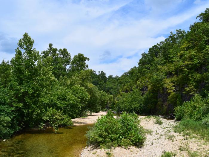
Roomy campsites surrounded by open lawn and natural shading, cool breezes, abundant songbirds and scenic views all await visitors at the Sutton Bluff Recreation Area. The campground is a popular site for those using the nearby designated Sutton Bluff off-road vehicle trails.
Recreation
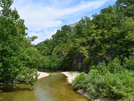
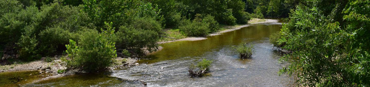
A 20 mile off-road vehicle trail can be accessed from the campground. Permits are required for off-road vehicle use in the area. The Karkaghne section of the Ozark Trail, which is popular among backpackers, hikers and mountain bikers, is accessible from a trailhead less than a mile from the campground. The West Fork of Black River provides access to a serene, slow-moving mountain stream and a natural gravel beach. Visitors enjoy wading in the waters, however the current is not strong enough to enable floating the river. Anglers can enjoy a variety of bass and bluegill.
Facilities
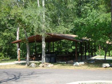
The campground offers multiple single-family sites and a large group site that can accommodate up to 32 guests. Each site is equipped with tables and campfire rings with grills, and electric hookups are available for RVs. Accessible vault and flush toilets, hot showers and drinking water are also provided. Firewood and ice are available by purchase from the campground host. A group picnic pavilion, equipped with about 10 tables, as well as grills, is perfect for large parties or family functions. Camping Sites #29, #32 and #33 have short parking spaces that are not able to accommodate large RVs/Trailers. Please take this into account when reserving sites.
Natural Features
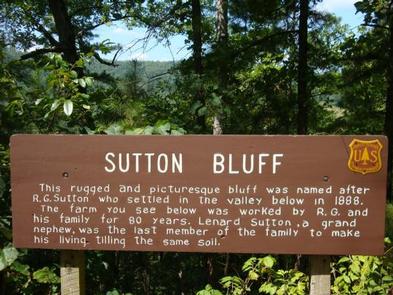
Sutton Bluff is located 13 miles outside Centerville, Missouri, on the Black River. It is nestled among a variety of short-leaf pine trees and shrubs, and a number of campsites sit alongside the West Fork of the Black River.
Nearby Attractions
The small mining town of Centerville is located roughly six miles from the campground.