
Directions
From Byrdstown, Tennessee, take Highway 111 south for 3 miles. After crossing the bridge turn right and follow the signs into the campground and day-use area, located to the left of Sunset Marina (2040 Sunset Dock Road, Monroe, TN 38573). From Livingston, Tennessee, take Highway 111 north for 15 miles. Follow the signs and turn left into the campground and day-use area. It is recommended that visitors do not rely soley on GPS or Mapquest to reach the park.
Phone
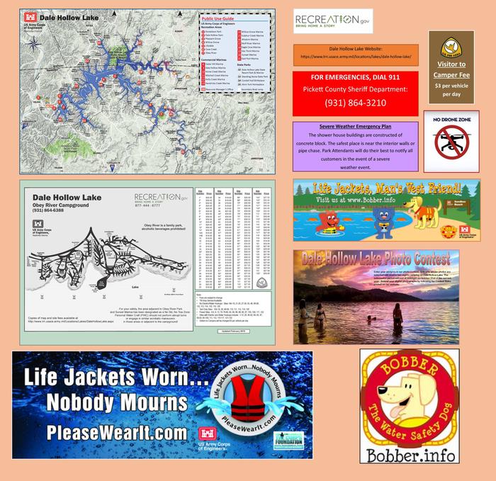
931-864-6388 CAMPGROUND; 931-243-3136 RESOURCE MANAGER’S OFFICE, DALE HOLLOW LAKE
Activities
BIKING, BOATING, CAMPING, FISHING, WATER SPORTS, DAY USE AREA, SWIMMING SITE, BIRDING, WATER ACCESS
Keywords
OBEY,DALE HOLLOW LAKE,OBEY RIVER,SUNSET/BRIDGE AREA,BYRDSTOWN,TN,DALE HOLLOW LAKE
Related Link(s)
Tennessee State Road Conditions
Overview
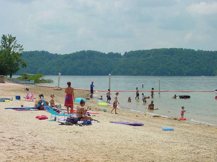
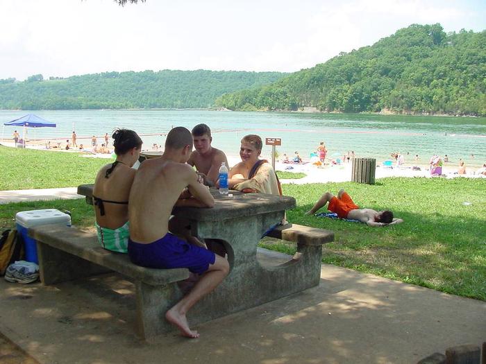
Obey River Park is a spacious campground located on the shores of Dale Hollow Lake, in the hills of Tennessee. The campground provides the largest camping area at the lake, as well as the largest and most visited swimming beach.
Recreation
Dale Hollow is renowned for its fishing opportunities. In addition to yielding the world record smallmouth bass and being known as a trophy smallmouth lake, the Obey River below Dale Hollow Dam is also known for excellent rainbow and brown trout fishing.
Boating and water skiing are also popular activities, and with 27,700 surface acres of water and 620 miles of shoreline, there is plenty of space for campers to explore the lake.
Obey River is the most popular campground and day-use area on Dale Hollow Lake. This is a vacation destination for camping, boating, skiing, fishing and beach-goers. The site is conveniently located next to a small community hosting restaurants, history and several marinas.
Facilities
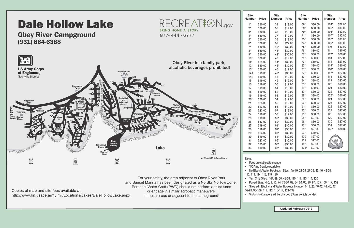
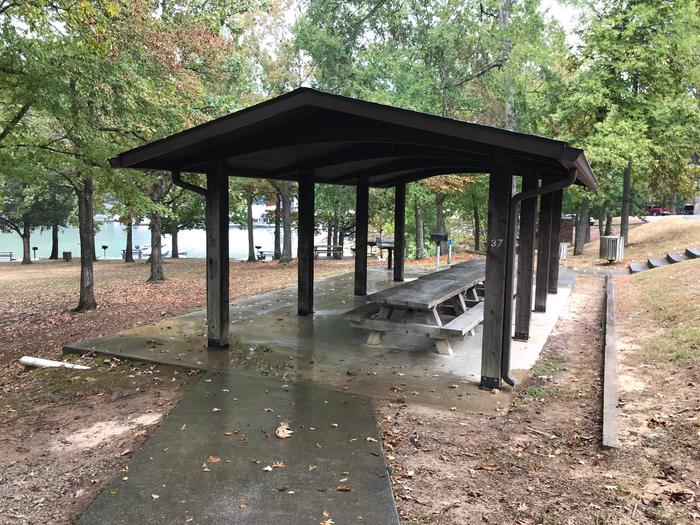
Obey River Park Campground features 131 campsites and two large group picnic shelters. Electric hookups, drinking water, flush toilets and a dump station all create a comfortable camping experience.
A swimming beach, basketball court and playgrounds provide additional recreational opportunities.
Camping is limited to a 14-day stay within a 30-consecutive day period.
Site Type Definitions:
- An RV Site is a paved/concrete site for wheeled camping units such as motorhome, fifth wheel, pull trailer and pop-up campers. RV sites are not suitable for tents.
- A Standard Site is one with a fine gravel surface pad. It will accommodate wheeled units and tents.
- A Tent Site will accommodate tents only.
- Group Sites are the picnic shelters.
For site specifics such as site measurements, parking and if the site is level, be sure to review the Information text at the bottom of each specific site page.
All camping equipment and vehicles are to be located on the designated site pad or parking areas.
General Site Notes:
- 50 Amp Service Available (View specifics under each site listing)
- No Electric/Water Hookups: Sites 14A-19, 21-25, 27-39, 43, 46, 48-58, 110, 113, 114, 118, 119, 120
- Tent Only Sites: 14A-19, 30, 49-58, 110, 111, 113, 114, 120
- Paved Sites: 4-6, 9, 13, 74, 78-80, 82, 84, 86, 88, 96, 97, 105, 106, 117, 132
- Sites with Electric and Water Hookups Include: 1-13, 20, 40-42, 44, 45, 47, 59-93, 95-109, 111, 112, 115-117, 121-132
- Visitors to Campers will be charged $3 per vehicle per day
- Fees are subject to change
Natural Features
Dale Hollow Dam and Lake was completed in 1943. Although the dam was built for flood control and power generation, it has now become a recreational oasis for more than 3 million visitors each year.
The dam is located on the Obey River, about 3 miles east of Celina, Tennessee. Surrounded by a thick expanse of forest, the clear blue lake creates a stunning scenic backdrop for a variety of water and land recreational activities.
In the late fall through early spring, the American Bald Eagle can be spotted flying overhead or perched on low-lying limbs. Dale Hollow hosts the second largest wintering eagle population in the states of Tennessee and Kentucky.
During migration seasons the call of the sandhill crane is often heard overhead. Lucky visitors might catch a glimpse of one up close, as they often land near the campground.
Nearby Attractions
The nearby towns of Byrdstown and Pall Mall, Tennessee, offer historic sites and tours. The Cordell Hull Birthplace and Memorial is located near Byrdstown, Tennessee. Hull, a great statesman, is most widely remembered as a recipient of the Nobel Peace Prize and the father of the United Nations. The Sergeant Alvin York Home Place, home of the World War I hero, is located in Pall Mall, Tennessee.
The Dale Hollow National Fish Hatchery is about 35 miles from the campground. Operated by the U.S. Fish and Wildlife Service, the hatchery is the largest federal trout hatchery east of the Mississippi, producing 1.5 million trout annually. The hatchery is open to visitors daily.
Charges & Cancellations
Full rules and reservation policies for fees associated with changes and cancellations can be found at https://www.recreation.gov/rules-reservation-policies
- There is no fee to make a reservation.
- A $10 service fee will be withheld from any refund for a cancellation.
- A $10 service fee may be charged to changes made to an existing reservation (see full policies for when this is applicable).
- A customer who cancels a reservation the day before or on the day of arrival will pay a $10.00 service fee AND forfeit the first night’s use fee (not to exceed the total paid for the original reservation).
- Customers who cancel a group day-use facility reservation (picnic shelter) less than 14 days before the arrival date will forfeit the total day-use fee.
- No-shows are assessed $20.00 service fee and forfeit the first nights recreation fee for a campsite or forfeit the entire day-use fee for a day-use facility.
- Applicable fees, including service/cancellation fees and change fees, are non-refundable and subject to change.
- No refunds for recreation use fees may be made at the campground.