
Directions
The cabin is located 24 miles east of Juneau, Alaska, at the east end of Turner Lake. Access by float plane only. In fall, winter and early spring, the cabin may be inaccessible due to frozen lake surface (float planes cannot land). Please call the Juneau Ranger District to check on conditions ahead of time at (907) 586-8800. Turner Lake is typically not ice-free until June.
Phone
907 789-6264
Activities
BOATING, CAMPING, FISHING, HUNTING, WILDLIFE VIEWING
Keywords
ETKE,TURNER LAKE EAST CABIN,TONGASS NF – FS
Related Link(s)
Overview
Turner Lake East Cabin is open for year-round enjoyment.. Guests can enjoy scenic views, wildlife watching and a variety of recreational activities. The site can be accessed by float plane, depending on conditions. Guests are responsible for their own travel arrangements and safety and must bring several of their own amenities.
Recreation
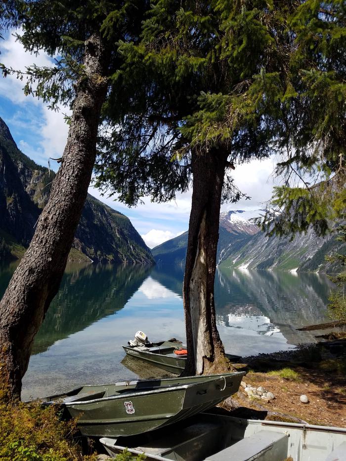
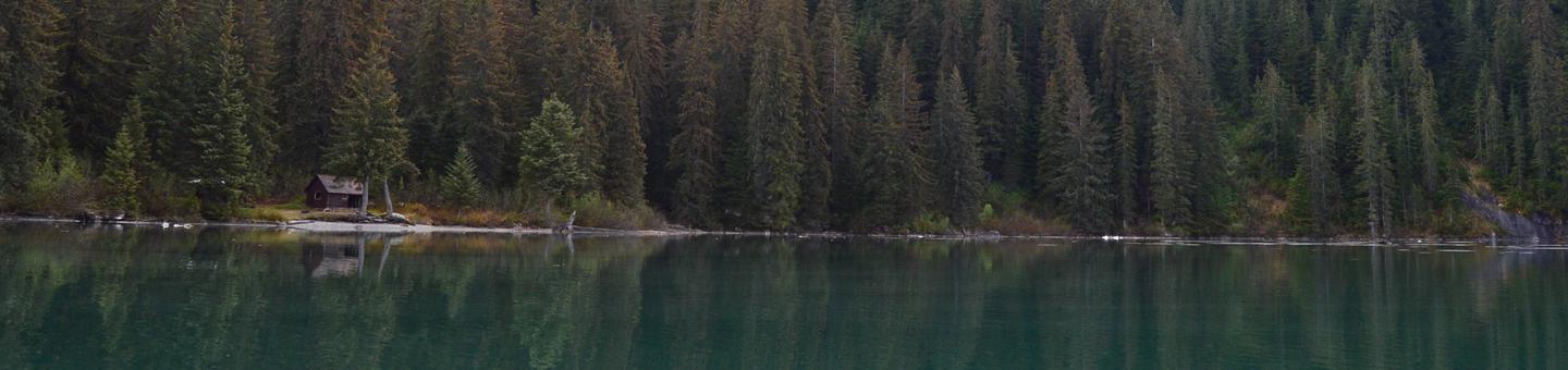
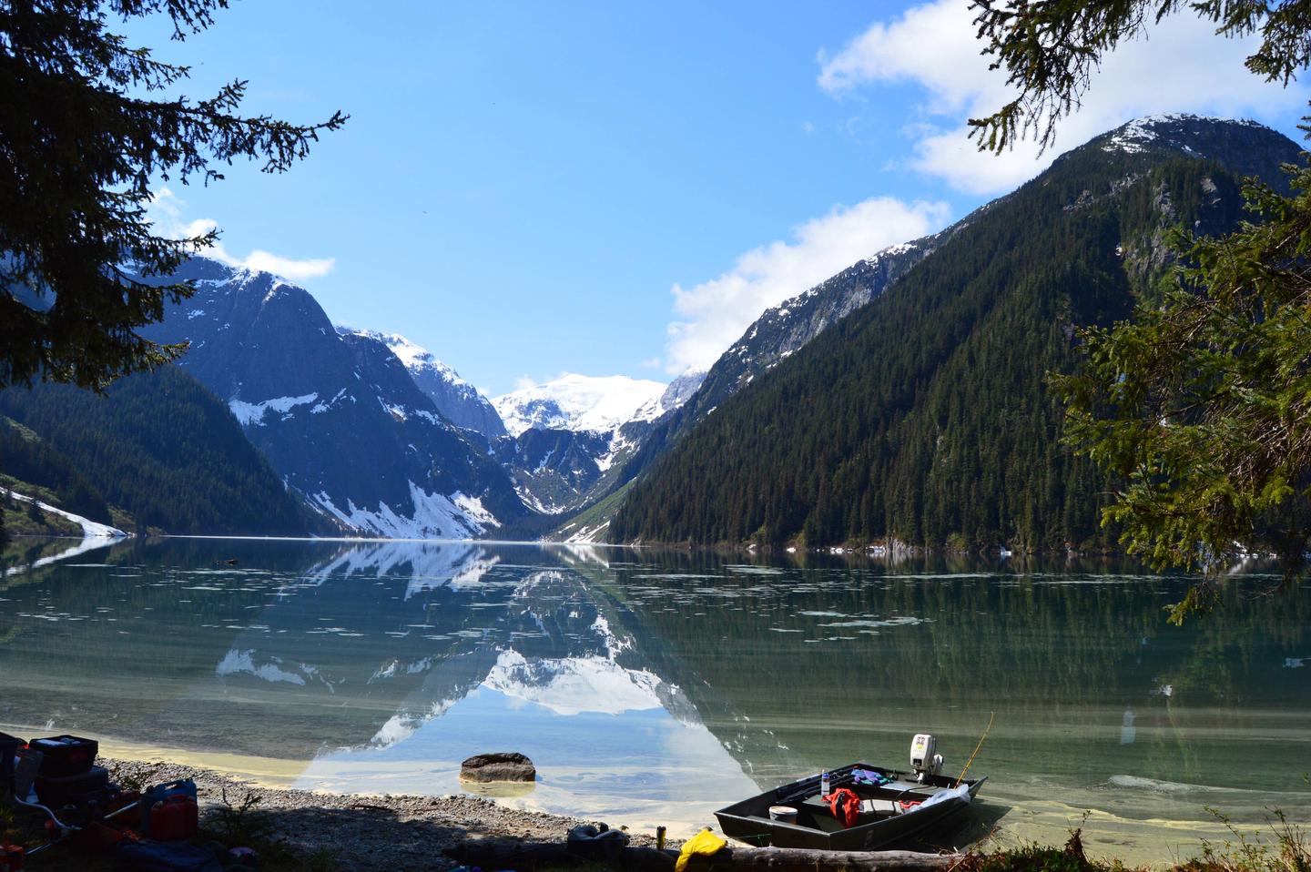
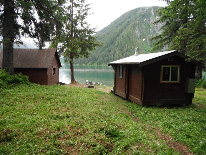
The cabin is located on the bank of Turner Lake. The cabin offers excellent views of mountain cliffs, waterfalls and hanging glaciers. Outside the cabin is a large sandy area with a fire pit for guests to relax. A skiff with oars is provided to use around the lake, but guests must supply their own flotation devices. Guests can also bring an outboard motor to attach to the skiff. Anglers can fish for cutthroat trout, Dolly Varden and kokanee salmon in the lake. Mountain goat or bear hunting is allowed with a permit in designated seasons. Salmonberries are available for picking in the summer.
Facilities
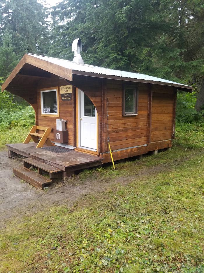
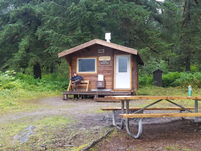
This 14 ft. by 16 ft. cabin is pan-abode style and sleeps six people with two single and two double bunks. The cabin also has a table and benches, broom, an oil heater, a cooler box for food storage, a campfire ring, an outhouse and food preparation space. Water and electricity are not provided. Water is available from the lake or a nearby stream, but guests should be sure to treat water before drinking or cooking with it ( water safety tips ). It is recommended that guests bring their own water supply. Heating oil is not provided. Visitors must bring a supply of #1 diesel oil or kerosene (a gallon per day on lowest setting), in addition to sleeping bags, sleeping pads, a cooking stove, lanterns or flashlights, cookware, plates, utensils, food, toilet paper, garbage bags, a fire extinguisher and fire starter. Visitors are expected to pack out trash and clean the cabin before leaving ( click here for more cabin details).
Natural Features
The cabin sits on relatively flat and brushy terrain and offers views of spectacular mountain scenery with numerous waterfalls cascading into the lake. A small sandy beach is located in front of the cabin. This area is home to bears and mountain goats ( bear safety information ). A variety of waterfowl may be spotted on the lake.