METHODIST COVE, NE Campground Reservation, Info, Images, Map, Directions

METHODIST COVE, Nebraska Campground Images, Info & Reservations

Directions

From U.S. Highway 80, take Highway 183 south to Alma, Nebraska. Turn left on South Street and travel 2.5 miles. The park entrance is on south side of the road.

Phone

308-799-2105

Activities

BOATING, CAMPING, FISHING, HUNTING

Keywords

METH,HARLAN COUNTY LAKE,METHODIST,HARLAN COUNTY LAKE

Related Link(s)

Rec Area Info & Images

Nebraska State Tourism

Nebraska State Road Conditions

Overview

Methodist Cove Park is located on the west side of Harlan County Lake by Alma, Nebraska.

The 13,000-acre Harlan County Lake is the second largest lake in the state. The lake and surrounding land hold great appeal for sportsmen, birders, naturalists or anyone wanting to just get away.

Recreation

Harlan County Lake is popular for fishing, hiking, hunting and boating.

Walleye, wipers, white bass, northern pike and channel catfish are the most sought after fish species. Game animals include pheasant, quail, prairie chicken, white-tailed and mule deer, turkey, waterfowl, rabbit and squirrel.

The lake offers a variety of hiking trails of varying length and style, as well as one equestrian trail a short drive away. An off-road vehicle trail is located in nearby Republican City.

Facilities

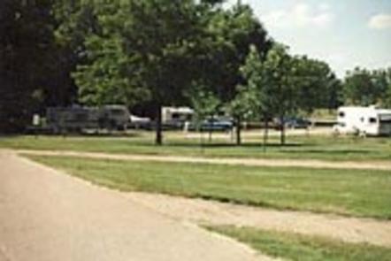
Methodist Cove Park offers 133 campsites, including a variety of individual, group, electric and non-electric sites. There is also one reservable group picnic shelter for day use.

One large heated shower house with flush toilets is centrally located within the campground and several vault toilets are located throughout the rest of the park. Other amenities include a dump station, drinking water, playground and boat ramp.

The main road is hard surfaced, while others are gravel. A fish cleaning station with grinder and running water is located near the entrance. There two full service marinas on the east end of the lake.

Natural Features

Located in South Central Nebraska, lands surrounding Harlan County Lake are primarily mixed grass prairie land. The campground is mostly forested, offering ample shade during the warmth of summer.

The Republican River Valley was once occupied by one of the greatest concentrations of buffalo on the Great Plains and was a favored hunting ground for the Pawnee, Sioux, Cheyenne and Arapaho Indian tribes.

Reservation

More from CampingHiking.net:

WELDON ISLAND, Georgia Campground Images, Info & Reservations

Directions From Interstate 85, take Exit 4 and turn East onto Old Dobbins Bridge Road.Turn right on Andersonville Road and follow the brown directional signs. Hattons Ford ramp is located at the end of Andersonville Road. Townville, SC, 29689 Phone 888-893-0678 HARTWELL PROJECT OFFICE Activities BOATING, FISHING, PICNICKING, SWIMMING, WATER

CIMARRON CAMPGROUND, New Mexico Campground Images, Info & Reservations

Directions Driving Directions: From Costilla, NM, on State Highway 522, travel east on State Highway 196 past Amalia to the intersection of Forest Service Road 1950. Travel on 1950 (a gravel road) east to the unit boundary. Follow Forest Service Road 1950 to the junction with Forest Service Road 1900.

GREEN RIDGE LOOKOUT, Oregon Campground Images, Info & Reservations

Directions Entry to the lookout is by combination lock. Please call the Sisters Ranger District at (541) 549-7700 one week in advance to get the gate combination. From Sisters, travel 5.5 miles west on U.S. Highway 20 to Forest Road 11 at Indian Ford Campground. Turn right on Forest Road

ALLEN SPRINGS CAMPGROUND, Oregon Campground Images, Info & Reservations

Directions From Sisters OR: Travel 9.6 miles northwest on Highway 20, then 11.1 miles north on Forest Road 14. Phone 541-323-1746 Activities CAMPING Keywords Related Link(s) Rec Area Info & Images Oregon State Tourism Oregon State Road Conditions Overview Like the other campgrounds on the Metolius, Allen Springs is located

BENNY CREEK GROUP AREA, Arizona Campground Images, Info & Reservations

Directions From Show Low, Arizona, take Highway 260 southeast 42 miles to Highway 373. Follow 373 south for 2.5 miles to the Benny Creek Campground entrance on the left. Phone 928-735-7313 Activities CAMPING, FISHING, HIKING Keywords BENN,APACHE-SITGREAVES NF-FS Related Link(s) Rec Area Info & Images Arizona State Road Conditions Arizona