NAMEKAGON, WI Campground Reservation, Info, Images, Map, Directions

NAMEKAGON, Wisconsin Campground Images, Info & Reservations

Listen

Directions

From Cable, Wisconsin, take County Highway M east for 11 miles. Turn left on County Highway D and proceed about 6 miles to Forest Service Road 209. Turn left at the campground sign and drive less than a mile to the campground entrance.

Phone

(715) 634-4821 OR (715) 264-2511

Activities

BIKING, BOATING, CAMPING, FISHING, SWIMMING SITE

Keywords

NAME,CHEQUAMEGON-NICOLET NF – FS

Related Link(s)

Rec Area Info & Images

Overview

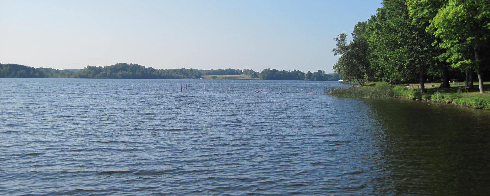
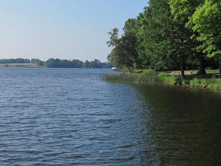
Namekagon campground is a family-friendly campground that runs alongside its namesake lake, at the headwaters of the Namekagon River. It is the perfect spot to kayak, canoe, jet ski, swim or take a boat ride to one of the many restaurants along the shoreline.

With its close proximity to mountain bike trails and the North Country hiking trail, Namekagon campground is an ideal location for making a base camp.

Recreation

Namekagon Lake offers excellent fishing, and anglers will find musky, pike, walleye and bass, among other fish varieties, available in abundance.

The campground is conveniently located near off-highway vehicle, hiking and mountain bike trails. The North Country National Scenic Trail is also nearby. The Namekagon Nature Trail is a one mile interpretive trail which traverses the immediate area and begins in the campground.

Facilities

The campground offers a couple dozen single-family campsites for tent or RV camping. Each site is equipped with tables and campfire rings with grills. Accessible vault toilets, drinking water, trash collection and recycling bins are also provided.

A day-use picnic area is equipped with multiple tables, picnic shelters, a basketball court, beach, boat ramp and fishing piers.

Natural Features

The campground is situated on the 3,227-acre Namekagon Lake that is famous for its fishing potential. It is surrounded by a hardwood and hemlock forest in northwestern Wisconsin.

Reservation

More from CampingHiking.net:

LAKELAND PAVILION, Texas Campground Images, Info & Reservations

Listen Directions While traveling East on US Highway 380, turn right (South) on State Highway 78 at Farmersville. Go South about 4 miles to CR 550. Turn right on CR 550 and continue about 2 miles to the entrance of the park. The pavilion is inside Lakeland Park. Phone 972-442-3141

GATES GROUP, California Campground Images, Info & Reservations

Listen Directions From Auburn, Calif., take Highway 80 to the Foresthill Road and travel 20 miles east to Foresthill. Turn right onto Mosquito Ridge Road and travel 42 miles east to French Meadow Reservoir. Follow the signs to the campground. Phone 530-367-2224 Activities BIKING, BOATING, CAMPING, FISHING, HIKING, PICNICKING, SWIMMING

EAST DAVIS CAMPGROUND, Oregon Campground Images, Info & Reservations

Listen Directions From Crescent, OR: Travel 8.8 miles west on County Road 61, then 7.7 miles north on Highway 46, then 2.6 miles west on Forest Road 4600 850. Phone 541-323-1746 Activities CAMPING Keywords Related Link(s) Rec Area Info & Images Oregon State Tourism Oregon State Road Conditions Overview East

MUDDY GUARD CABIN, Wyoming Campground Images, Info & Reservations

Listen Directions From Buffalo, Wyoming, take Wyoming State Highway 16 west 24 miles. Turn left on Crazy Woman Road (FSR 33), travel 400 feet, turn right on Forest Service Road 473. Visitors will use a gate to access the cabin. Please keep the gate closed. Phone 307-684-7806 Activities BIKING, BOATING,

Diamond Creek Guard Station, Idaho Campground Images, Info & Reservations

Listen Directions From Soda Springs, take Highway 34 north approximately 12 miles to the China Hat turnoff (Blackfoot River Narrows). This road will follow Blackfoot River for another 11 miles to a junction; there is a Forest Service sign at this point. Take the right fork (Caribou National Forest Road