UINTA RIVER GROUP, UT Campground Reservation, Info, Images, Map, Directions

UINTA RIVER GROUP, Utah Campground Images, Info & Reservations

Directions

From Roosevelt, Utah, take State Highway 121 north to Neola, then travel on Uinta and Ouray Indian Reservation Road to Forest Road 118.

Phone

435-722-5018

Activities

BIKING, CAMPING, HIKING, WILDLIFE VIEWING

Keywords

UNIR,ASHLEY NF – FS

Related Link(s)

Rec Area Info & Images

Utah State Road Conditions

Utah State Tourism

Overview

Uinta River Group Campground is located about 25 miles from Roosevelt near the Uinta River at an elevation of 7,600 feet. Visitors come to enjoy the area’s fishing and trail opportunities.

Recreation

Anglers fish for rainbow, brown, brook and cutthroat trout on the Uinta River.

The Uinta River Trailhead is just up the road, providing access to the Chain Lakes region of the High Uintas Wilderness. Hiking, backpacking and horseback riding are popular in the wilderness area, and numerous sparkling lakes provide great backcountry fishing opportunities.

Facilities

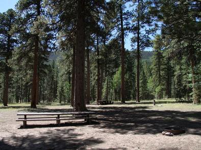
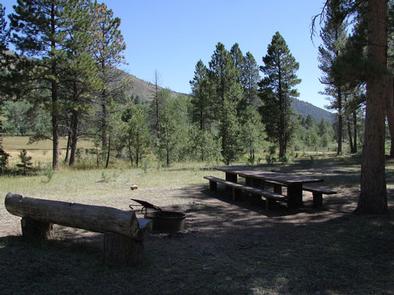
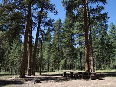
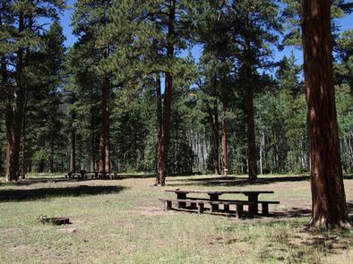
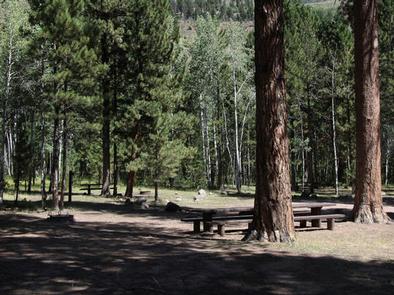
The campground contains one large group site that can accommodate up to 150 people. Several picnic tables and campfire rings with grills are scattered throughout the area.

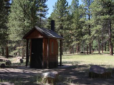
Vault toilets and trash collection are provided. The available water is not potable. Campers must bring their own supply. Roads and parking spurs are gravel.

Natural Features

The campground lies in an open meadow beneath towering Ponderosa pines. Summer wildflowers and wildlife are abundant.

Reservation

More from CampingHiking.net:

CLEAR LAKE CABIN LOOKOUT, Oregon Campground Images, Info & Reservations

Directions Access begins at the junction of Highway 26 and Forest Service Road 42, 12 miles south of Government Camp, Oregon, at the Skyline Sno-Park. Guests must park and the Sno-Park and ski, snowshoe or snowmobile to the facility. From the parking area, proceed on Forest Service Road 42 to

BUTTE LAKE, California Campground Images, Info & Reservations

Directions From Redding, California drive 63 miles east on State Highway 44 to Old Station. From the intersection of 44 and State Highway 89, continue east on 44 for 11 miles. Watch for sign to Butte Lake Campground. Turn right and continue for six miles on a rough gravel road.

REUNION FLAT, Wyoming Campground Images, Info & Reservations

Directions From Driggs, Idaho, travel 9 miles east. Turn east at the Key Bank on Little Avenue and follow the road to the forest boundary. Turn right on Forest Road 009 and go 3 miles to the campground. Phone 208-270-0150 OR 541-351-1182 Activities BIKING, CAMPING, FISHING, HIKING, WILDLIFE VIEWING Keywords

CAVE SPRING, Arizona Campground Images, Info & Reservations

Directions From Phoenix, take I-17 to Highway 179 north toward Sedona. Turn north on Highway 89A and continue for 11 miles into Oak Creek Canyon. From Flagstaff, take I-17 to Highway 89A south. Follow 89A for 18 miles to Oak Creek Canyon. Phone 928-282-1629 Activities CAMPING, FISHING, HIKING, WILDLIFE VIEWING,

DENBY POINT, Arkansas Campground Images, Info & Reservations

Directions From Hot Springs, Arkansas, take US 270 west about 26.5 miles to Ouachita Shores Parkway. Turn right and follow access road one mile north to park. From Mount Ida, Arkansas, take US 270 east approximately 9.5 miles to Ouachita Shores Parkway. Turn left on access road one mile to

JOHNSON CREEK CAMP, Texas Campground Images, Info & Reservations

Directions From Jefferson, Texas, travel 3.8 miles northwest on Highway 49. Turn left onto FM 729 and continue for 8.5 miles to the park entrance on the left.. Phone 903-755-2435 Activities BOATING, CAMPING, FISHING, WATER SPORTS, WILDLIFE VIEWING, SWIMMING Keywords JOCC,LAKE OF THE PINES,LAKE O THE PINES,FERRELLS BRIDGE DAM Related