CURLY JACK CAMPGROUND, CA Campground Reservation, Info, Images, Map, Directions

CURLY JACK CAMPGROUND, California Campground Images, Info & Reservations

Directions

From CA State Highway 96 in Happy Camp, turn south on to Elk Creek Road. Drive across the river bridge then follow Elk Creek Rd approx. .5 mile to Curly Jack Rd. Turn right on to Curly Jack Rd., and drive .3 miles to campground entrance.

Phone

530-493-2243

Activities

CAMPING, FISHING, HIKING, WILDLIFE VIEWING, SWIMMING, WHITEWATER RAFTING

Keywords

CURJ,KLAMATH NF – FS

Related Link(s)

Rec Area Info & Images

California State Tourism

California State Road Conditions

Overview

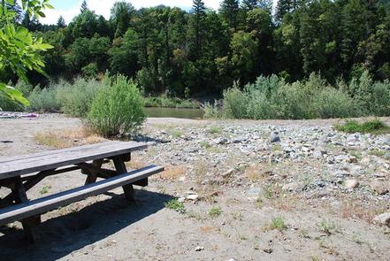
Curly Jack Campground is situated along the Klamath Wild and Scenic River near the town of Happy Camp. Visitors enjoy whitewater boating and fishing on the river, and exploring local hiking trails.

Recreation

Fishing, birding, hiking and whitewater boating are popular options, as is scenic driving along the State of Jefferson Scenic Byway. Visitors can access a Class III section of the Klamath River from the campground. The campsite is a put-in and take-out point for whitewater rafting – boats must be carried across a gravel bar.

Facilities

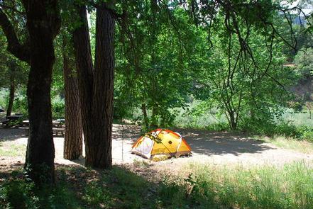
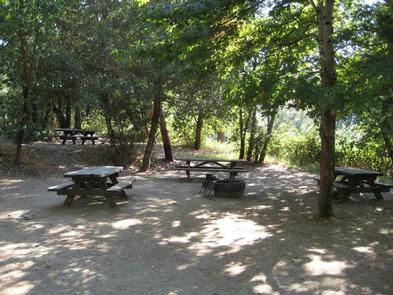
The campground offers shaded single family sites, as well as four group sites that can accommodate up to 30 people each. Many sites have a view of the river. Group sites feature a general area for dispersed tent camping and a large gravel parking area for extra vehicles and trailers.

Natural Features

The campsground sits at an elevation of 1,075 feet on the banks of the Klamath River opposite the town of Happy Camp. The Klamath National Forest is comprised of a vast array of mountains, streams and lakes straddling the California and Oregon border. The nearly 2-million acre forest includes five wilderness areas, one scenic byway, 200 miles of wild and scenic river and 1,100 miles of hiking and equestrian trails. Elevations range from 450 to 8,900 feet, making for varied topography and diverse plant and animal life.

Nearby Attractions

The campground is within walking distance to the town of Happy Camp, where there are restaurants and a grocery store. A whitewater rafting outfitter and several fishing guides are based in Happy Camp.

Reservation

More from CampingHiking.net:

Little Naches Campground, Washington Campground Images, Info & Reservations

Directions From Naches, take Highway 410 northwest 30 miles to Forest Road 107. Turn onto 107 and follow to the campground. Phone 541-338-7869 Activities BIKING, CAMPING, FISHING, HIKING, WATER SPORTS Keywords LILN,NACHES,OKANOGAN – WENATCHEE NF -FS,LITTLE NACHES,LITTLE NACHES CAMPGROUND,NATCHES Related Link(s) Rec Area Info & Images Washington State Tourism Washington

JIMS LAKE CABIN, Alaska Campground Images, Info & Reservations

Directions Access to the cabin is by floatplane only. It is about a 50-minute flight from Juneau. This cabin is in a designated Wilderness area, and access by helicopter is illegal. In fall, winter and early spring, the cabin may be inaccessible due to frozen lake surface (floatplanes cannot land).

ROCKY CREEK (SOMERVILLE LAKE), Texas Campground Images, Info & Reservations

Directions From Austin, Texas, take US 290 east to Brenham. Follow HWY 36 north 11.5 miles to FM 1948. Turn left on FM 1948 and follow 5 miles to the park entrance. Phone 979-596-1622; FOR BOOKING, CALL 1-877-444-6777 Activities BOATING, CAMPING, FISHING Keywords ROC2,SOMERVILLE LAKE,LAKE SOMERVILLE,ROCKY CREEK SOMERVILLE LAKE,SOMERVILLE LAKE

DOUGLAS CREEK CABIN, Montana Campground Images, Info & Reservations

Directions From Hall, travel south on Highway 1 for about 3 miles to Douglas Creek. Take Forest Road 707 and continue approximately 7 miles to the cabin. Maps may be purchased by calling the Pintler Ranger District. Phone 406-859-3211 Activities BIKING, CAMPING, HIKING, HUNTING, WINTER SPORTS, WILDLIFE VIEWING Keywords DCAB,BEAVERHEAD-DEERLODGE

PLOTNIKOF LAKE CABIN, Alaska Campground Images, Info & Reservations

Directions Accessible early June through October. This cabin is located 45 miles southeast of Sitka, 4 miles east of Whale Bay, on the south-central part of Baranof Island. Access by floatplane is 40 minutes from Sitka. For geographic features surrounding the cabin, refer to USGS topographic map Port Alexander C-3.

WHITE STAR, Colorado Campground Images, Info & Reservations

Directions From Leadville, travel 15 miles south on Highway 24 to Highway 82. Turn right and go west 5.5 miles on Highway 82, turn left into the White Star Campground. Phone 719-486-0749 (FOR INFORMATION ONLY, NO RESERVATIONS) Activities BOATING, CAMPING, FISHING, HIKING, MOUNTAIN BIKING Keywords WSTR,TWIN LAKES,PIKE AND SAN ISABEL