

Directions
From Crescent, travel 12.2 miles west on County Road 61, then 3.5 miles north on Highway 58, then 2.6 miles west on Forest Road 60.
Phone
541-323-1746
Activities
BIKING, BOATING, CAMPING, FISHING, HIKING, WINTER SPORTS, WATER SPORTS, SWIMMING SITE
Keywords
CRESCENT LAKE (OR)
Related Link(s)
Overview
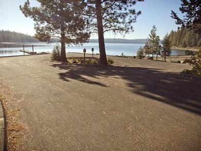
Crescent Lake Campground is located on a hill overlooking beautiful Crescent Lake in Deschutes National Forest. It offers visitors the opportunity to experience the beauty and recreational opportunities of the eastern Cascade Range.
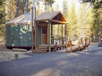
Crescent Lake is the first campground in the Deschutes National Forest to offer yurts in a scenic location, great for individuals and groups alike.
Recreation
Crescent Lake is a prime location for boating, fishing and swimming. The Summit Lake Trail is popular among hikers and mountain bikers, offering excellent views of Diamond Peak across Crescent Lake. A boat ramp is located on-site.
Visitors can take advantage of skiing, snowshoeing and snowmobiling in the winter months. Crescent Lake Snowpark offers a base camp for exciting winter excursions. The Summit Lake Trail is open to snowmobiling.
Facilities
The yurts offers visitors unique camping opportunity. Each is equipped with a bunkbed with one double and one single mattress, a double fold-out futon, a table and chairs and a wood stove. Visitors need to bring their own linens, lantern and eating essentials. Drinking water are provided. No electricity is available.While the campsites are pet-friendly, unfortunately pets are not permitted within the yurts.
The campground is located near a small lodge offering a small general store, restaurant and various types of boat rentals.
Natural Features
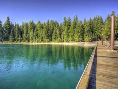
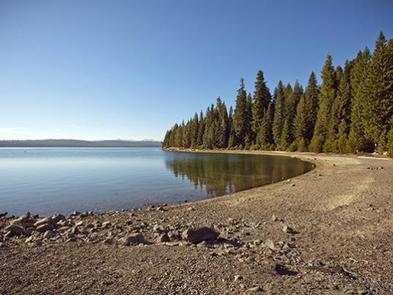
Cresent Lake is nestled in a glacier basin east of the towering Cascade Mountain Range. It boasts brilliant blue-green water and sandy beaches.
A forest of lodgepole pine provides the backdrop to this area, with mountain hemlock, fir and spruce also in the mix. Wildlife found in the area includes deer, native fish and migratory birds.
Nearby Attractions
Visitors can explore wilderness areas, rivers, lakes and reservoirs, and approximately 1,600 miles of trails that comprise nearly 2.5 million acres within the Deschutes National Forest and the adjacent Ochoco National Forest.
Lava Lands Visitor Center in nearby Bend, Oregon, and the unique geological landscape of Newberry National Volcanic Monument draw visitors to the region as well.
Visitors enjoy traveling the Cascade Lakes Scenic Byway, known as Oregon’s Highway in the Sky, which climbs into the clouds on a 66-mile drive through the Cascade Range, weaving past snow-capped peaks and alpine lakes.