Gold Bar Group Sites, UT Campground Reservation, Info, Images, Map, Directions

Gold Bar Group Sites, Utah Campground Images, Info & Reservations

Listen

Directions

From Moab, drive five miles north on Hwy 191 to the intersection with Hwy 279. Turn left/west on Hwy 279 and drive ten miles to the campground entrance road.

Phone

435-259-2100

Activities

BIKING, BOATING, CLIMBING, CAMPING, HIKING, OFF HIGHWAY VEHICLE, RECREATIONAL VEHICLES, PHOTOGRAPHY, PADDLING, MOUNTAIN BIKING, OFF ROAD VEHICLE TRAILS, WATER ACTIVITIES, CANOEING, NON-MOTORIZED BOATING, WATER ACCESS, SCENIC DRIVE, RAFTING, RIVER TRIPS, ROCK CLIMBING

Keywords

Related Link(s)

Rec Area Info & Images

Utah State Road Conditions

Utah State Tourism

Overview

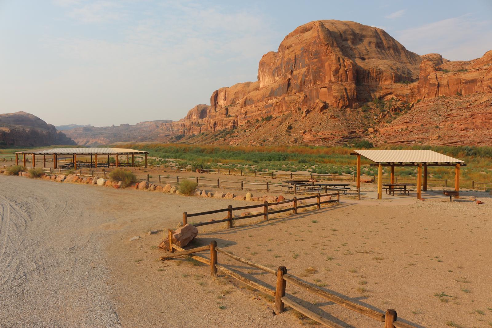
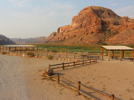
The four group sites at Gold Bar are located along the Colorado River and are ideal for large gatherings such as school groups or family reunions. Within close proximity to national parks and open space, outdoor enthusiasts will enjoy hiking, mountain biking, whitewater rafting, and four-wheel drive tours in the surrounding area. The town of Moab is approximately 15 minutes away and has dining, shopping, sports rentals, tour companies and museums.

Recreation

There is a boat ramp located at Gold Bar giving access to the Colorado River. The group sites are close to the trailhead for Corona Arch and numerous hiking and four-wheel drive roads. Both Arches and Canyonlands National Parks are nearby.

Facilities

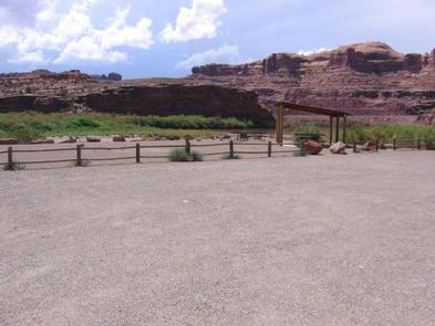
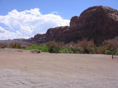
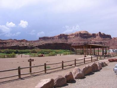
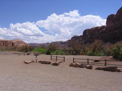
Group areas have fire grates, picnic tables, vault toilets and sites A, B, and C have shade shelters. Site D does not have a shade shelter, but is ideal for groups with motorhomes. The group sites do not have water, dump stations or electric hook-ups. Trailer and RV Parking is limited as sites are meant for tent camping.

Natural Features

The group sites at Gold Bar are located on the Colorado River and provide for striking views of the red rock canyons and mesas.

Nearby Attractions

Scenic Highway 279 parallels the Colorado River and there are multiple opportunities for hiking, biking and four-wheeling. Arches and Canyonlands National Parks and Dead Horse State Park are nearby as well as the Manti-La Sal National Forest and the La Sal Mountain Loop Road which offer cooler temperatures.

Reservation

More from CampingHiking.net:

Dundo Group Campground, Virginia Campground Images, Info & Reservations

Listen Directions From Washington, D.C., metro area, travel west on Interstate 66 to exit 43A. Take US Highway 29 south approximately 55 miles to Ruckersville, Virginia, then take US Highway 33 west to Shenandoah National Park and Skyline Drive Swift Run Entrance. Follow Skyline Drive south approximately 18 miles and

KIRBY COVE CAMPGROUND, California Campground Images, Info & Reservations

Listen Directions From San Francisco (travelling north):  Cross the Golden Gate Bridge and take exit 442 onto Alexander Avenue. This will be the exit after the Vista Point. Continue straight for about a mile, and then turn left onto Bunker Road. Travel through the Baker-Barry Tunnel and continue straight until

HUNTERS GROUP SITE, Washington Campground Images, Info & Reservations

Listen Directions Take State Highway 2 west of Spokane for 32 miles to the town of Davenport. Turn north on State Highway 25 and travel 37 miles. Follow signs for the campground. Turn left (west) on Campground Road in the town of Hunters. Phone 509-754-7889 Activities BOATING, HISTORIC & CULTURAL

SPARROWFOOT, Missouri Campground Images, Info & Reservations

Listen Directions From Highway 13, travel about a mile east on SE 450 Road and follow signs into the park. Phone 660-885-7546 Activities BOATING, CAMPING, FISHING Keywords SPAF,TRUMAN LAKE,HARRY S TRUMAN Related Link(s) Rec Area Info & Images Missouri State Road Conditions Missouri State Tourism Overview SPARROWFOOT CAMPGROUND WILL REMAIN

FISH CREEK CAMPGROUND, Montana Campground Images, Info & Reservations

Listen Directions Important: Please do not rely on GPS for directions to Fish Creek Campground. Please use these directions: Fish Creek is located four miles northwest of the west park entrance near West Glacier, Montana. Access is from U.S. Highway 2, approximately 32 miles northeast of Kalispell, Montana. Phone 406-888-7800

TWIN COVE POINT, Oklahoma Campground Images, Info & Reservations

Listen Directions From Highway 11 in Barnsdall, Oklahoma, take a left onto West Chestnut Avenue and go 0.2 miles. Take a left on South Eighth Street and go 1.5 miles south. Take a right into the Twin Cove Point facility. Phone 918-847-2220 Activities BOATING, CAMPING, FISHING, HUNTING, SWIMMING SITE Keywords